Abisko National Park in northern Sweden is a popular hiking destination throughout the year. The most stunning attractions and photography spots of Abisko are easily accessible, even for those who prefer shorter and less challenging hikes. Short trails and viewpoints near the road are suitable even for the busy traveler – you can see a lot in a day.
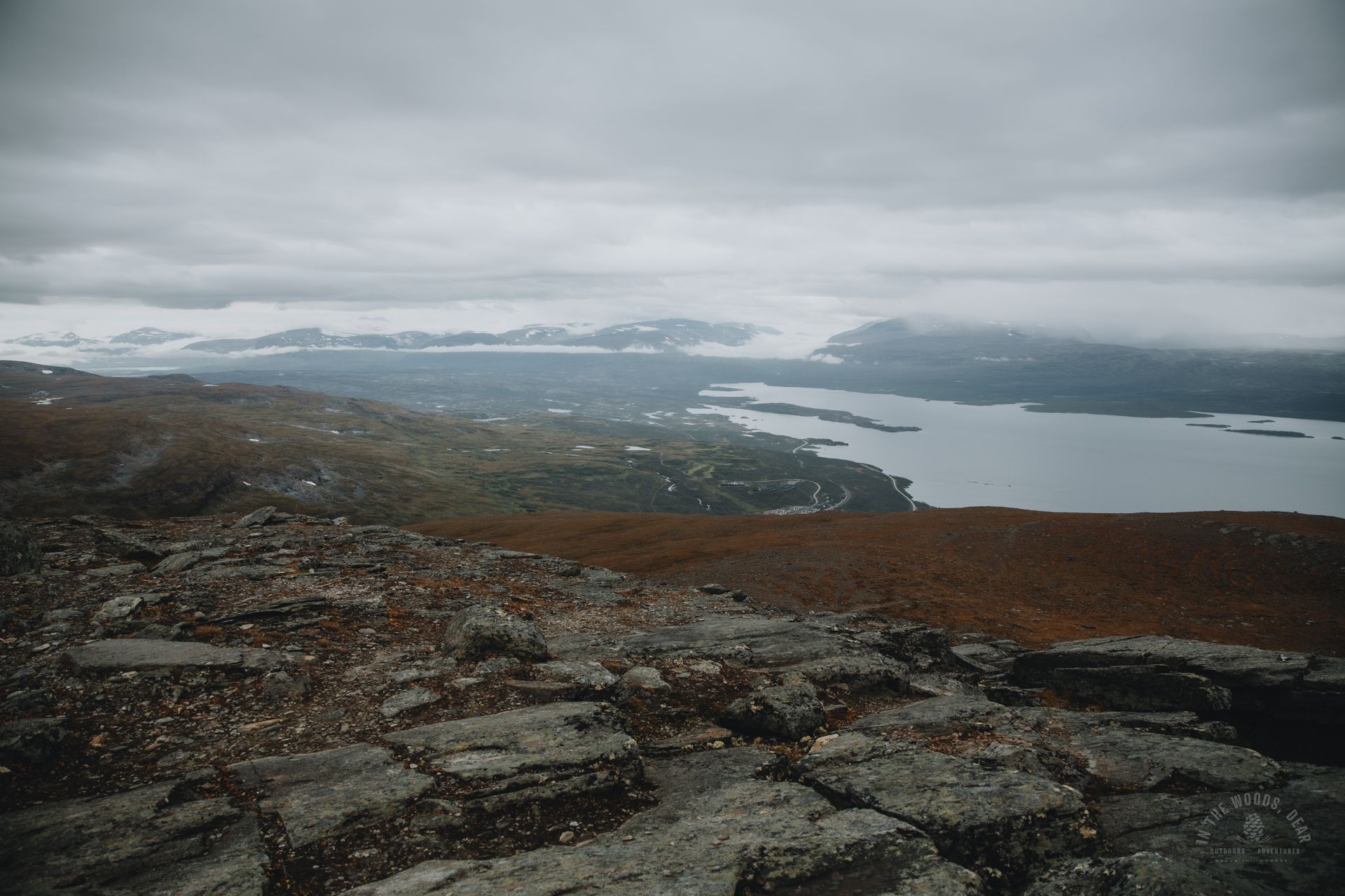
Nuolja or Njullá is a popular skiing destination in winter, but during the snow-free season, it offers breathtaking panoramic views from the summit towards Lake Torneträsk, Abisko National Park, and Norway. The 1169-meter (3835 ft) Mount Nuolja dominates the landscape along Abisko's trails.
For a more adventurous climb to the summit, taking the Rihdonjira Nature Trail is an option, while a scenic chairlift to Nuolja's upper slopes and the Aurora Sky Station is available for those seeking a smoother ascent.
Abisko National Park
Established in 1909, the Abisko National Park is located in the municipality of Kiruna in northern Sweden, right on the border of Norway. The area's nature ranges from mountainous terrain to lush forests and marshes. The waters of clear lakes and rivers are mainly drinkable.
The nature in Abisko National Park is protected with strict regulations. Activities like berry picking and mushroom picking are allowed, but dogs must be leashed within the national park. Movement in bird protection areas is prohibited in late spring and summer.
Camping in Abisko is allowed only at designated sites within the Abisko Touriststation and Abiskojaure cabins, which are subject to fees. Camping is free along the Kungsleden trail (King’s Trail) at the Nissonjohka camping area, approximately four kilometers (2.5 miles) from the road. Outside the boundaries of Abisko National Park, camping is allowed freely.
Abisko – Trails and Attractions
Abisko serves as the starting point for numerous short day-hike trails and longer routes suitable for multi-day hikes. One of the most famous long-distance trails is the classic Abisko-Nikkaluokta hike along the Kungsleden (King's Trail), continuing to Singi before turning towards Kebnekaise.
From the same trailhead along river Abiskojåkka, you can venture into the lush Kårsavagge valley or the Baddustrail towards Lapporten. The Nordkalott Trail (Arctic Trail) also passes through Abisko, leading to Kilpisjärvi through Malla Nature Reserve towards the summit of Halti in Finland and further to Norway.
Abisko's most captivating attractions include the Abisko Canyon and river Abiskojåkka, Lake Torneträsk, Lapporten, and waterfalls found on Nuolja's slopes by Rihdonjira, Kårsafallet on river Kårsajåkka, and the "Wild Reindeer Waterfall" in the canyon.
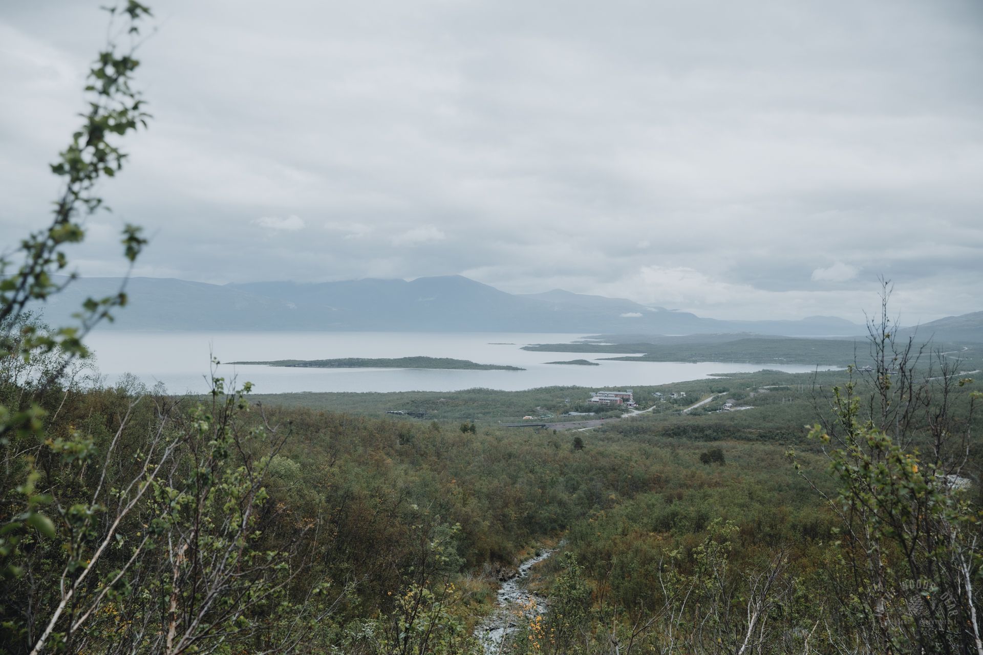
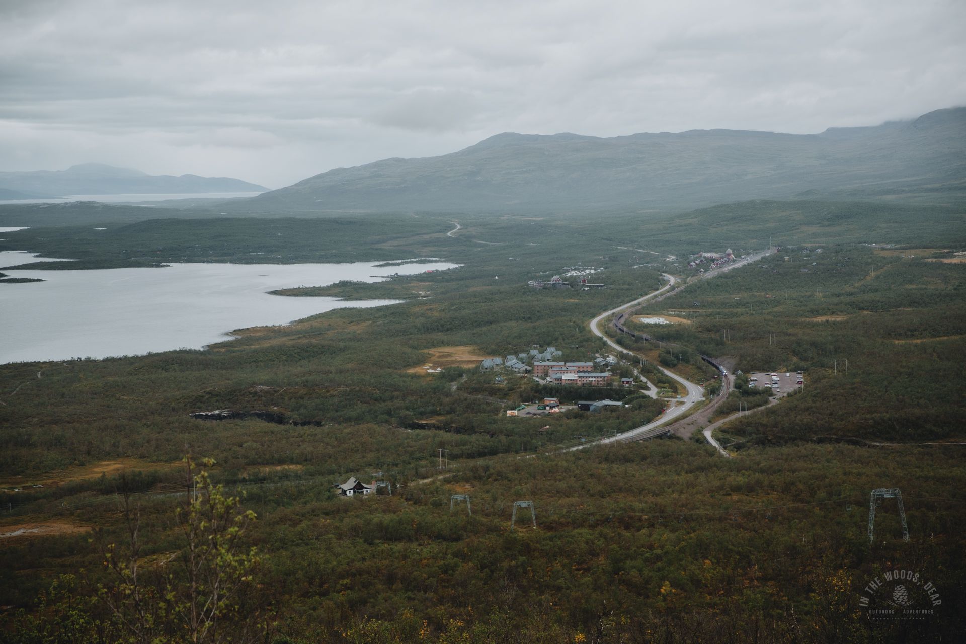
Abisko is easily accessible by car, train, or bus from Kiruna or Narvik. The drive from Kiruna to Abisko takes just over an hour. The STF Abisko Turiststation and Naturum Visitor Center are located along the E10 road and the railway. Naturum provides information boards, a map, and two parking areas.
If staying at the STF fell station, parking is available north of the road. South of the train station, there is a large free parking area suitable for long-term parking for hikers.


Nuolja is a Year-round Outdoor Destination
Nuolja, or Njullá in Northern Sámi, is a fell rising on the shore of Lake Torneträsk, reaching a height of 1169 meters (3835 ft). The border of the Abisko National Park passes directly over the summit of Nuolja and the adjacent Slåttatjåkka mountain. Therefore, the more stringent rules of the national park apply to the slopes on the Abisko side of the fell.
Nuolja Offpist is a skiing center on Nuolja with excellent natural slopes for winter sports. The STF Aurora Sky Station, opened in 2007, provides a vantage point for observing the Northern Lights and admiring the midnight sun in the summer. The station also houses a café.
A chairlift takes visitors to the Aurora Sky Station on Nuolja's slopes, reaching an elevation of 900 meters (2953 ft). This way, the steepest paths can be avoided on the ascent to Nuolja's summit.
There are several routes to reach the summit of Nuolja. You can start from the lower station of the chairlift on the north side, take the chairlift, or climb up the Rihdonjira Nature Trail. From Björkliden, you can ascend directly to the summit or take a route via the saddle between Nuolja and Slåttatjåkka.
In winter, it is not advisable to take the Rihdonjira Nature Trail due to steep slopes being avalanche-prone.


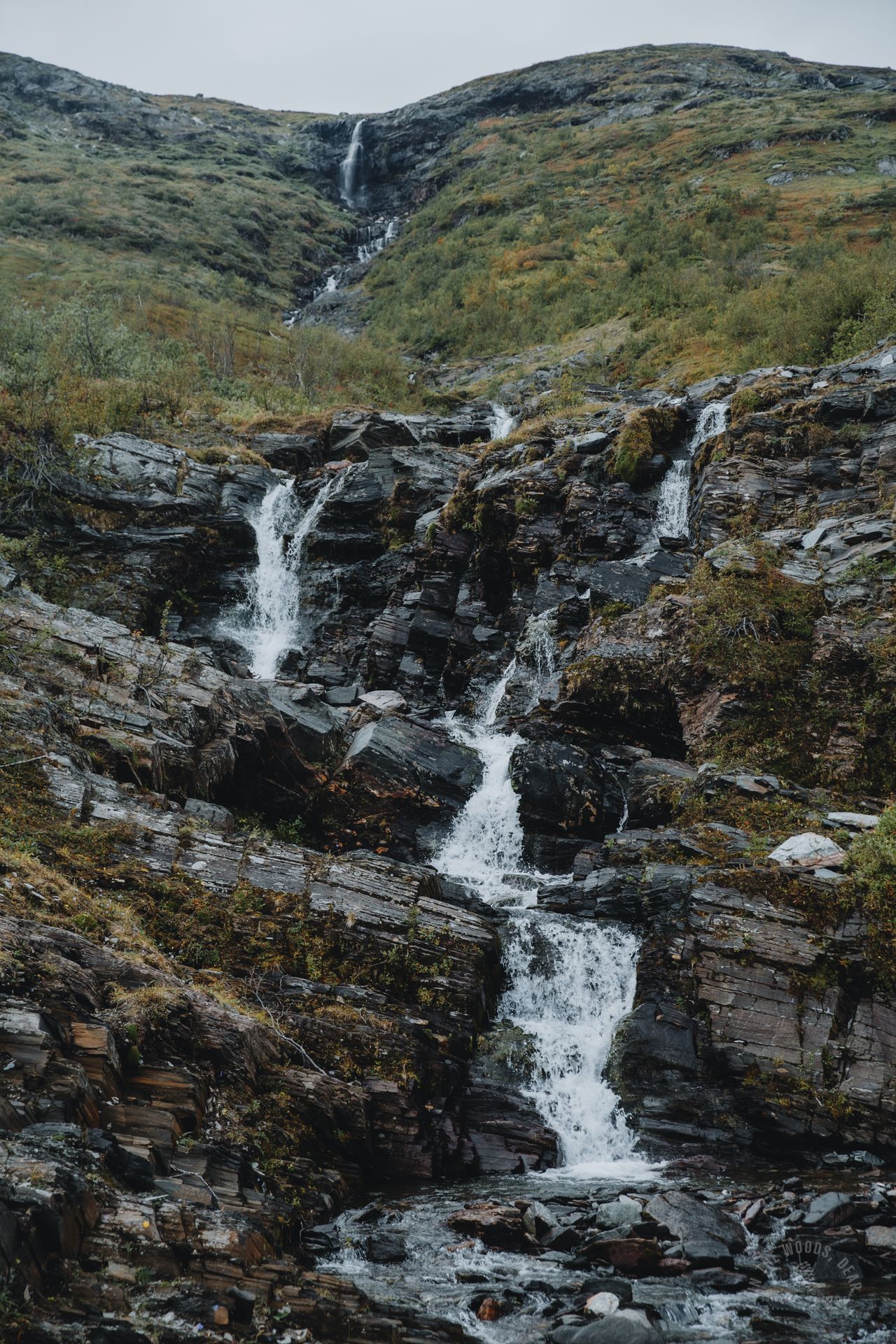
Route to Nuolja Summit via Rihdonjira Waterfall
The Rihdonjira Nature Trail starts on the west side of river Abiskojåkka, at the same point as the trail to the Kårsavagge valley. The trail is marked with red hexagonal markers.
After a short muddy and rocky section, the trail is covered with duckboards. Nuolja rises majestically above the trees' canopies. Soon, the trail narrows and ascends in a dense birch forest.
On the Rihdonjira Nature Trail, summer flowers flourish due to the soil's high lime content. By early September, the flowers may have faded, leaving only the red and orange hues of the leaves to reminisce about the beauty of the past summer.
The path quickly turns into a steep ascent on a narrow sandy trail. To the right, river Rihdonjira splashes down in cascades in a deep gorge. The waterfall continues as a winding ribbon up the entire length of the slope.
A bit higher, the trail approaches the water, looping around the waterfall. There is still some climbing left before the nature trail crosses the river. At the crossing, there are good rocks to sit on and have a picnic.
Abisko and Lake Torneträsk begin to emerge beyond the dense shrubs. Crossing Rihdonjira is easy as it is shallow and there are enough rocks. The trail turns towards the chairlift, meandering through twisted willows.
The steepest slope comes near the end of the chairlift, approaching the Aurora Sky Station. Wet sand and gravel make the climb challenging and poles may get stuck into willow bushes. The ascent challenges the thigh muscles – especially if you have been on a long hike in the preceding days and already walked the Kungsleden in the morning.
Nuolja doesn't seem to be crowded, at least on a gray afternoon in early September. Few visitors opt for the chairlift. There’s nobody outside the café.
From the endpoint of the lift, the slope eases. A stone path makes for a comfortable and easy walk. It's about two kilometers (1.2 miles) from the Aurora Sky Station to the summit of Nuolja.


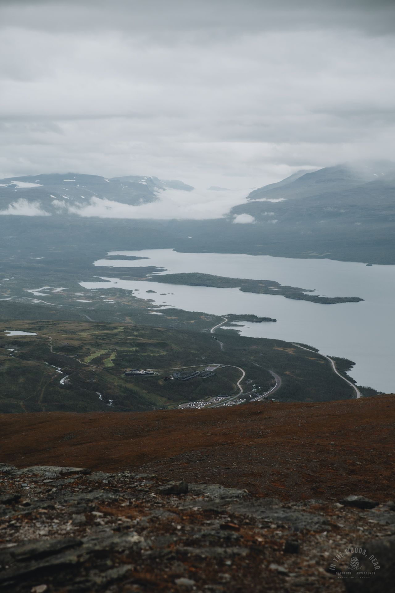
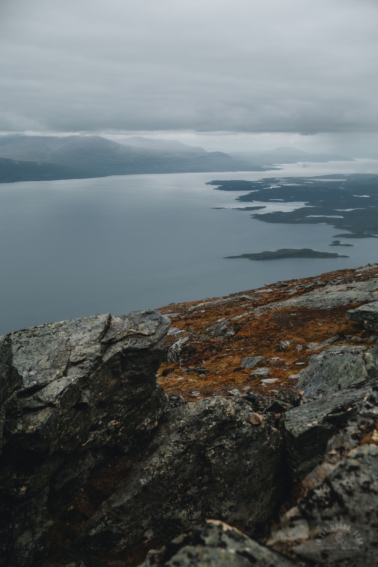


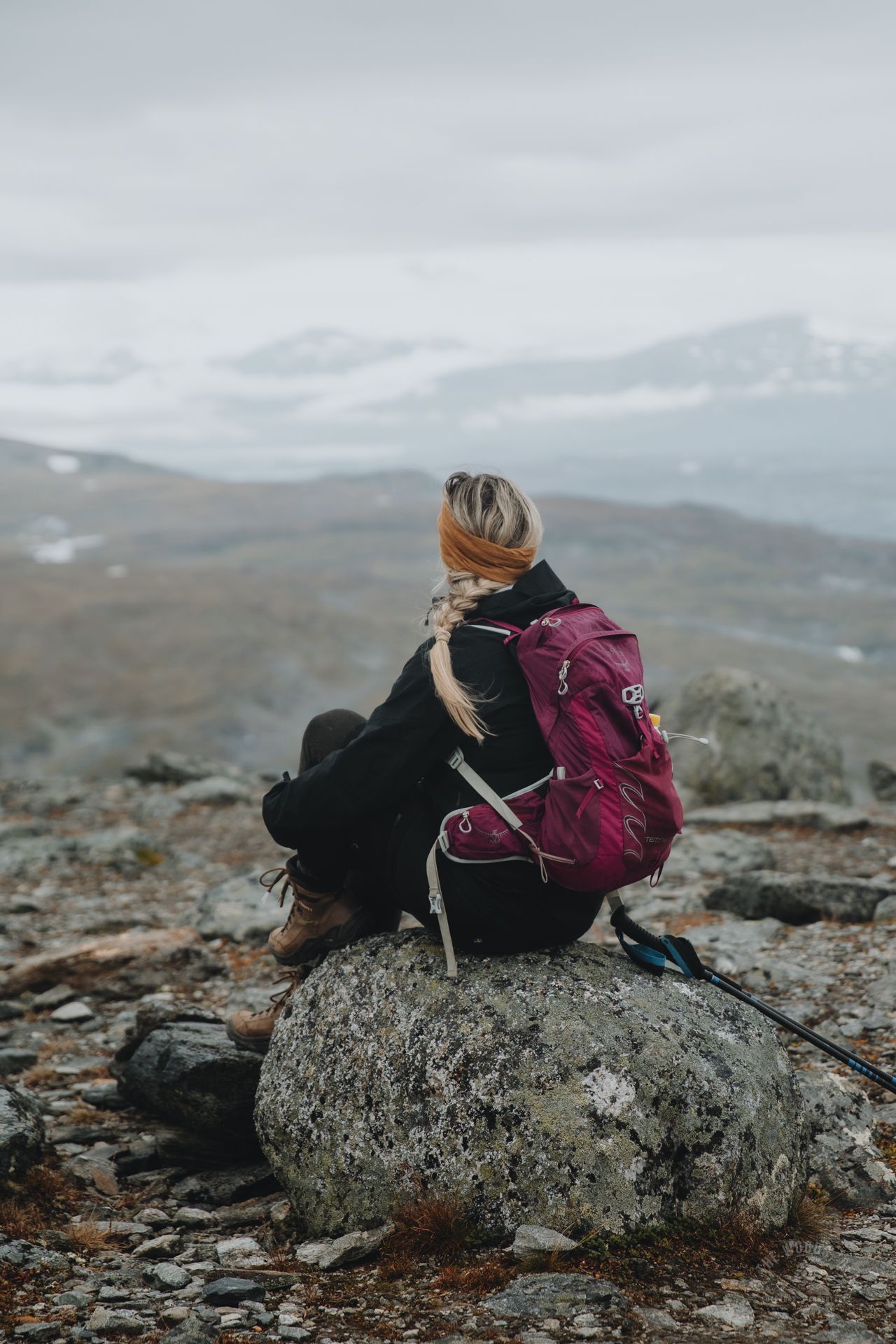
The very last ascent is a bit steeper again, and poles come in handy. In the view, you can see one of northern Sweden's most photographed natural sites, the U-shaped Lapporten, and the lush Abisko National Park. It took three hours from the railway station's parking lot to the summit of Nuolja.
A pile of stones and colorful flags mark the summit of Nuolja. Only from the northern edge of the summit, you can truly admire the vastness of Lake Torniojärvi. The E10 road winds like a thin ribbon towards Björkliden and further towards Riksgränsen, the border with Norway, and the snow-dappled mountains.
Nuolja also seems perfect for trail running. A group of young runners arrived from the direction of Abisko, slapped the stone pile, and disappeared towards Björkliden. From Nuolja, you could continue hiking to Kårsavagge valley, west of Slåttatjåkka, or along the river Gohpasjohka towards Lake Latnjajavri.
The descent from Nuolja to the Aurora Sky Station is swift down a gentle slope. If you don’t want to pass through the waterfalls again, it's possible to descend the slope next to the chairlift back to Abisko.
Several paths crisscross the ski slope, all quite steep. Loose gravel makes descending a bit challenging. The slow zigzagging lasts until reaching the treeline.
At Nuolja Offpiste, there is avalanche guidance and a slope map at the starting point of the lift. For those on foot during the snow-free season, there is a sandy walking path leading back to the fell station and the train station's parking area.
Links
Abisko Map & Information (Swedish National Parks)