Husfjellet is located northeast of Senja Island in Northern Norway, close to popular attractions such as Tungeneset and Ersfjorden Beach. Husfjellet is praised as one of the most rewarding hiking destinations in Senja. Although the hike is classified as challenging, the ascent is mostly gradual, and the scenery is breathtaking throughout the journey.
Norway's largest and most famous island group is the Lofoten Islands, with Senja Island following closely behind. Senja also offers similar landscapes: breathtaking sharp mountain peaks, turquoise shimmering fjords, and winding roads along the coastline. Senja is beginning to gain popularity comparable to the Lofoten Islands in terms of tourists, so the mountain trails and roads are often crowded during the summer months.
While on the most famous mountain, Segla, or the neighboring Hesten mountain, there is usually a lot of crowds no matter the weather, Husfjellet is clearly a more peaceful hiking destination. Only a few other brave hikers appeared in the mist and rain when I visited the summit of Husfjellet.
Arrival and Parking for Husfjellet
Husfjellet is located in Skaland, between the Bergsfjorden and Steinfjorden fjords. It takes about an hour to drive from Finnsnes to Skaland via Bergsbotn.
In the village of Berg, there is a Joker grocery store that offers a free toilet and coffee! It's worth buying delicious and fresh cinnamon rolls to enjoy with your coffee as a thank you for the great service, and after the hike, a pizza roll topped with sun-dried tomatoes tastes heavenly. Near the grocery store, there is a beach where you can stop by on a good day.
The trailhead for the Husfjellet trail is across the street from the grocery store. The trail passes right by Berg church. Parking is commonly done at the church parking lot, but in recent years, separate parking lots have been built in Senja to accommodate the growing number of tourists. So, follow the signs and park accordingly.
Near the Fv251 road, there is a good camping area, Skaland camping. There aren't too many tent spots, but the grass is flat, and the facilities are modern. Payment can be conveniently made online.


Husfjellet Trail
The Husfjellet hike includes three destinations: Myran with its lean-to shelter, Sommardalen with the Sommarhaugen viewpoint, and the actual summit of Husfjellet. You need to bring your own firewood to the lean-to shelter's fireplace if you want to have a campfire.
The Husfjellet hiking trail is marked in red, indicating it is challenging. Along the way to Myran's lean-to shelter, the trail is classified as green, meaning it's easy. From there to the Sommardalen viewpoint, the trail is moderate, marked in blue.
The height of Husfjellet is 632 meters (2073 ft). Many sources state that the height is 635 meters (2083 ft), but according to the area's information signboard (as well as my own map app), the mountain is three meters lower. Maybe erosion over time.
Overall, the hike is relatively easy, but in the middle, the bog may be really wet, and near the summit, it becomes rocky with some exposure. In my opinion, Husfjellet was easier than Barden, Hesten, and Sukkertoppen. The hike to Grytetippen was much more laborious as well.
Hiking to Husfjellet
The hike to Husfjellet starts amidst a sea of flowers, where a signpost points the way. Next to the sign, there's an information board and a map of the Husfjellet trail. The sign also provides estimated hiking times for different stages of the trail.
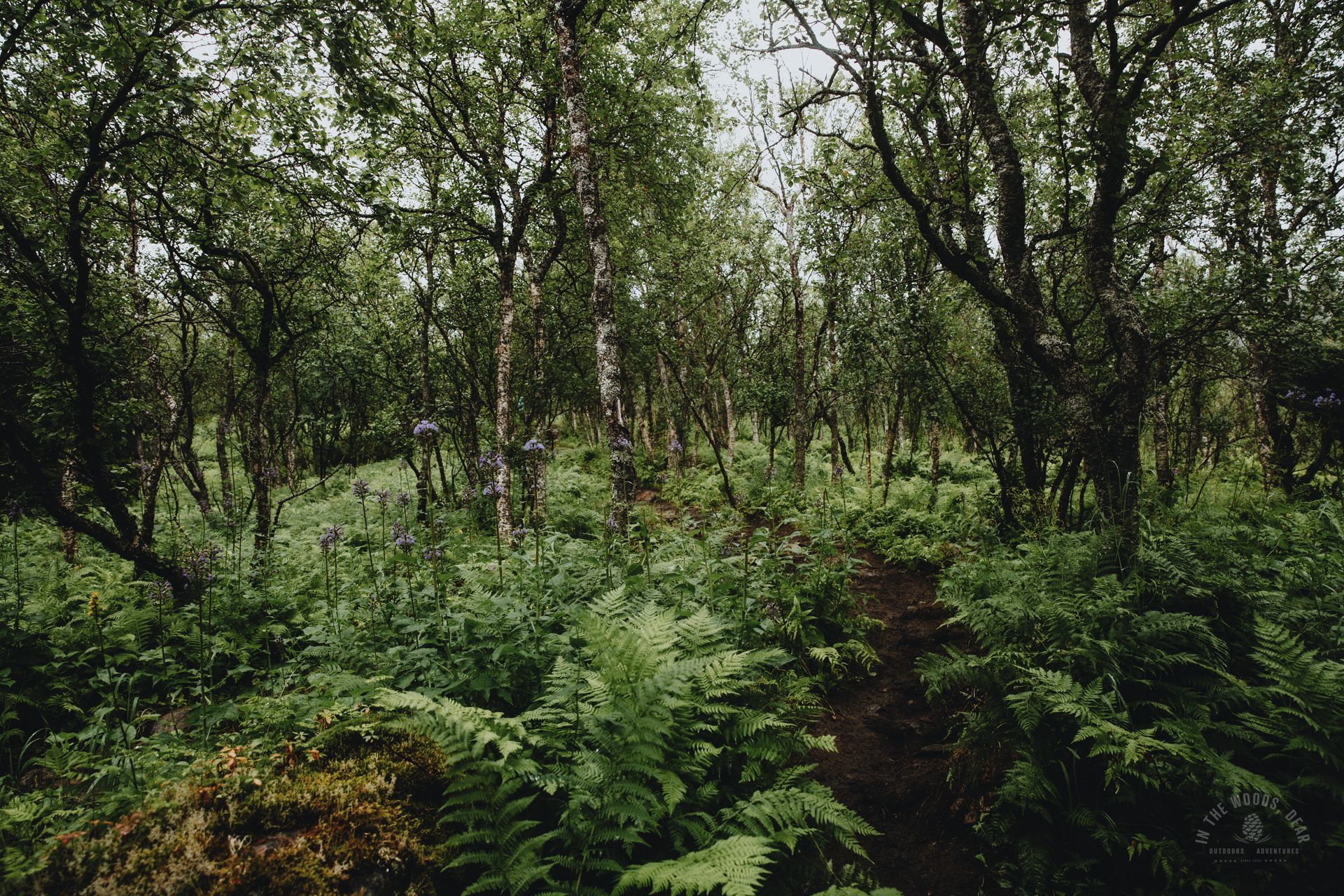
The flower meadow transitions into dense pine forest. A birdhouse hangs on the tree trunk among the thick branches of spruce trees. Mossy patches quickly recede as the sandy path winds through the open area.
In half an hour, you'll reach Myran and the lean-to shelter. By this point, you can already catch glimpses of the dark turquoise waters of Bergsfjorden beyond the trees. The two shelters are draped with ferns and summer flowers, under the roof there are benches and tables.


The journey continues with a gentle ascent. The first stream is easy to cross using stones. The brownish water likely originates from the marshy ground.
Next, you'll turn 90 degrees to the right into a dense forest. The path becomes muddy at this point, with some large rocks on steep slopes. In fifteen minutes, you'll ascend above the tree line enough that the magnificent Bergsfjorden and the surrounding mountains beautifully unfold in front of your eyes.
The Husfjellet trail has been traversed so many times, that mud and peat have given way to rock. The rain makes the boulders slippery. Pathetic, weather-beaten, leafless birches in the mist resemble scenes from Kaldoaivi in Lapland.
The summit of Sommarhaugen in Sommardalen (327 m / 1073 ft) is reached in an hour and a half. If you're looking for an easy route and stunning views, you can simply visit Sommarhaugen to admire Bergsfjorden and peek over to Sommardalen, where Husfjellet rises.
The trail to Husfjellet continues from Sommarhaugen, descending into the valley. The valley is mostly bog, meaning wet peat. If it's been rainy, the trail may have about a meter of brown water.
Most of the bog has wooden boards built over it, allowing you to avoid the wettest spots. Some sections of the boards sink when stepped on, and the gaps between some boardwalks are so long that you need to gather speed to jump across. A few young men were hiking fast in sneakers and sunk quite deeply when taking some wrong steps.
After the bog, the terrain begins to rise again towards the summit of Husfjellet. Small birches reappear to line the peat path. There are several intersecting paths, but they all likely lead to the same destination.


The Summit of Husfjellet in the Mist
The summit of Husfjellet is very rocky, and the trail runs right along a steep edge. In the mist, the drop-off is hardly visible – there's no exposure (as you can’t see it), but for safety reasons, it's advisable to stay a sufficient distance from the edge.
On a clear day, the summit of Husfjellet offers stunning panoramic views in all directions. To the northeast, you can see the sharp Tungeneset beyond the Steinfjorden fjord, to the south, the beautiful Bergsfjorden fjord, which can be admired already from Sommardalen. In the southwest, you might catch a glimpse of Sukkertoppen, the Sugar Top Mountain, if you got a nice weather.
At the top of Husfjellet, there's a mailbox containing a guestbook. From the mailbox at the summit, you could walk even further and a bit higher along the narrow ridges. On a clear day, stunning 360-degree views can be seen from almost every direction. In the mist and pouring rain, summiting only brings the joy of exercise.
If you have the energy, on the way back, you could continue along the ridge, veering left towards another peak, Litjebrusen. There's a clearly visible trail leading to Litjebrusen, and the views are quite similar to those from Husfjellet. You can descend straight down to Sommardalen and Sommarhaugen along the southern ridge of Litjebrusen.
My sports watch showed a total distance of 8.7 km, an ascent of about 644 m, and a total time of 3:42. In bad weather, there weren't many stops, and I came down in less than an hour, as there wasn't much to see.
Tip: It's likely that your shoes will get wet on this hike even on a sunny day. I wouldn't recommend the bog section for very young children, especially during the rainy season. The hike is also quite long, and access to clean water is somewhat limited.


