Parastinden (1419 m) - Hiking in Northern Norway
- Table of contents
- Parastinden
- Rognli - Parastinden day trip
- Kilpisjärvi - Parastinden hike
- From Gappohytta hut to Parastinden
- Hiking to the waterfalls
- The final ascent of Parastinden
- Parastinden - summit in the afternoon sun
- From Parastinden to camping near Gappohytta
- Kilpisjärvi - hiking and day trips
- Destinations in the Lyngen area
Parastinden in Norway is a favourite mountain especially among Finnish hikers. The mountain, which resembles a shark's fin, can be climbed on a short day trip from Rognli in Norway, or on a longer hike from Kilpisjärvi in Finland.
You can see the peak of Parastinden when standing in Kilpisjärvi - and from the top of Parastinden you can see Kilpisjärvi. Many people summit Parastinden on the Three country cairn hike (Finland - Norway - Sweden).
Parastinden
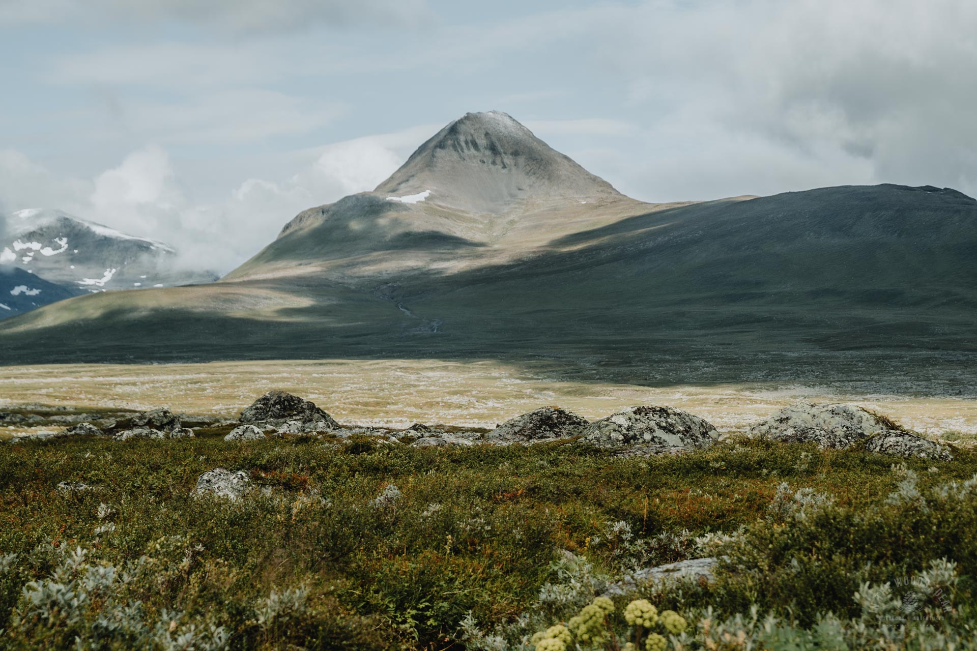
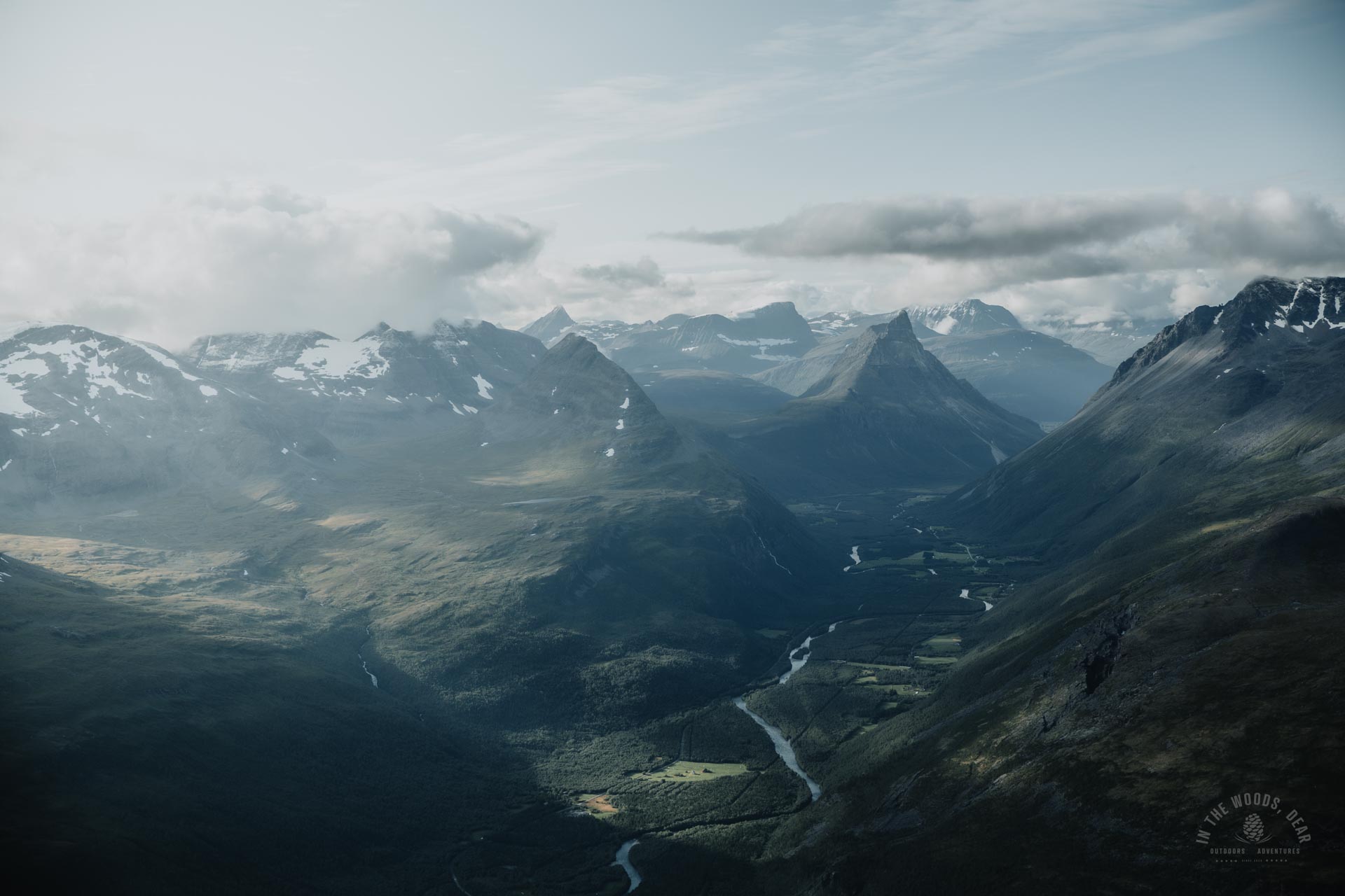
Parastinden (Bárrás in Sámi) is a steep mountain south of Lyngen and Signaldalen in northern Norway. Parastinden rises in sublime solitude between two valleys, Stordalen and Parasdalen. The mountain is 1419 metres above sea level.
The slopes of Parastinden are easy to hike and not particularly steep. Only the last sharp peak is very steep. The final ascent is about 650 metres long (measured with a straight line on the map) and the route ascends about 340 metres on that distance.
The summit can be reached from the east side of the mountain, where the ridge is wide. The summit of Parastinden is also suitable for most people who suffer from fear of heights.
Rognli - Parastinden day trip
The easiest day trip to Parastinden is from Rognli on the Norwegian side. From Rognli, take the E8 road going around the Lyngenfjord to the bottom of the fjord at Storfjorden and turn off at Signaldalen. At Signaldalen you can also see perhaps the most famous landmark in the area, Otertinden with its sharp peaks.
Google Maps makes it a little tricky to find the right spot. Turn off to the right at Signalnes and cross the Stordalselva river. Then drive to the end of the road to Rognli, where you will find parking space.
The route runs alongside Paraselva in Parasdalen, and then starts to climb left towards the slopes of Parastinden. The shortest hike from Rognli to the top is about five kilometres.
Kilpisjärvi - Parastinden hike
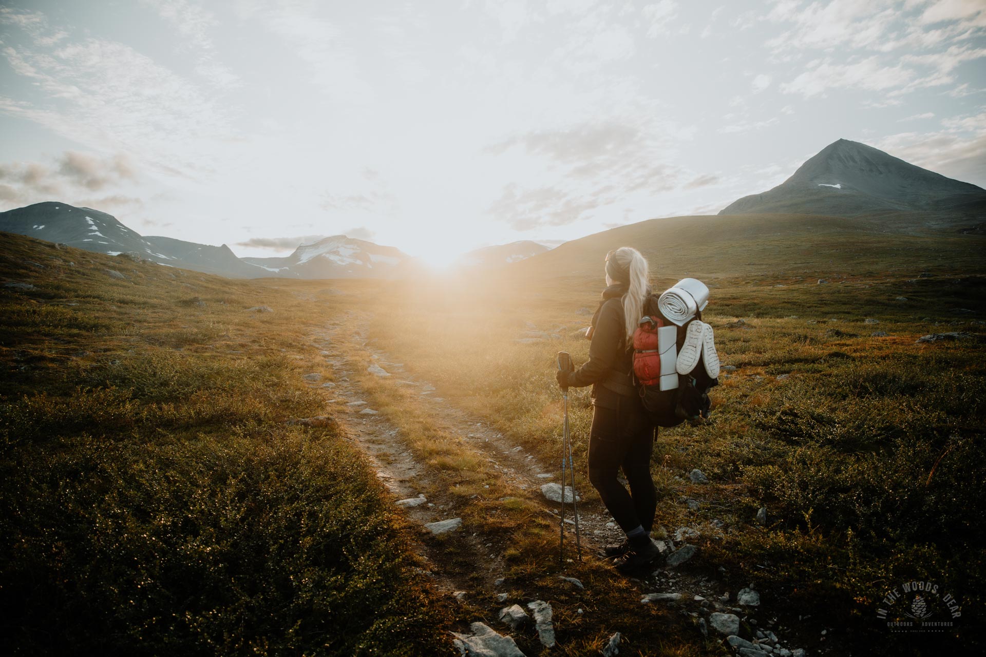
From Kilpisjärvi, hike the Arctic trail through the Malla Nature Reserve. The easiest way is to follow the marked trail past Goldahytta and Gappohytta huts to Parastinden. The length of the Kilpisjärvi - Parastinden hike is at its shortest about 32 km: from Kilpisjärvi to Gappohytta about 26 km, and from Gappohytta to the top of Parastinden about 8 km.
During the nightless night in mid-summer, Parastinden can be conquered in one day from Kilpisjärvi, if you are fit and enthusiastic enough. However, you won't have time to hike back to Kilpisjärvi - it would be a suitable distance for a trail run or fastpacking.
The Parastinden map and the Three country hike map can both be found on the Calazo Kilpisjärvi-Halti map.
I did the Three country hike in late August, with the summit of Parastinden conveniently on the way from Gappohytta.
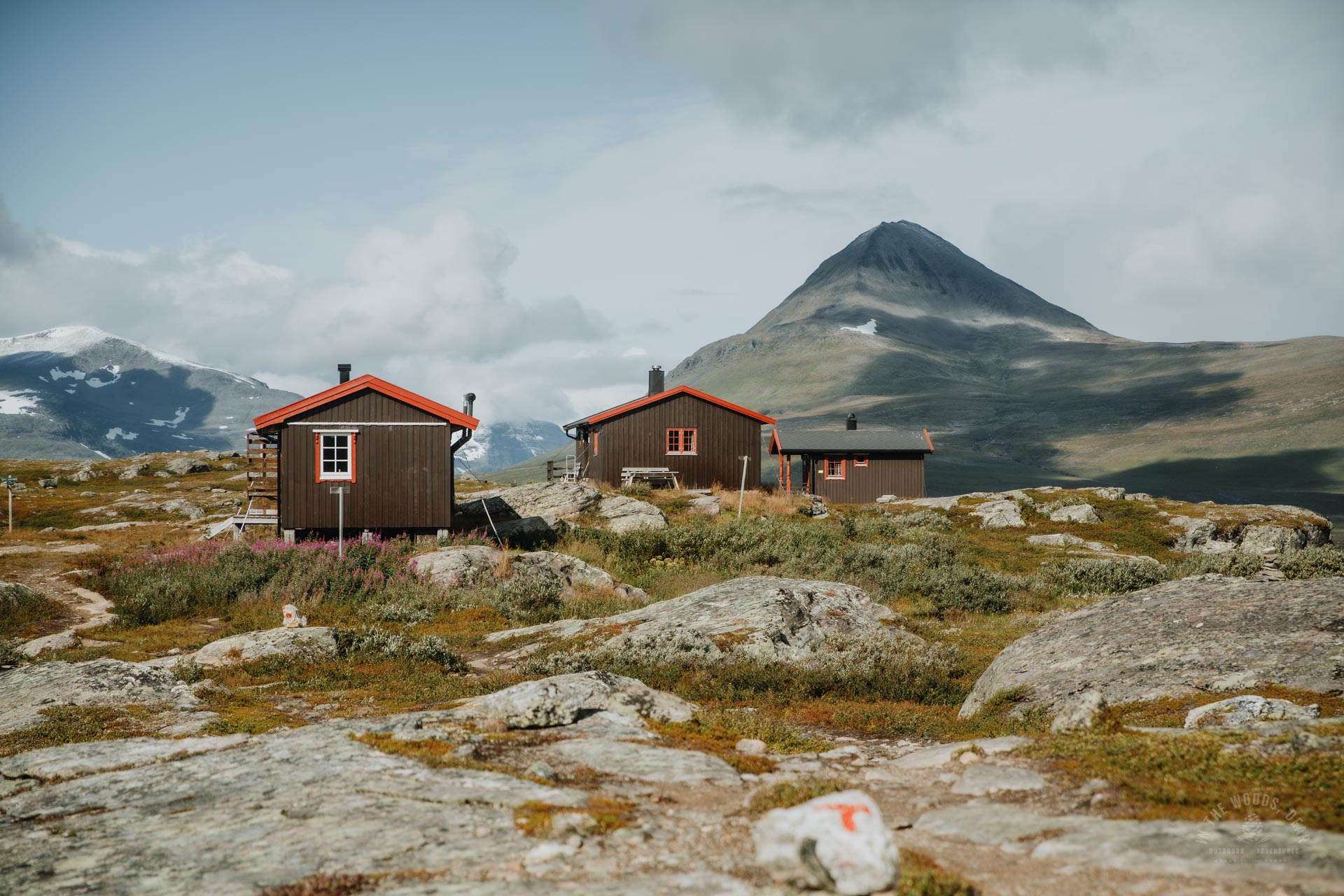
From Gappohytta hut to Parastinden
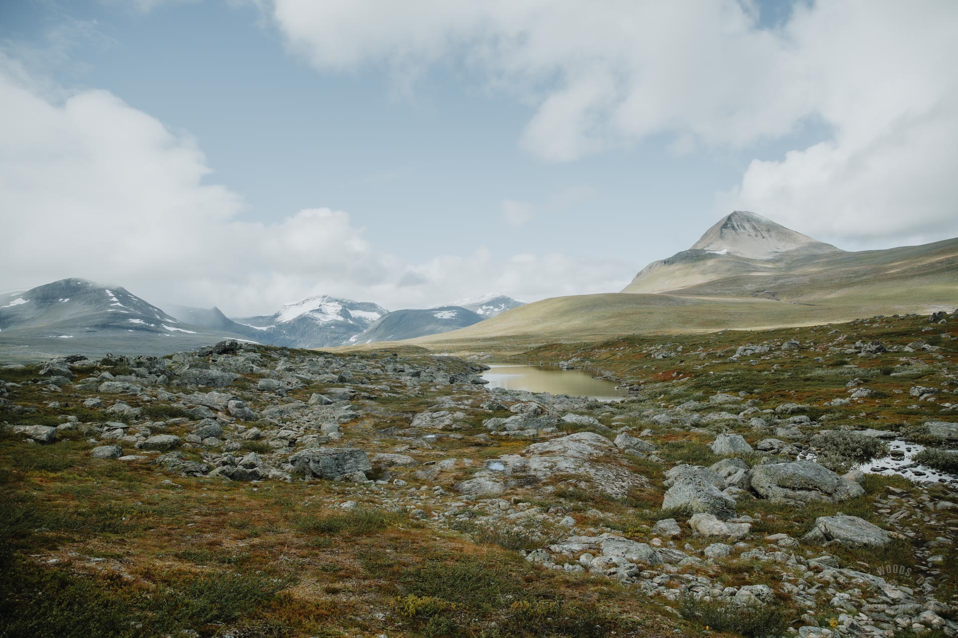
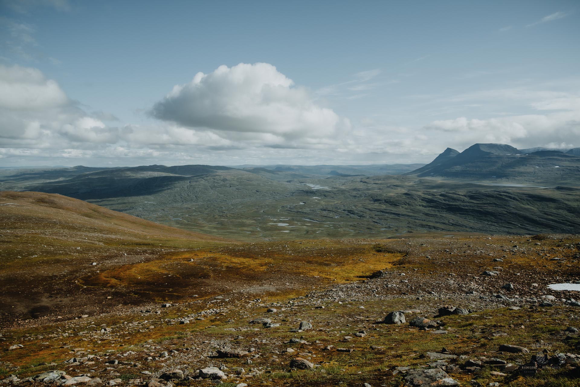
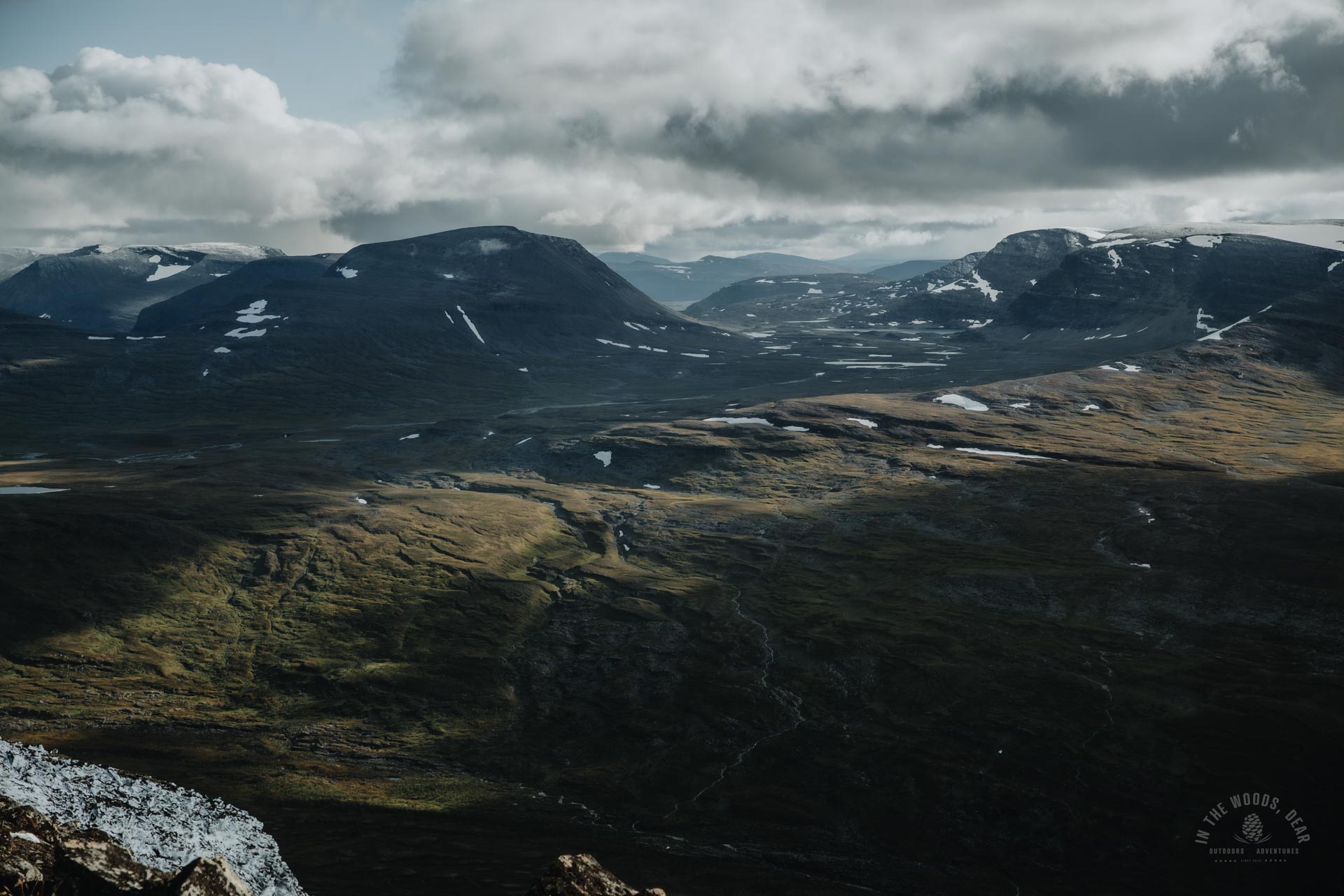
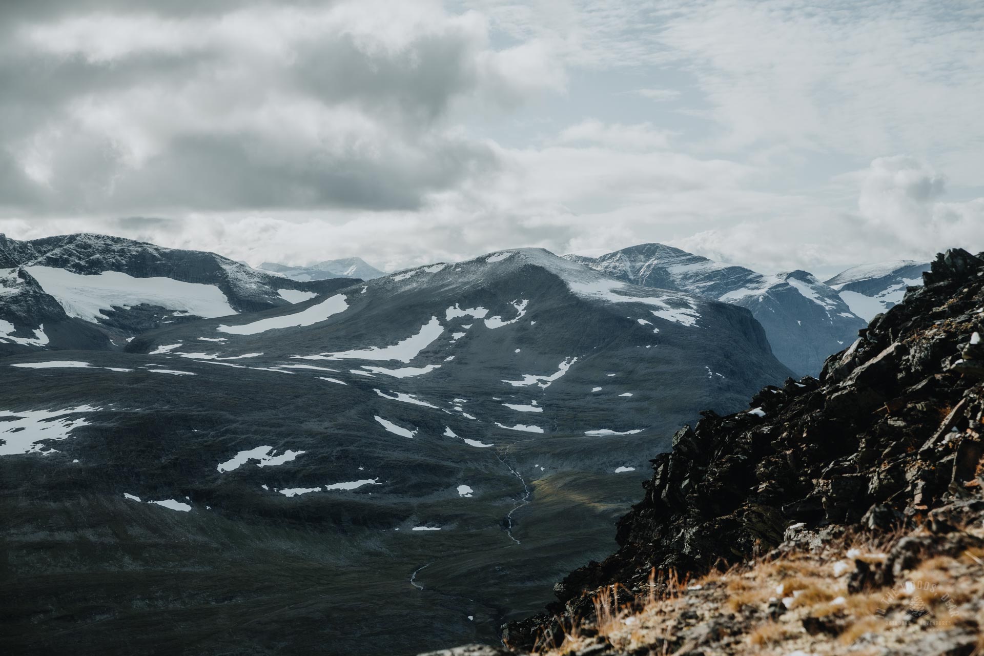
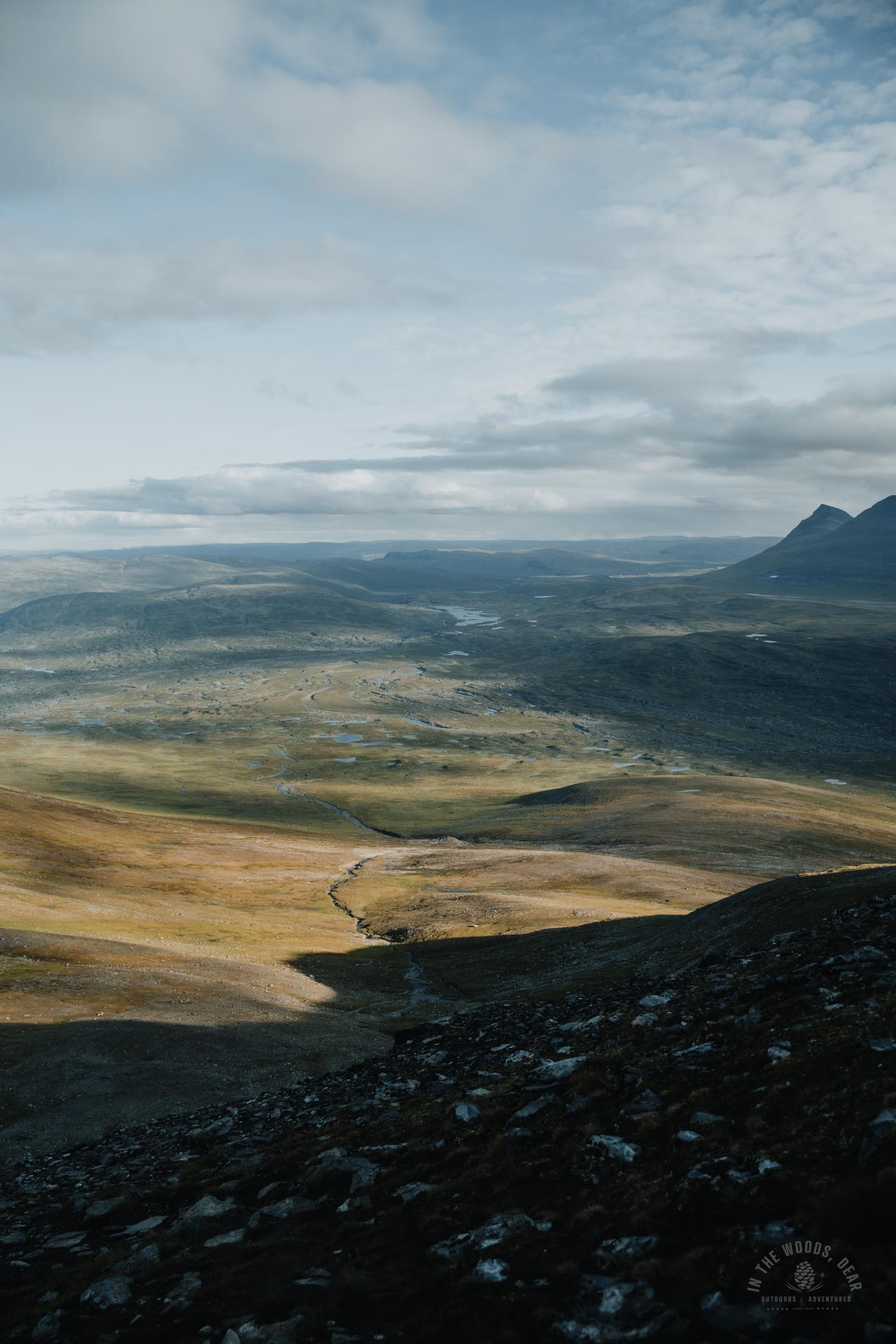
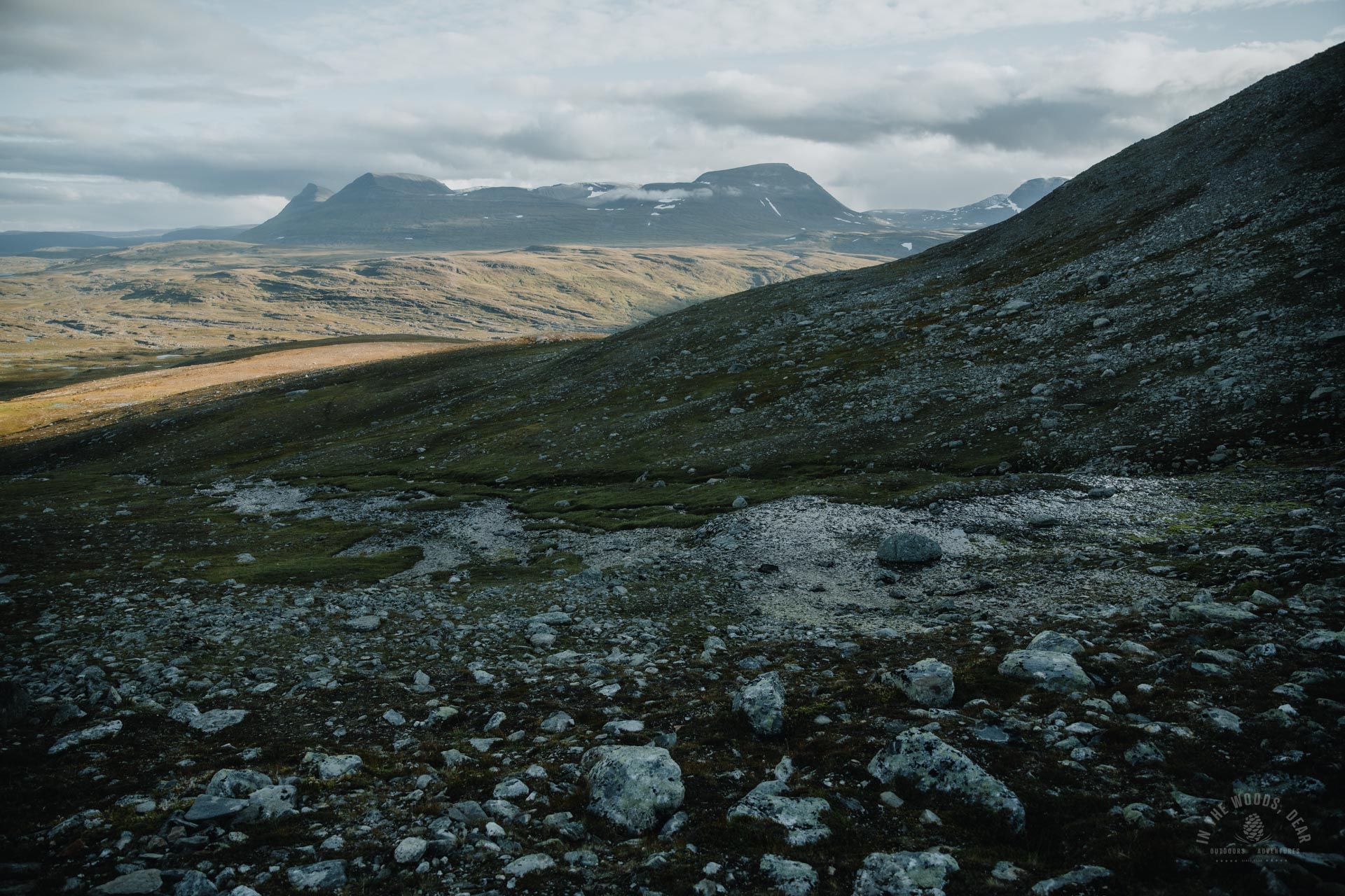
I had camped for the night at the nice Indre Skjaerdalen valley and was thinking about the route to the top of Parastinden. The eastern slope of the mountain is long and gently sloping, so from Indre Skjaerdalen you could draw an almost straight line to the top.
However, the terrain north of Rundfjellet was so rugged that the hike could become difficult. There would also be two rivers - Gappojohka and Visiedggajohka - which I knew nothing about the possibilities of crossing. A good four kilometres along a well-marked trail to Gappohytta seemed a reasonable choice all in all.
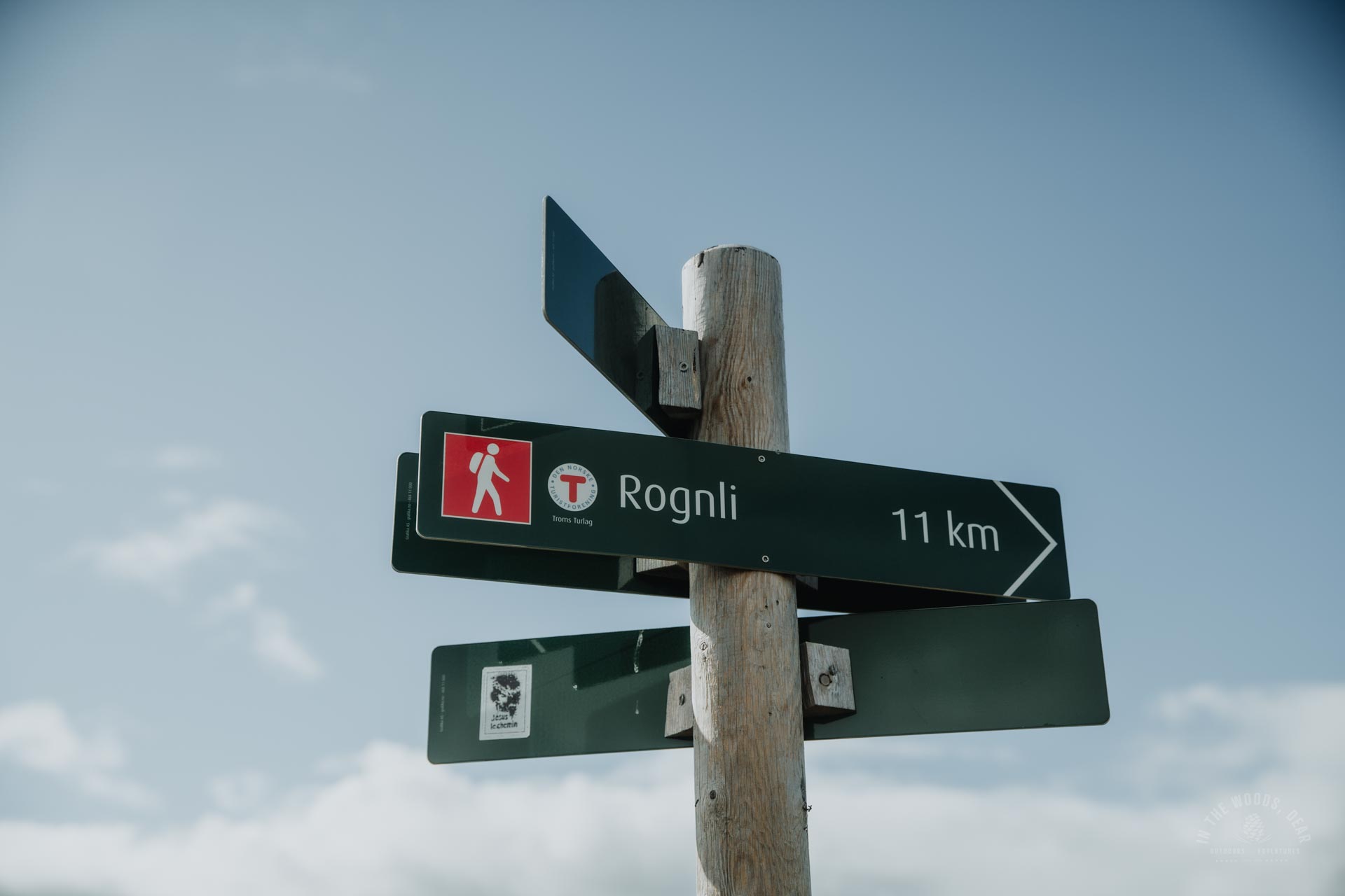
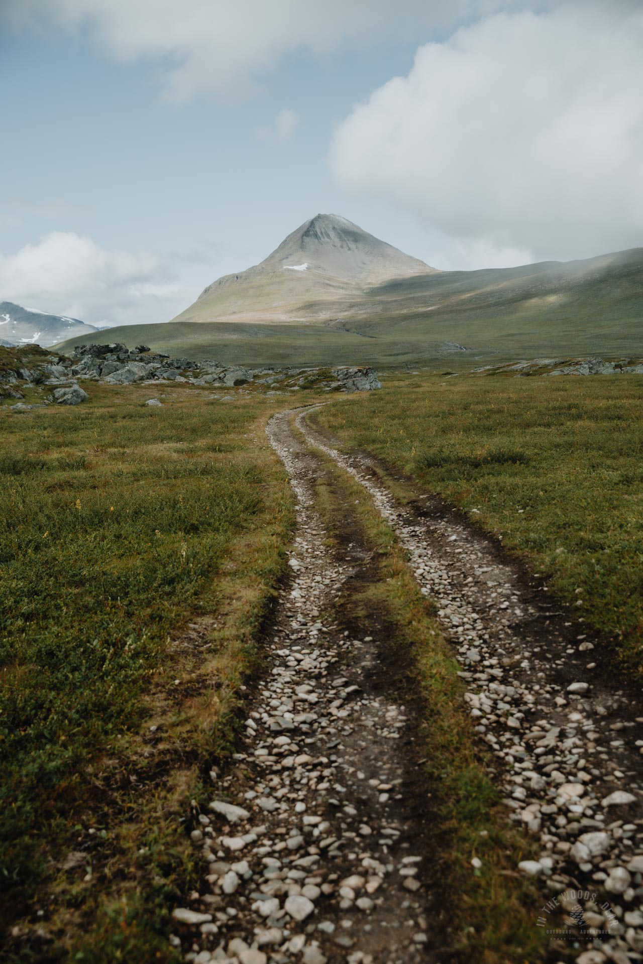
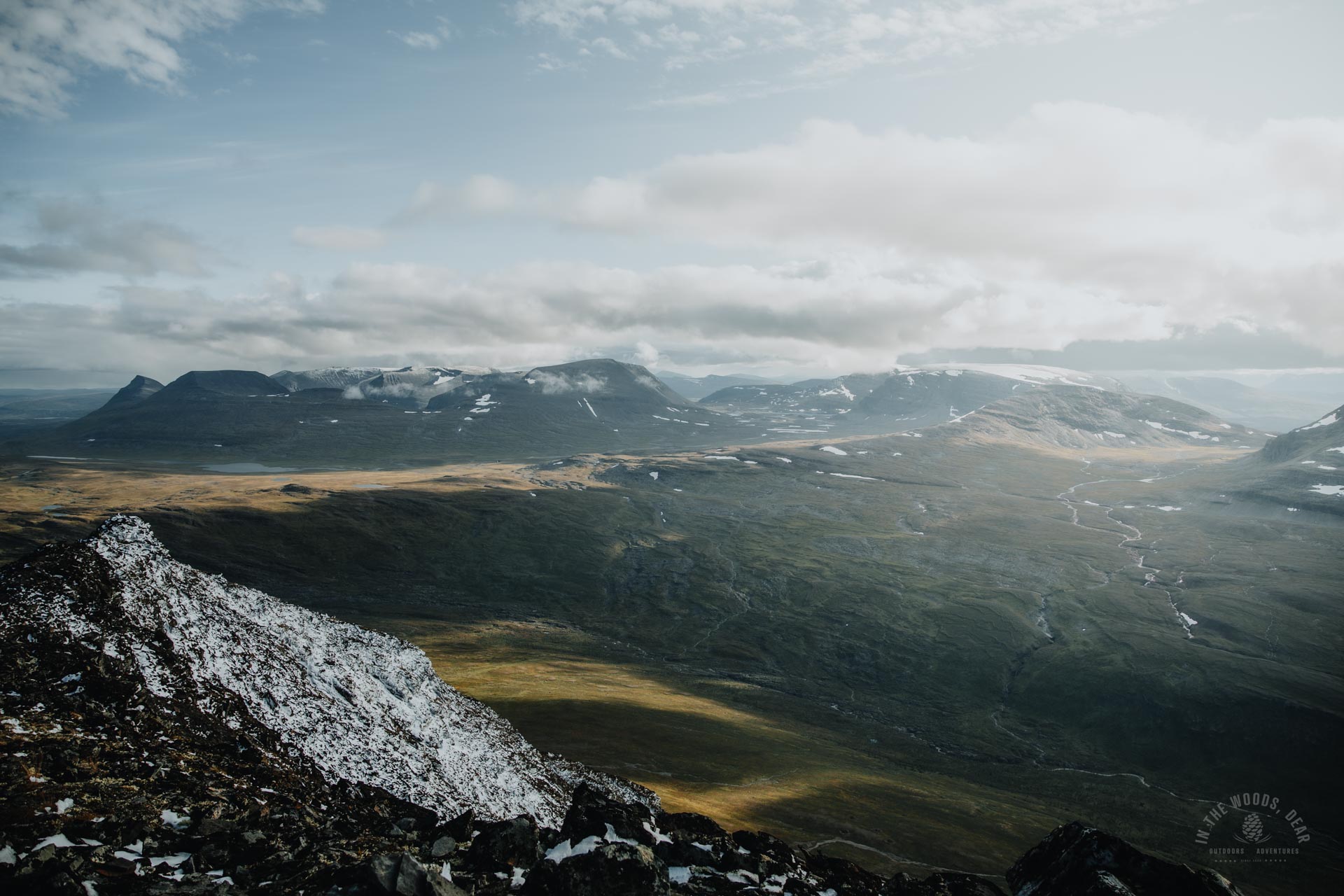
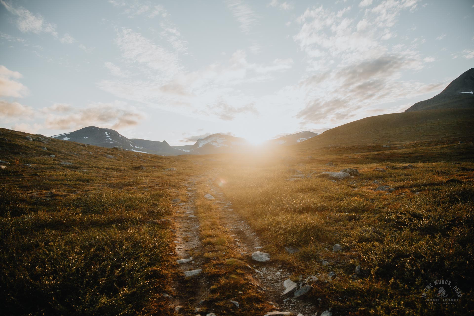
From Gappohytta there are two routes to Parasdalen and Rognli. To the north-east there is a normal path nearer Njearreláhku. To the north is a country road or ATV track across the flat fell highlands of Visiedga.
I set off along the ATV track at 11:30 from the Rognli signpost. It is eleven kilometres from Gappohytta to Rognli and eight kilometres to the summit of Parastinden.
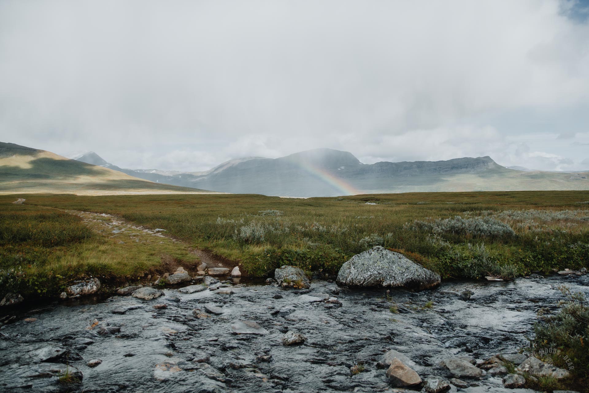
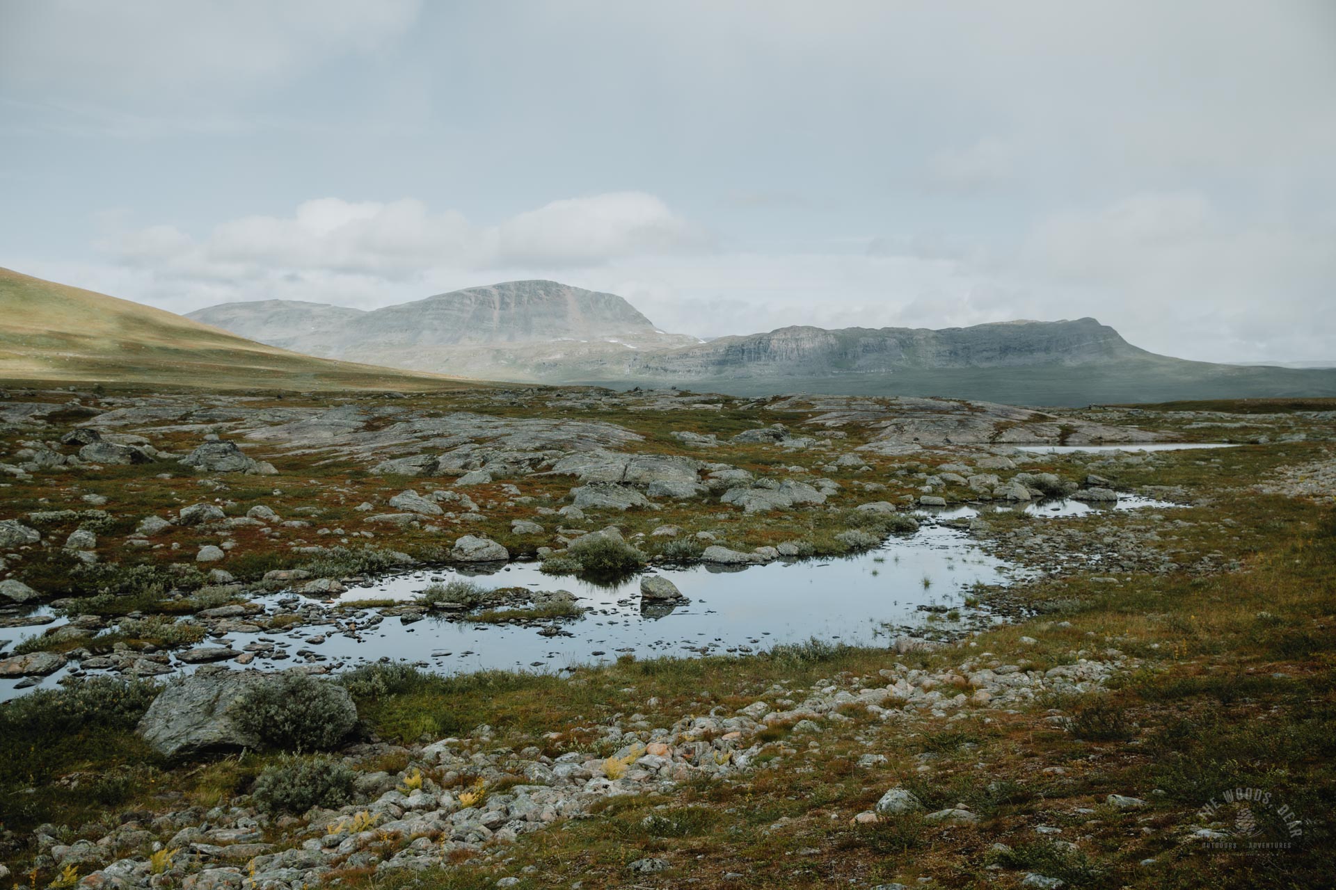
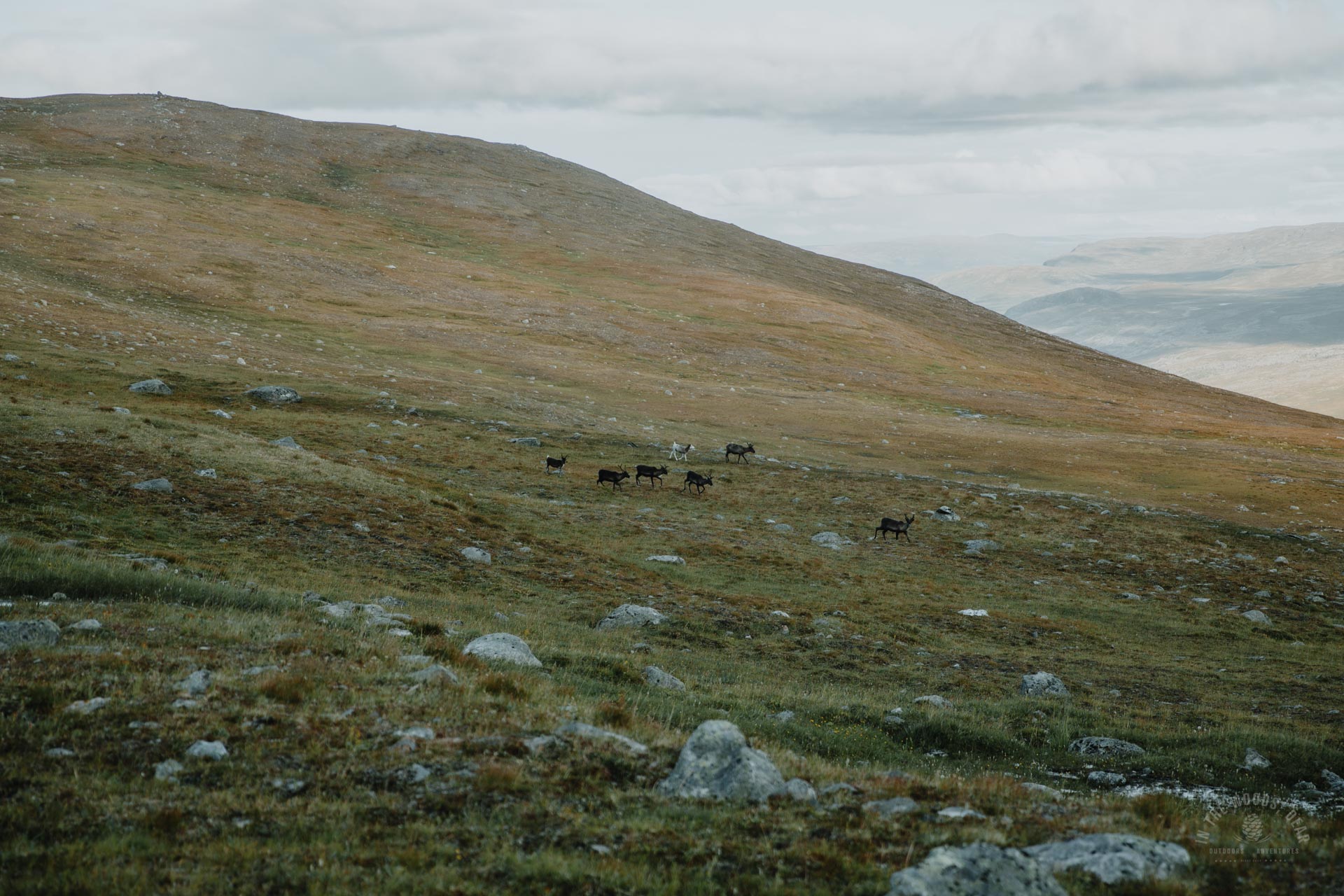
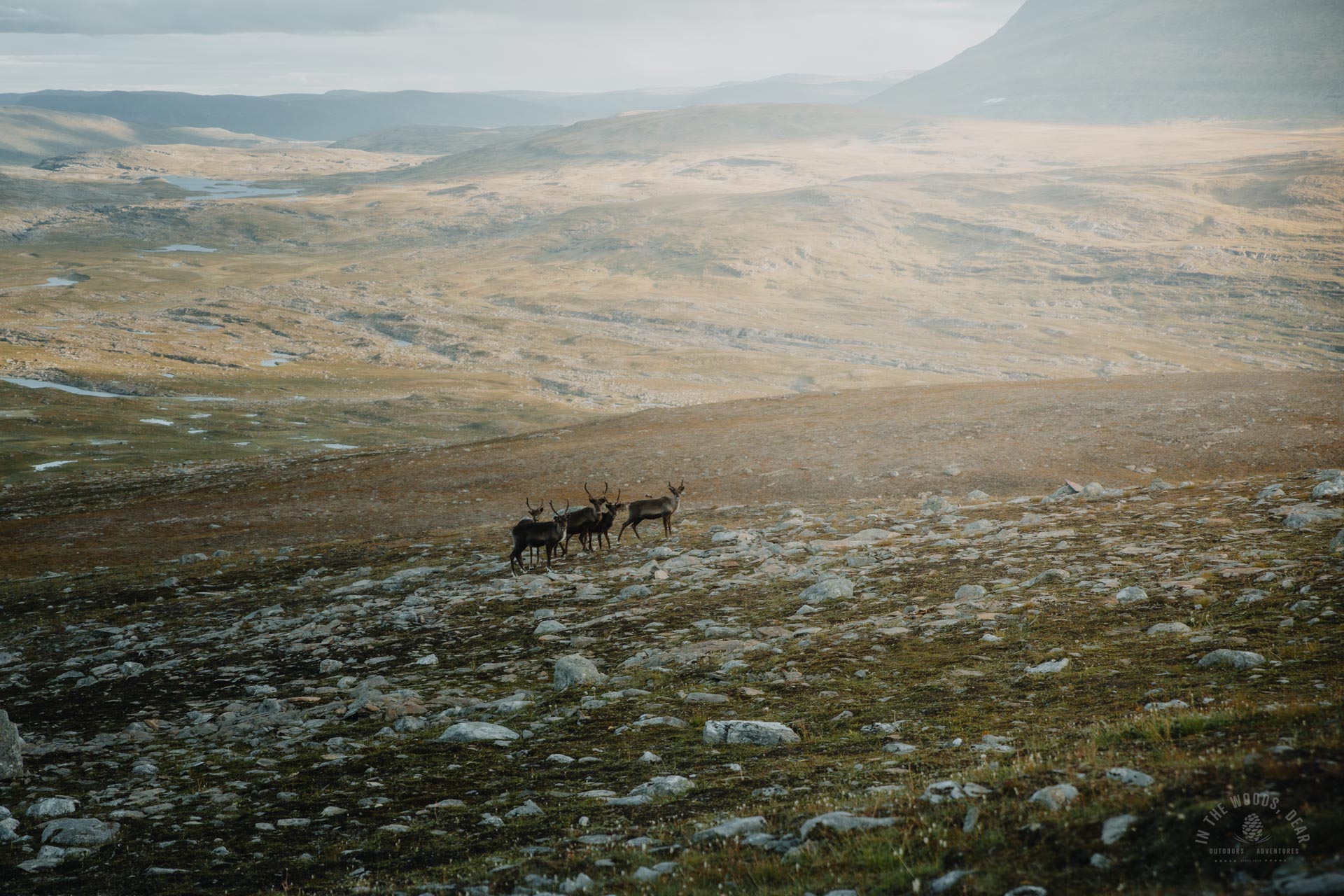
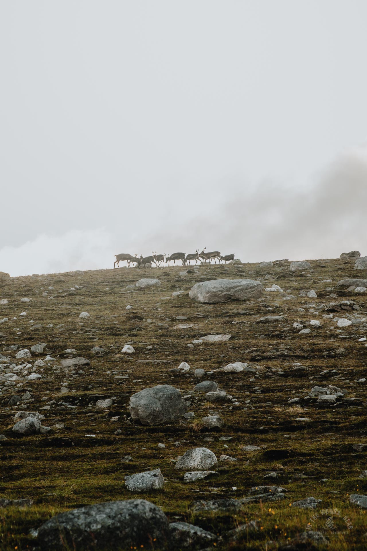
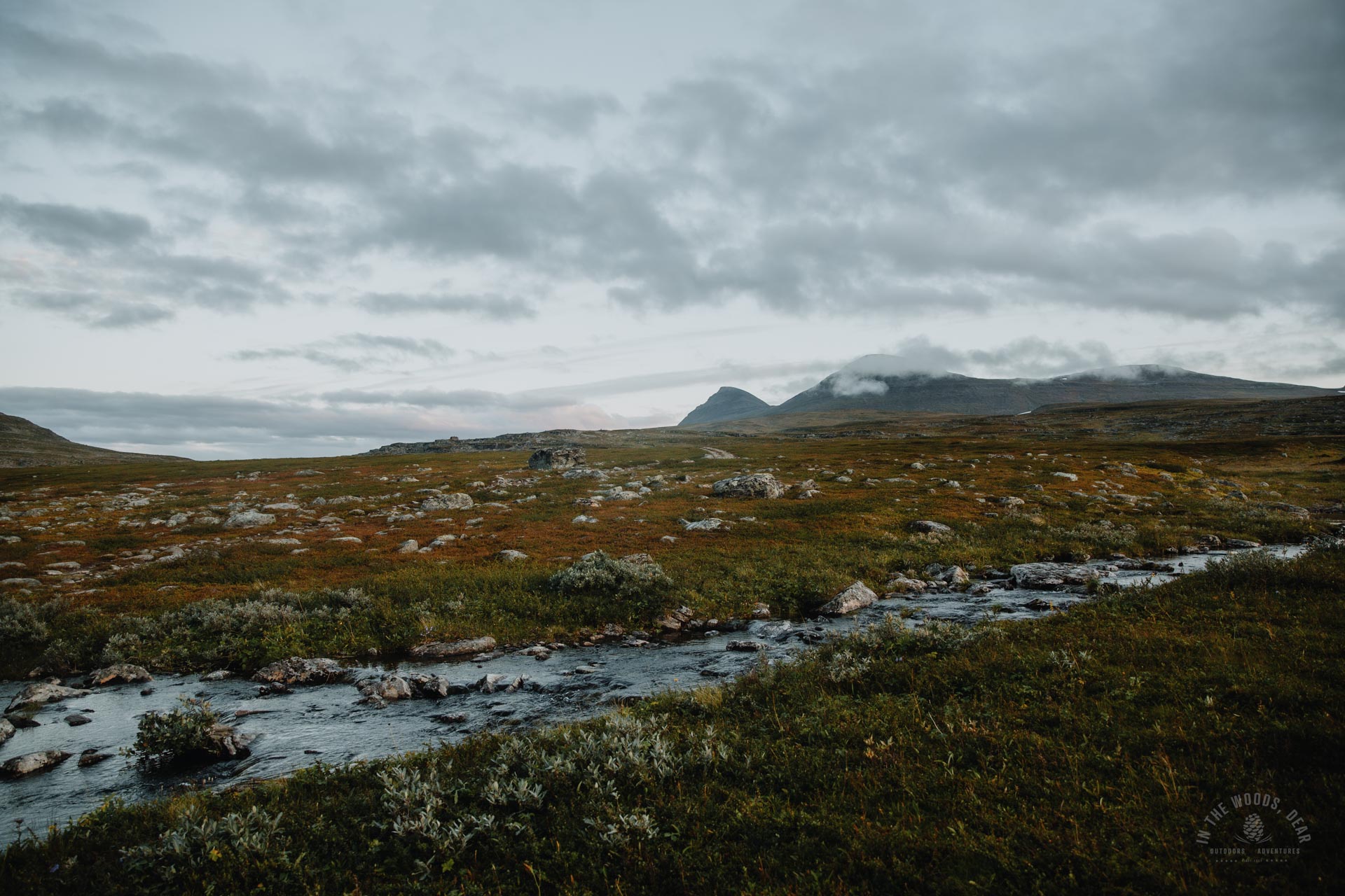
Crossing the Visiedggajohka river at the road crossing was easy, without taking my shoes off. In the distance, I could see pretty rainbows under some separate clouds sprinkling the water and sun shining. And of course reindeer walking in small herds.
Around the road, beautiful little ponds and streams sparkled. Occasional splashes of orange and red in the landscape whispered about the arrival of autumn. Often in late August you can still hike in a t-shirt, this year temperatures stayed within a few degrees.
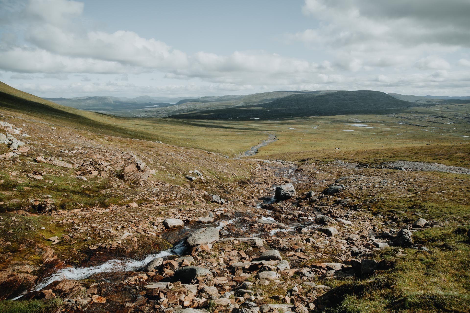
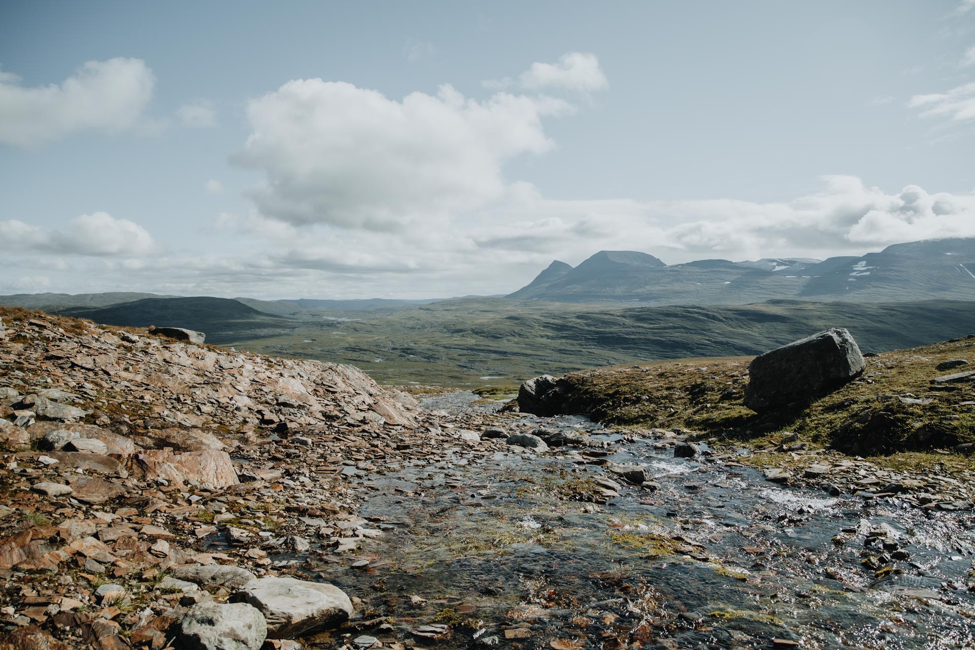
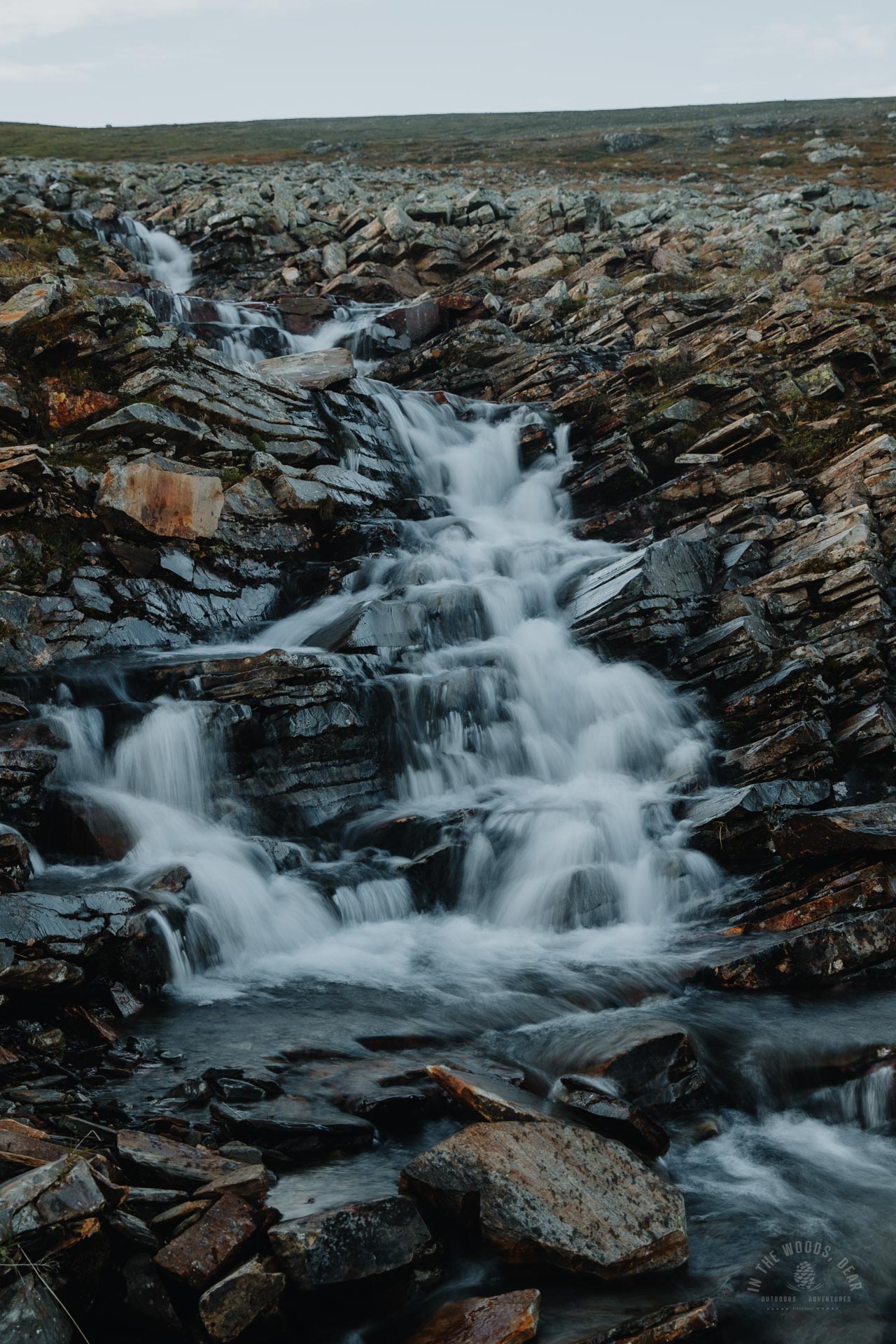
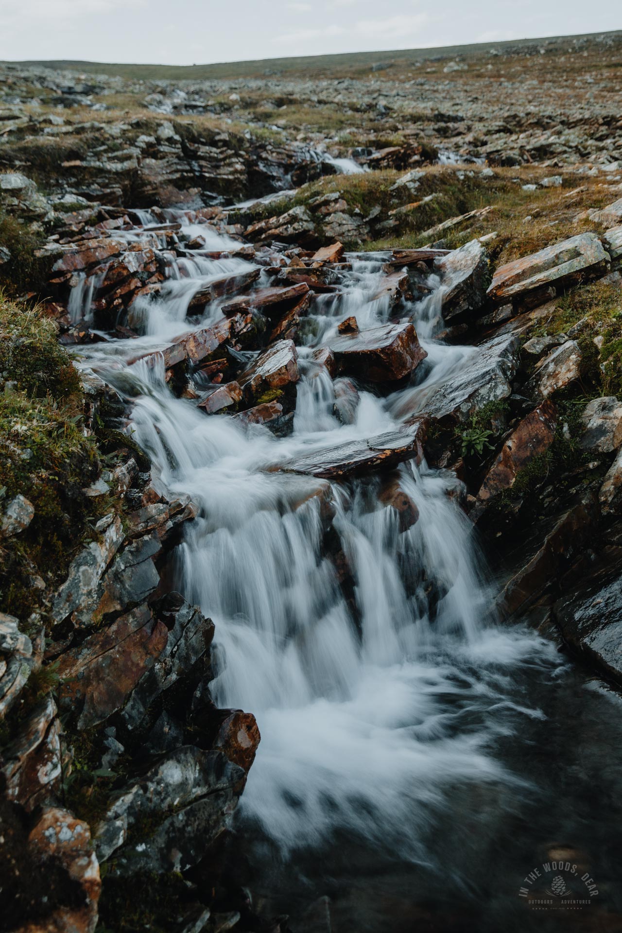
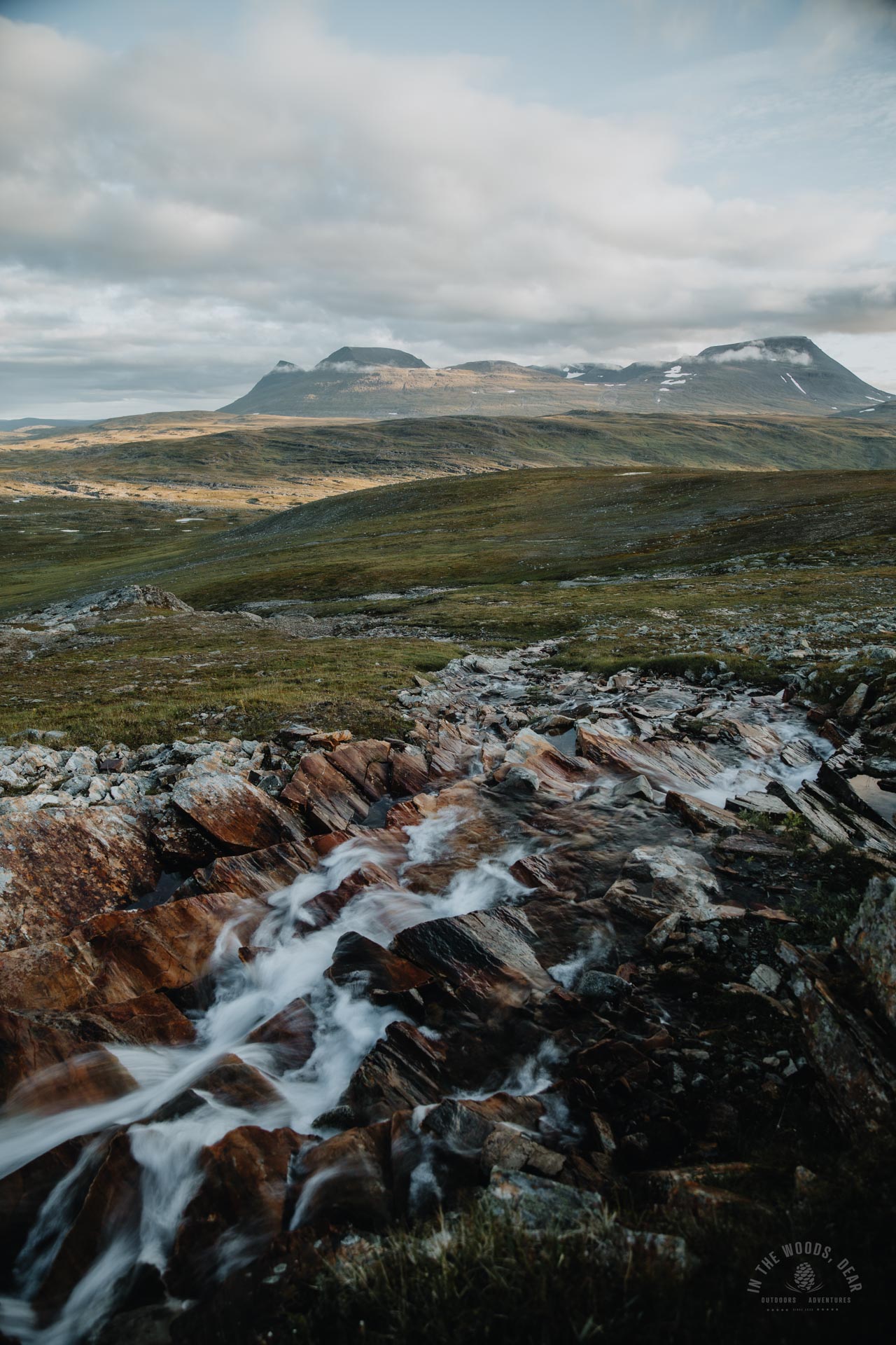
Hiking to the waterfalls
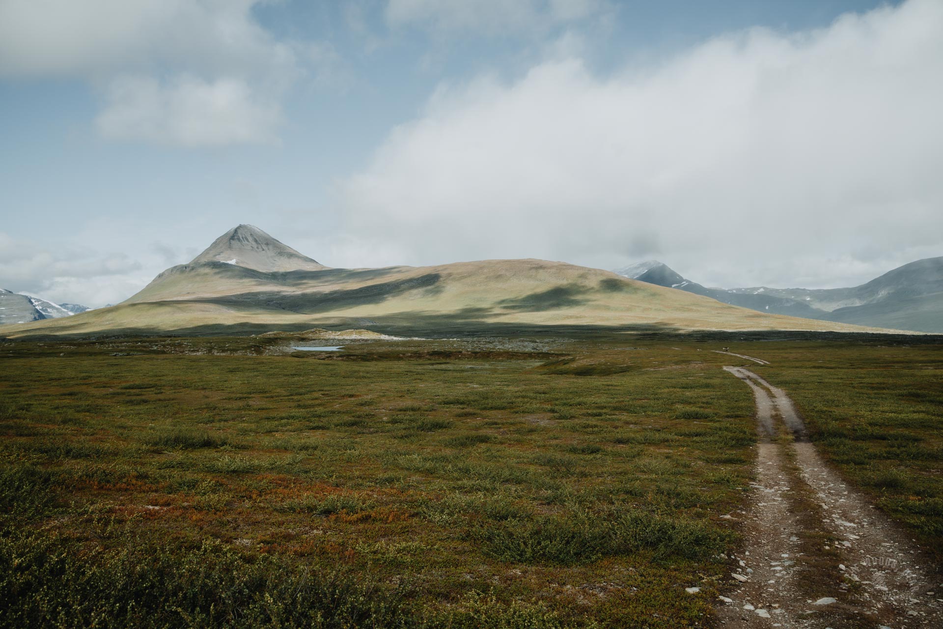
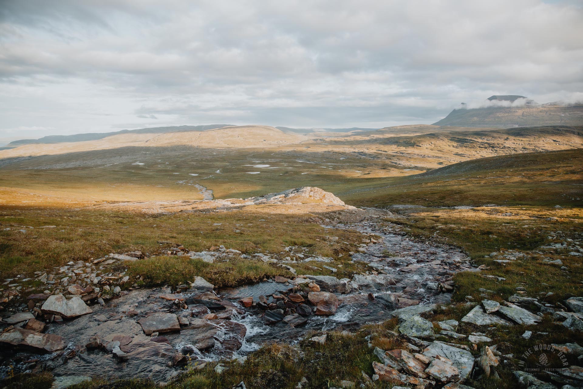
After four kilometres on the road, it felt very pleasant to step off the trail. The terrain seemed dry and flat, the wetlands mostly stayed around the ponds I passed. I set off in the direction of the stream and its groove that descended from the mountain.
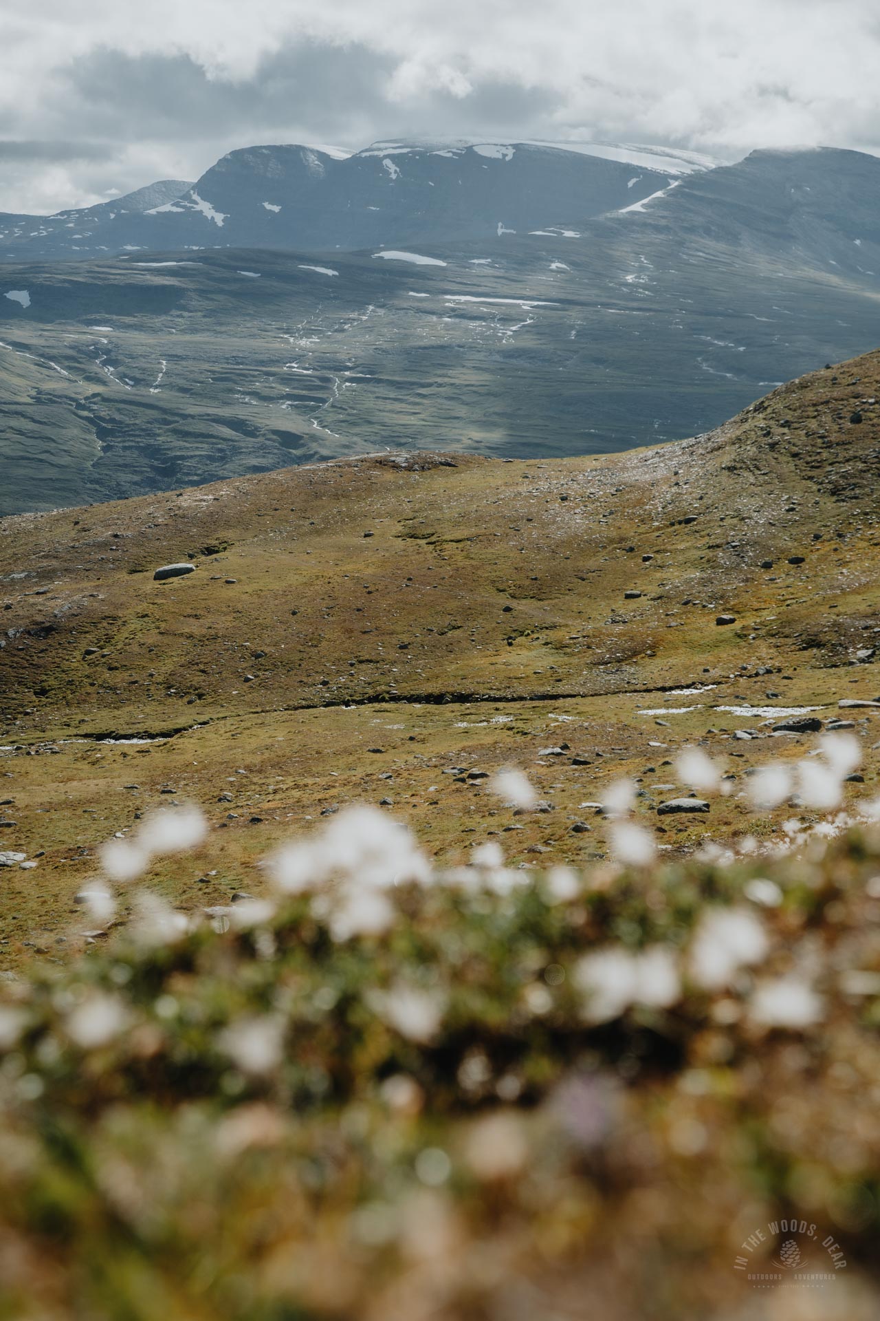
No great navigational skills were needed, though: the mountain rose straight ahead and the target spot was on the right edge of a black triangle. The slope was covered with low tundra vegetation for the first part, then mostly grass and some lichen.
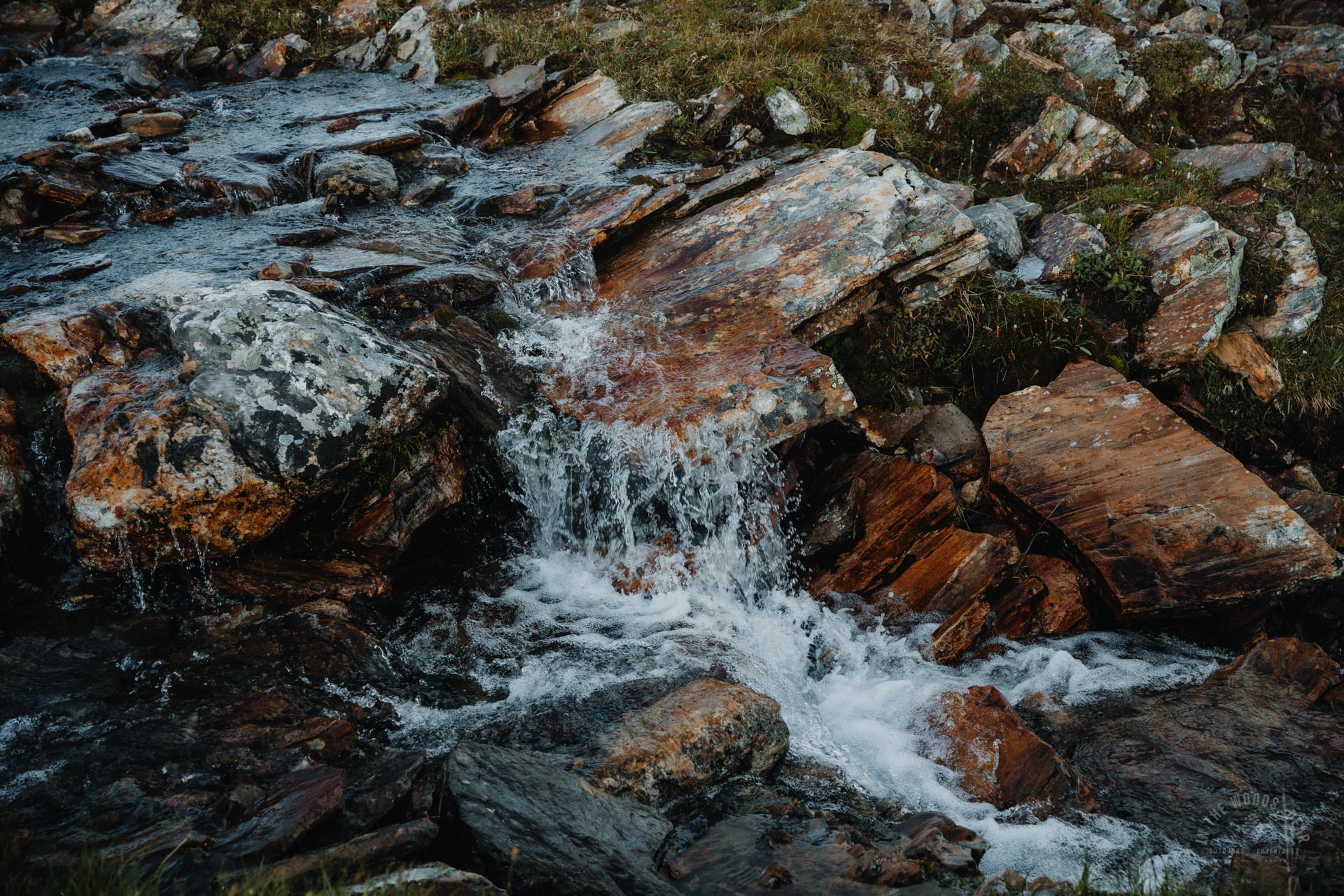
I came to a wide stream running off from the left. Water was flowing a few inches deep. The stream was full of small stones to walk across with dry feet.
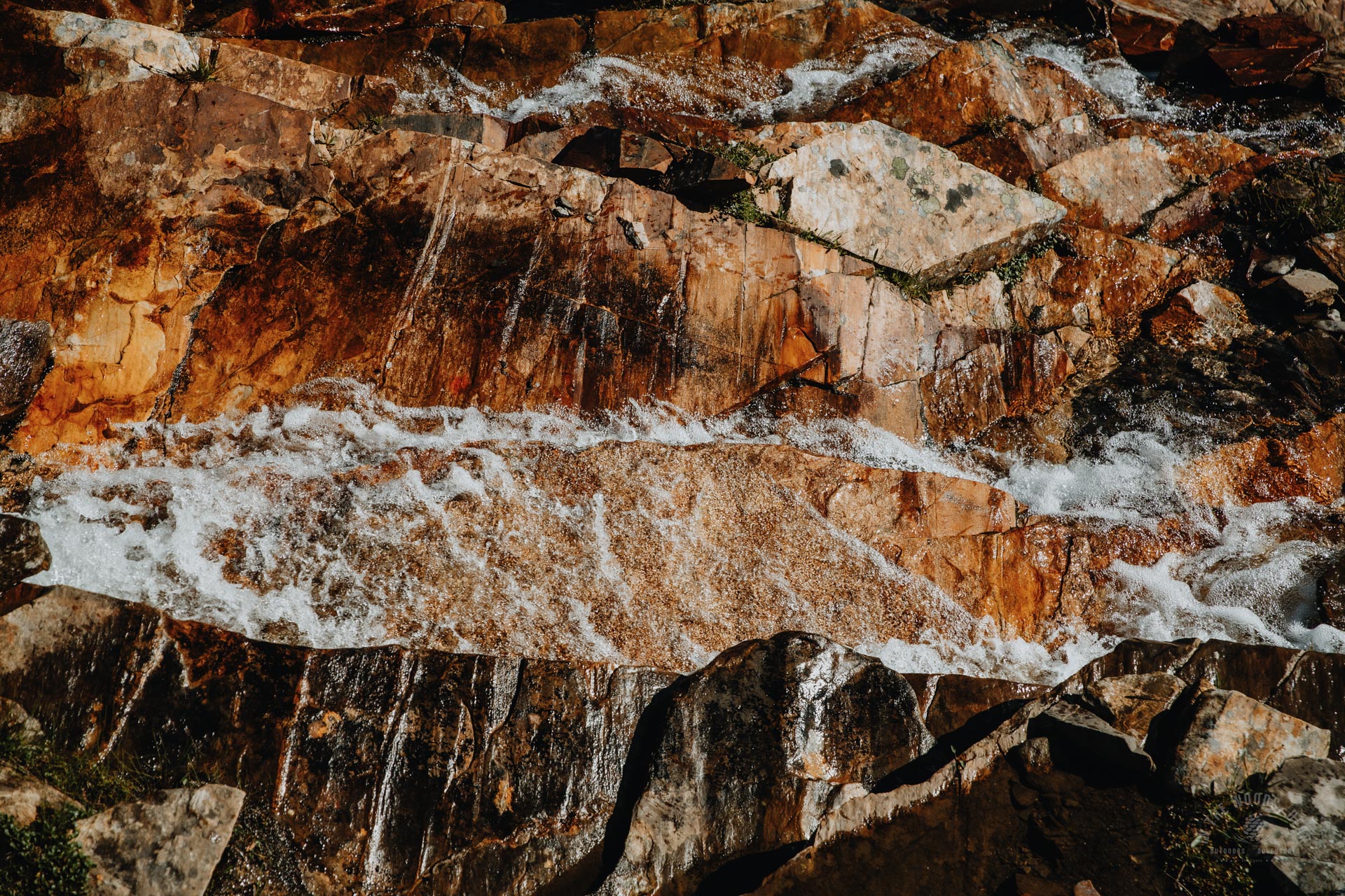
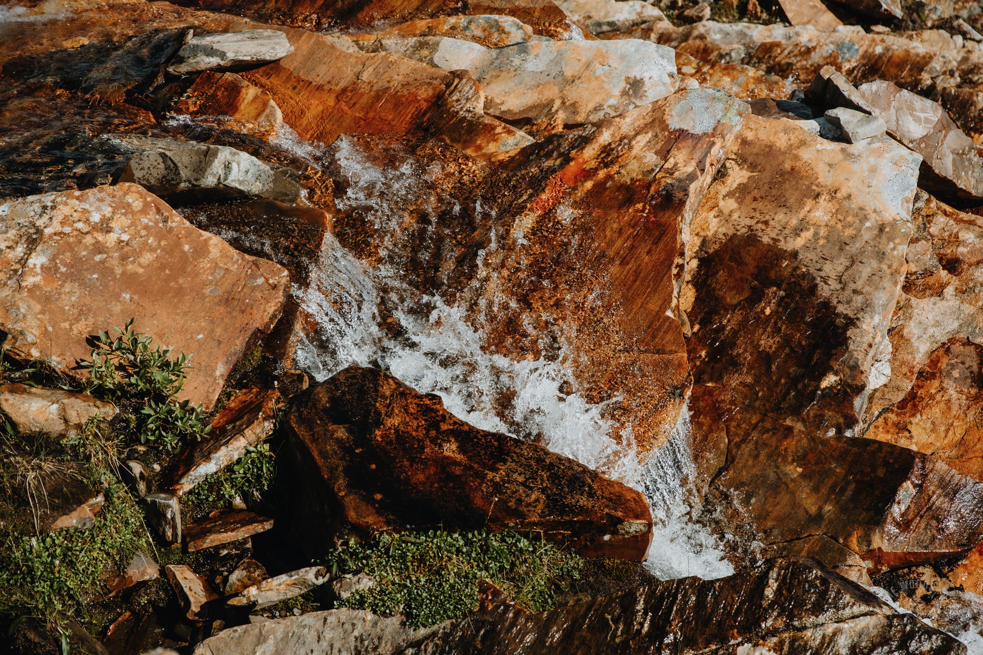
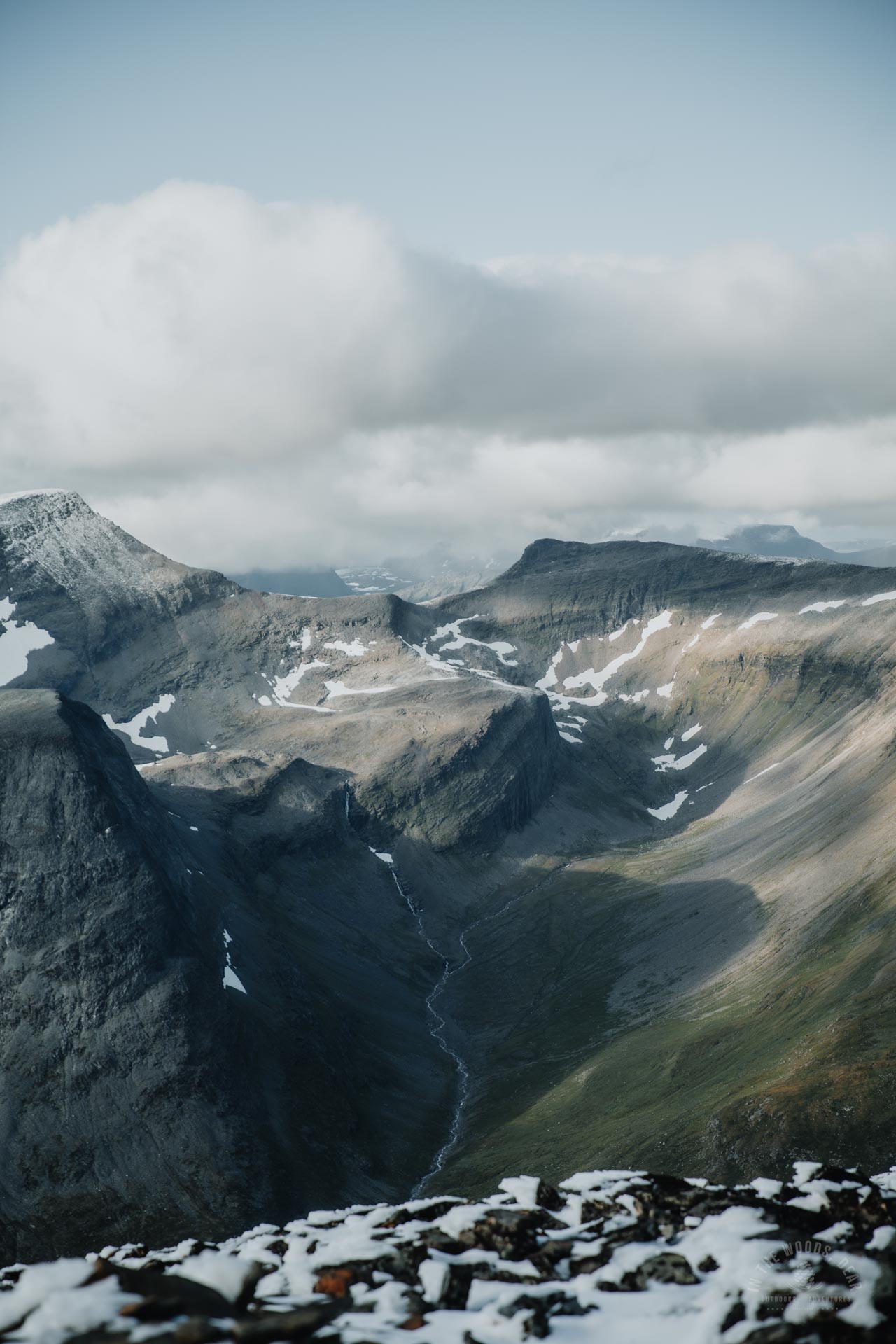
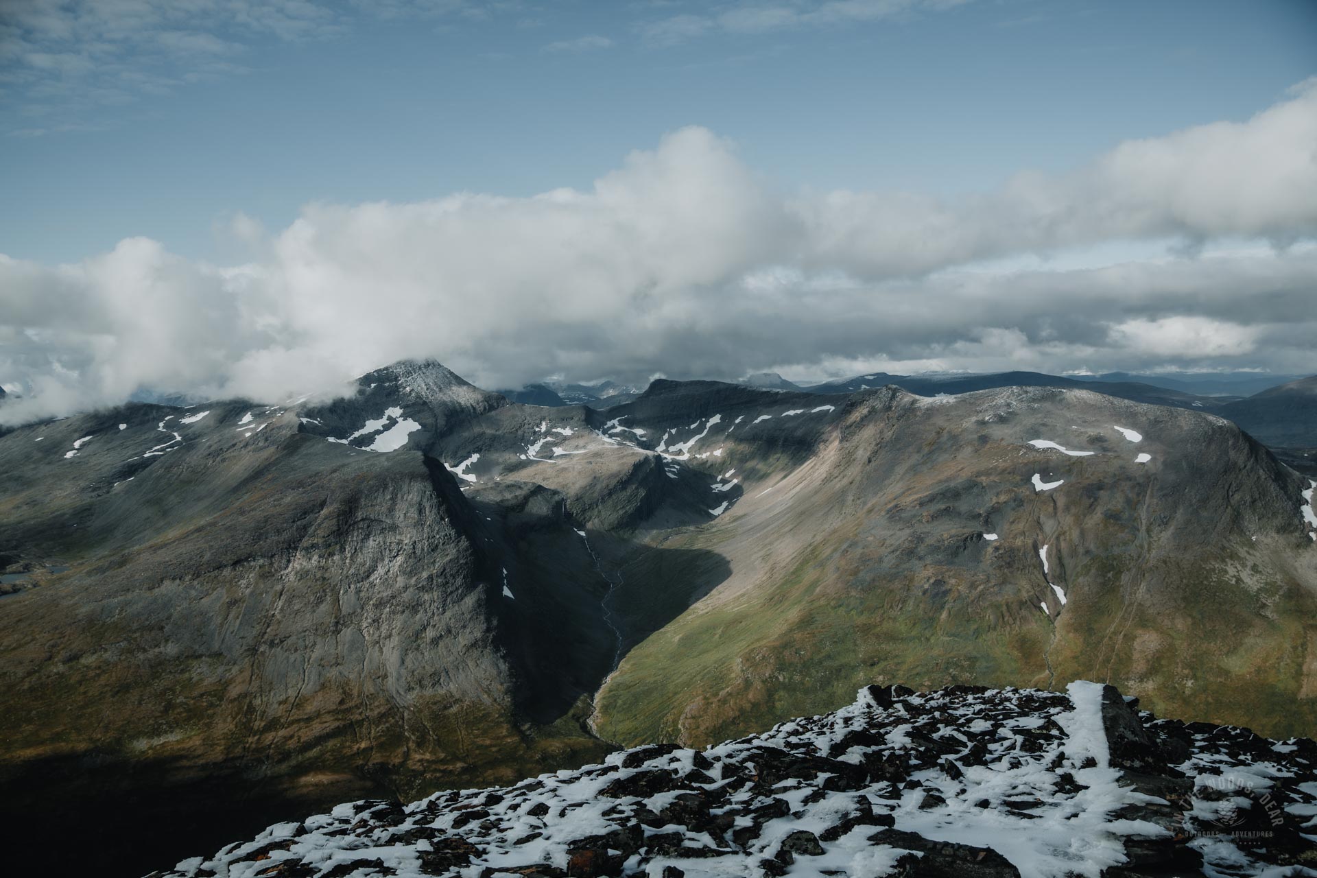
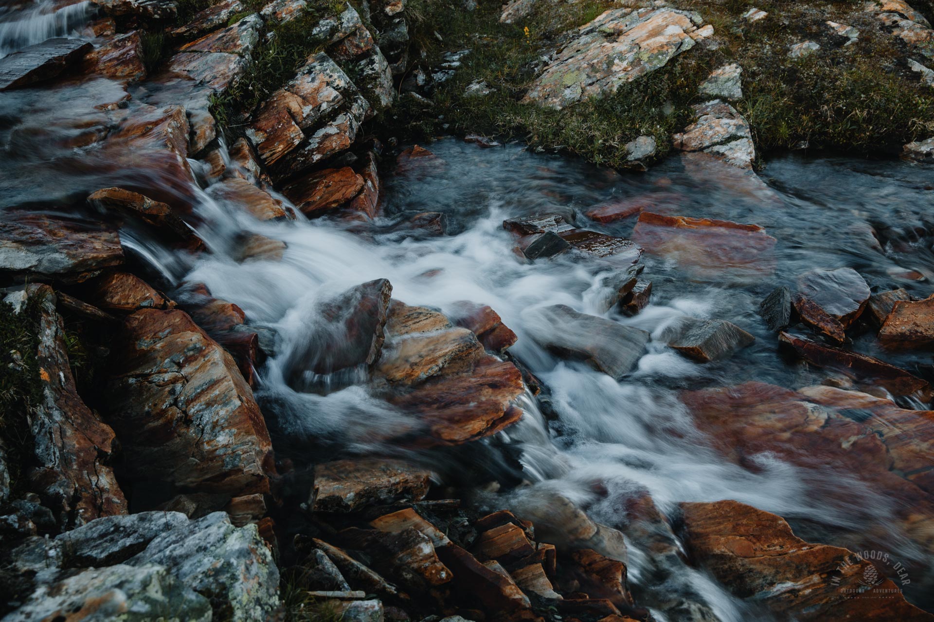
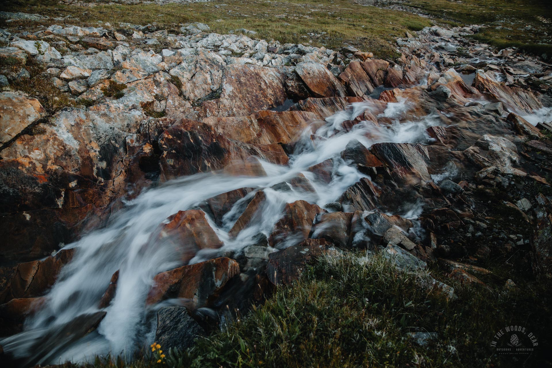
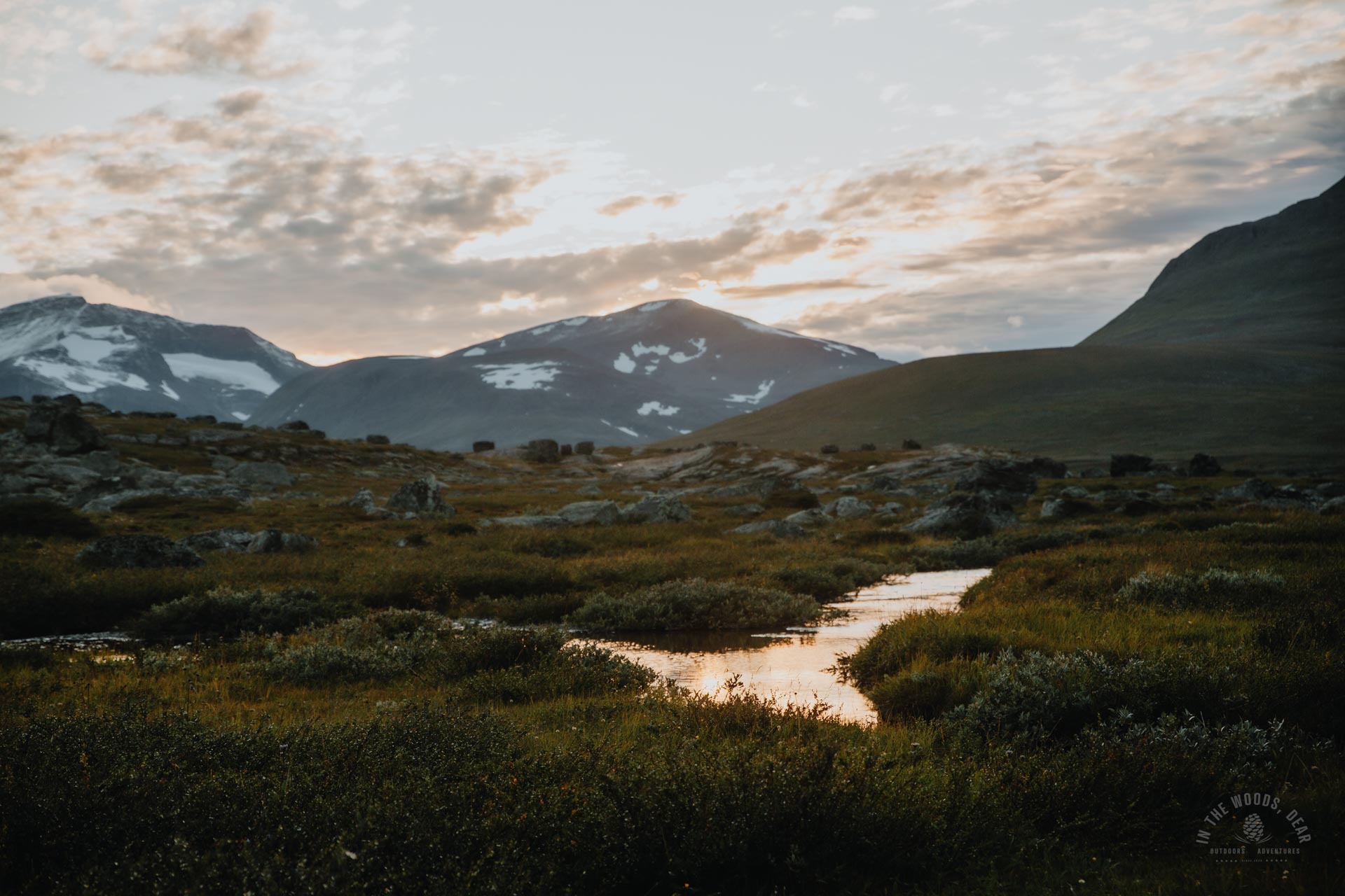
After a short stretch of grass, I could hear the noise of a larger stream. The kilometres-long stream that stretched almost to the top of the mountain looked incredibly beautiful. Crystal clear water foamed in slate troughs and flowed in endless cascades towards the lush Visiedga.
I sat at the falls, listening to the water and enjoying the sunny day. Yesterday the rain had increased towards evening and tomorrow it would rain again. I decided to take the same route on the way back to photograph the waterfalls when the sun would no longer shine too brightly.
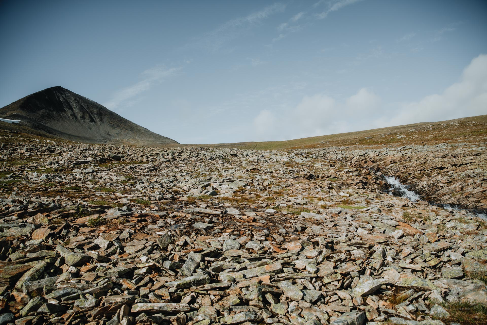
The slope turned into an easy rocky outcrop. The reddish and grey stones spread in an even layer around the creek bed. But the hike was easy, much easier when comparing to e.g., Halti hike.
Soon the grass was back underfoot. I crossed the brook at a shallow and wide point. You can cross it from almost anywhere without getting your shoes wet, though.
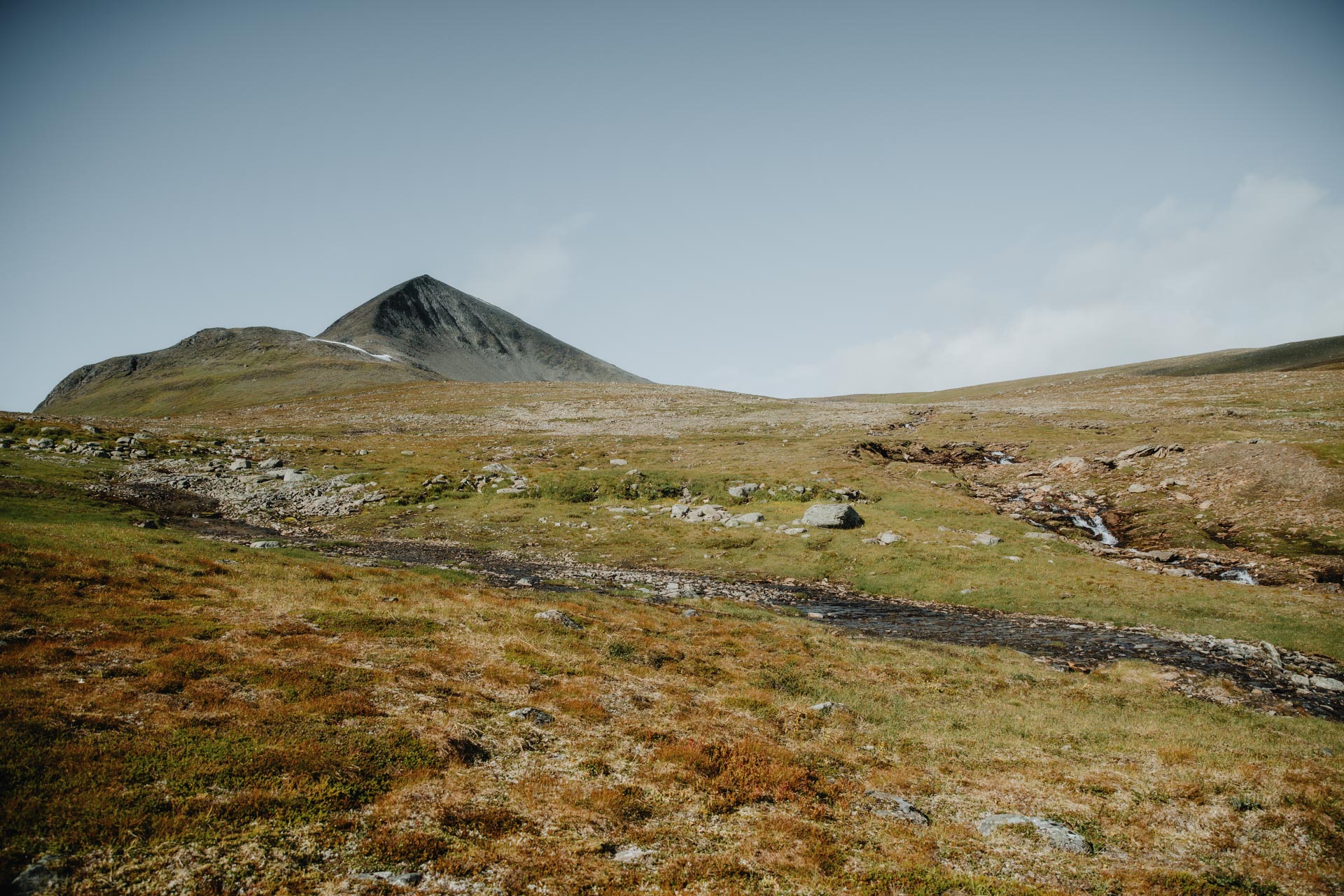
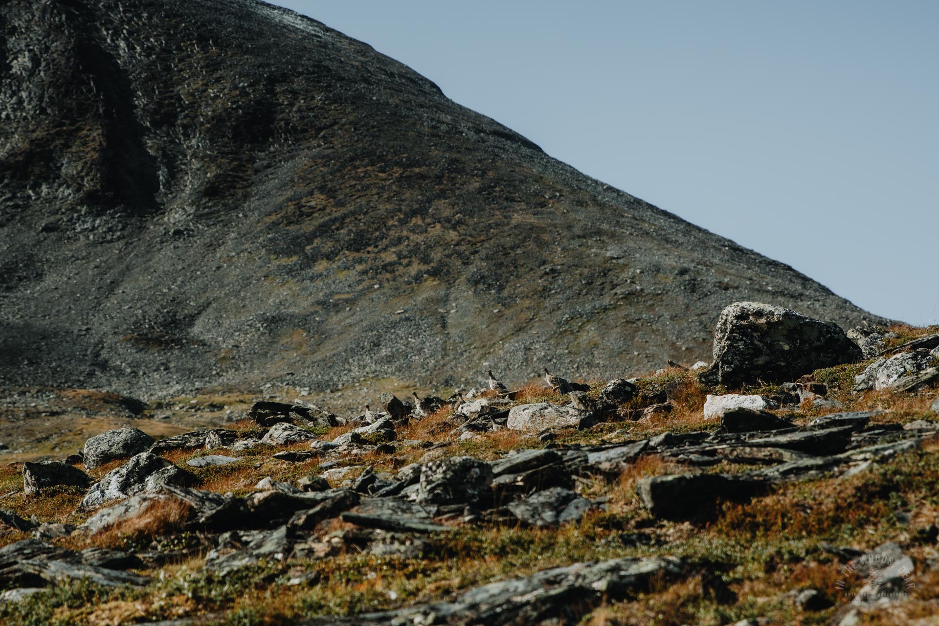
There was only one more slightly steeper slope to the long plateau on the east side. Among the rocks and tufts of grass, birds scampered at a fast pace.
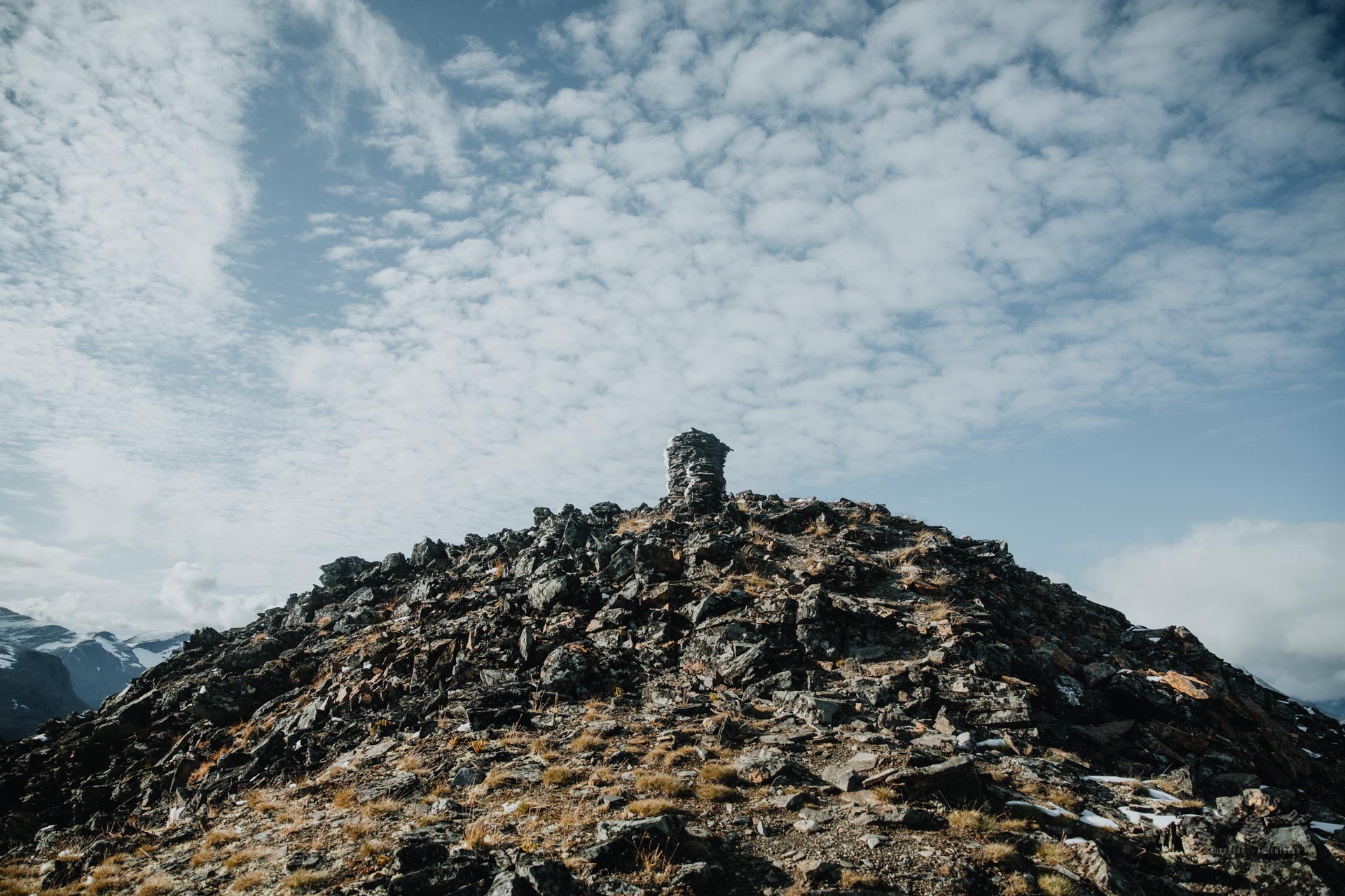
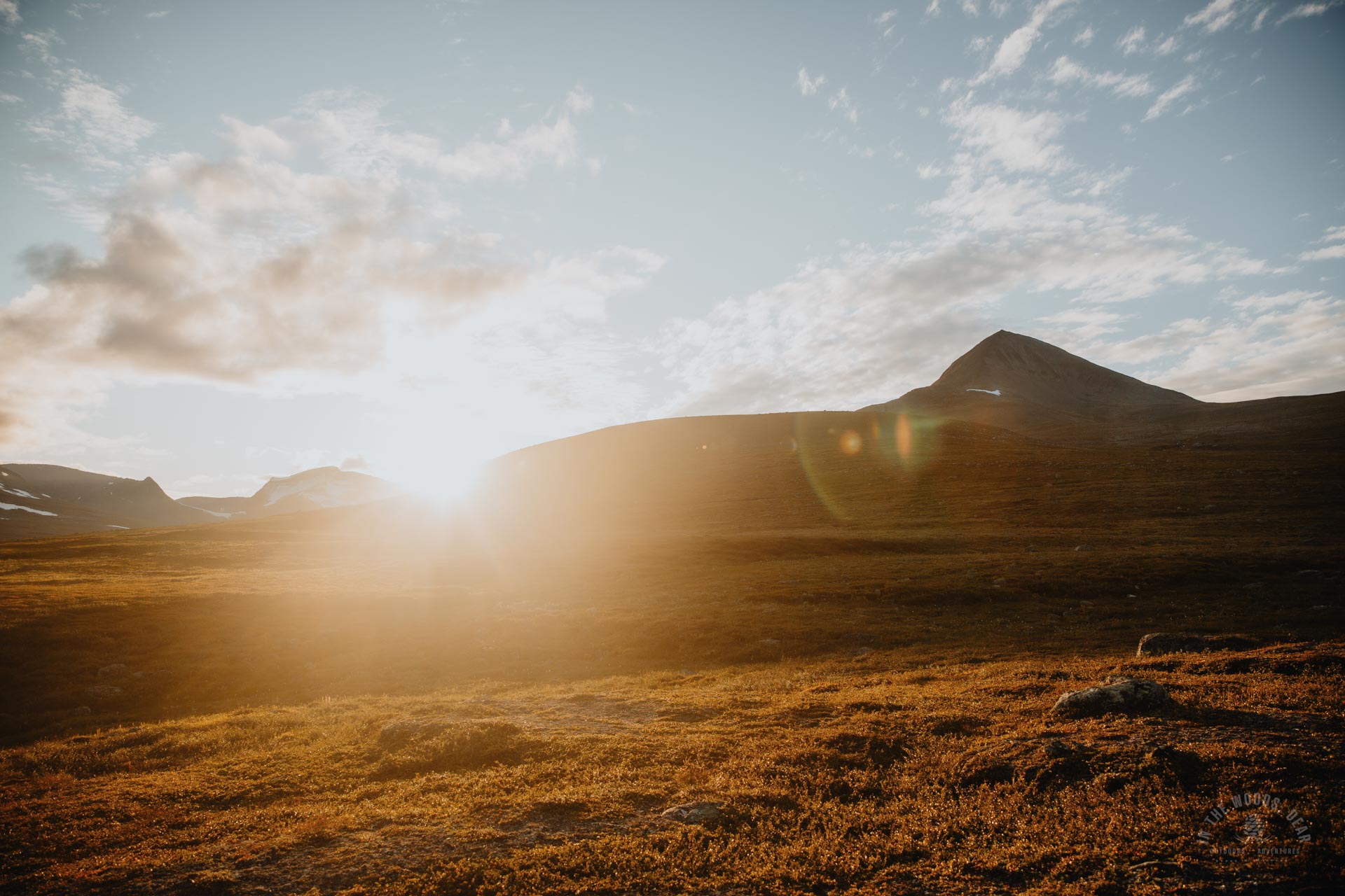
I came to a big cairn on a large rock. It was nice to have a sandwich and a chocolate bar here to keep me going for the steep final climb. The almost windless sunny afternoon was the perfect time to conquer Parastinden.
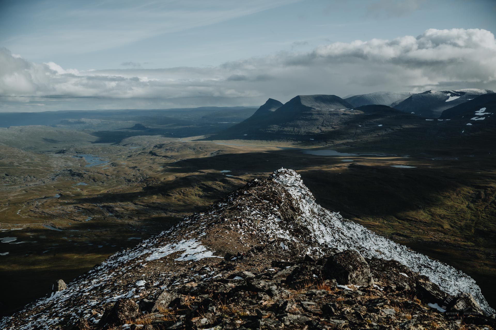
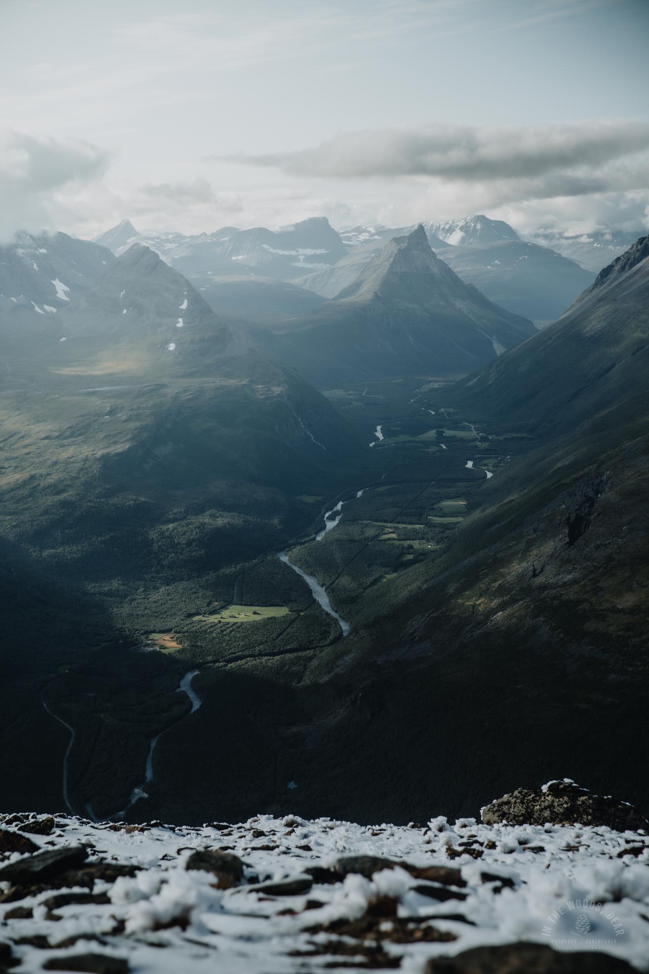
The final ascent of Parastinden
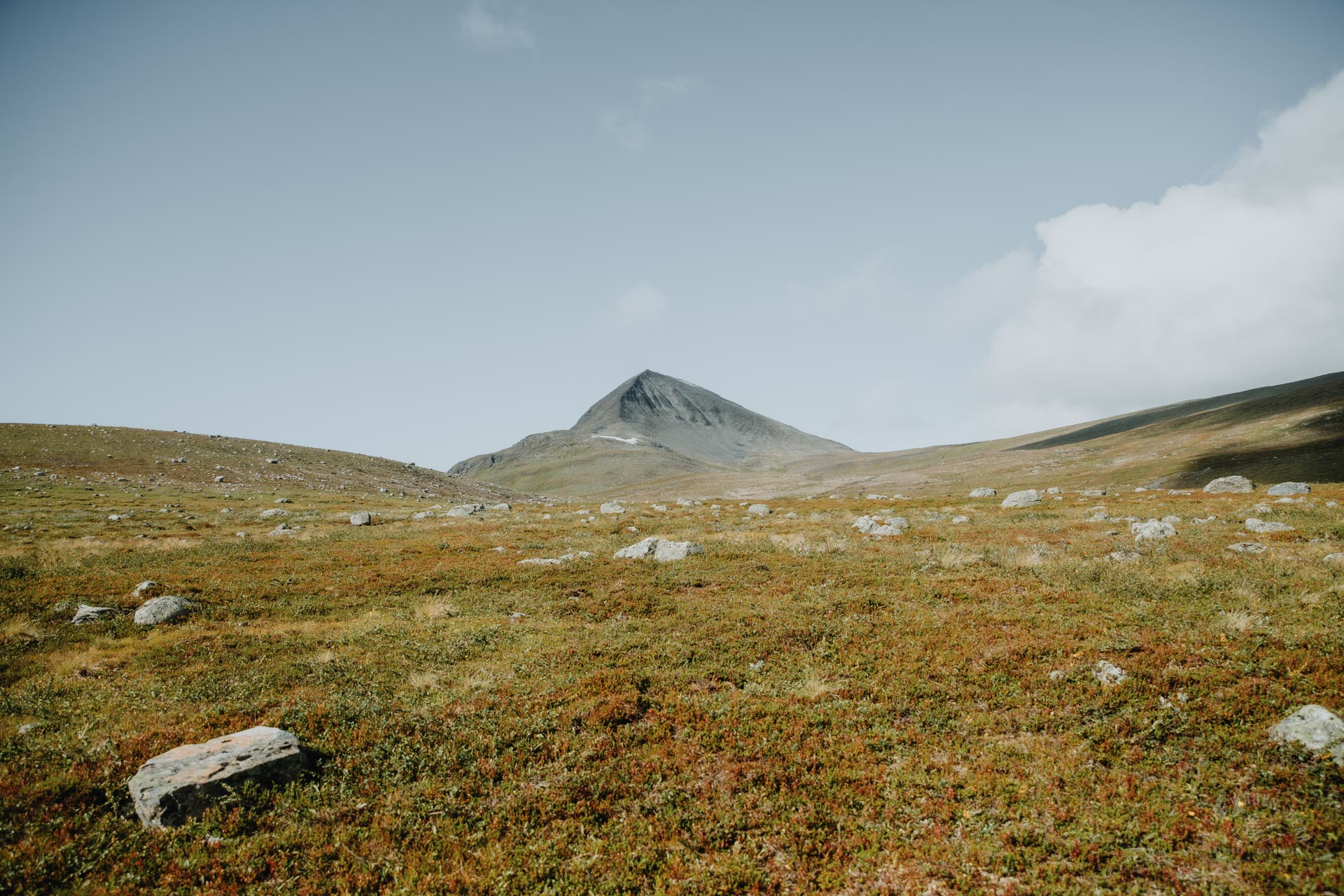
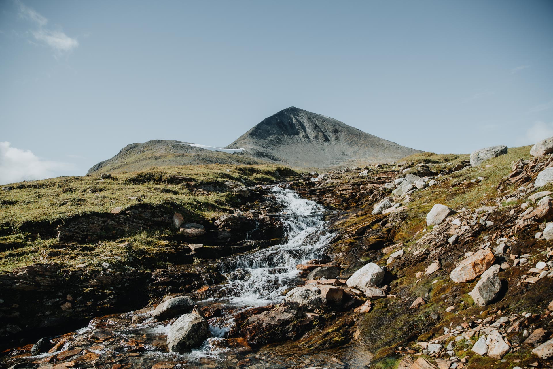
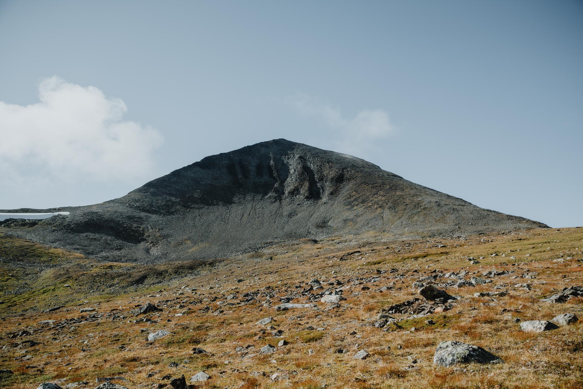
The top of Parastinden is like a black shark's fin, similar to Volandstinden in Lofoten. From a distance, the narrow black triangle looks like a wild climb, but on the spot you realise that the slope is safely wide.
The climbing does make you sweat, especially if you climb to the top with a rucksack on your back. It was exactly three o'clock when I headed for the stone wall.
I had thought that rock piles would be a common sight on the popular mountain. But there was only one after the big cairn at the base. I set off climbing up the middle of the ridge. The sun was shining directly in my eyes, and it was difficult to see a good line of passage.
Pretty soon my route became steeper and steeper, and I drifted closer to the northern edge. I didn't want to get too close to the northern edge, as the mountain face is very vertical on that side. I climbed back towards the middle.
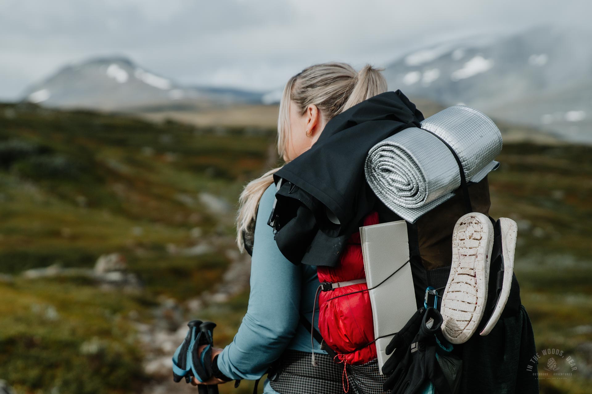
As the slope steepened, I had to scramble with the help of my hands. Climbing with a rucksack on my back was exhausting. I had imagined Parastinden to be an easy mountain to climb, and I wondered how difficult the ascent felt. At this speed, I would be on the slope for hours.
At the same time I saw a red stick maybe fifteen metres away on the left, towards the southern edge of the ridge. There was also a red spot. There was a marked route to the summit after all!
I hurried to the red stick and realised once again that I had missed the easy options. At this point, there was a clear gravel path winding up a much gentler slope with smaller stones.
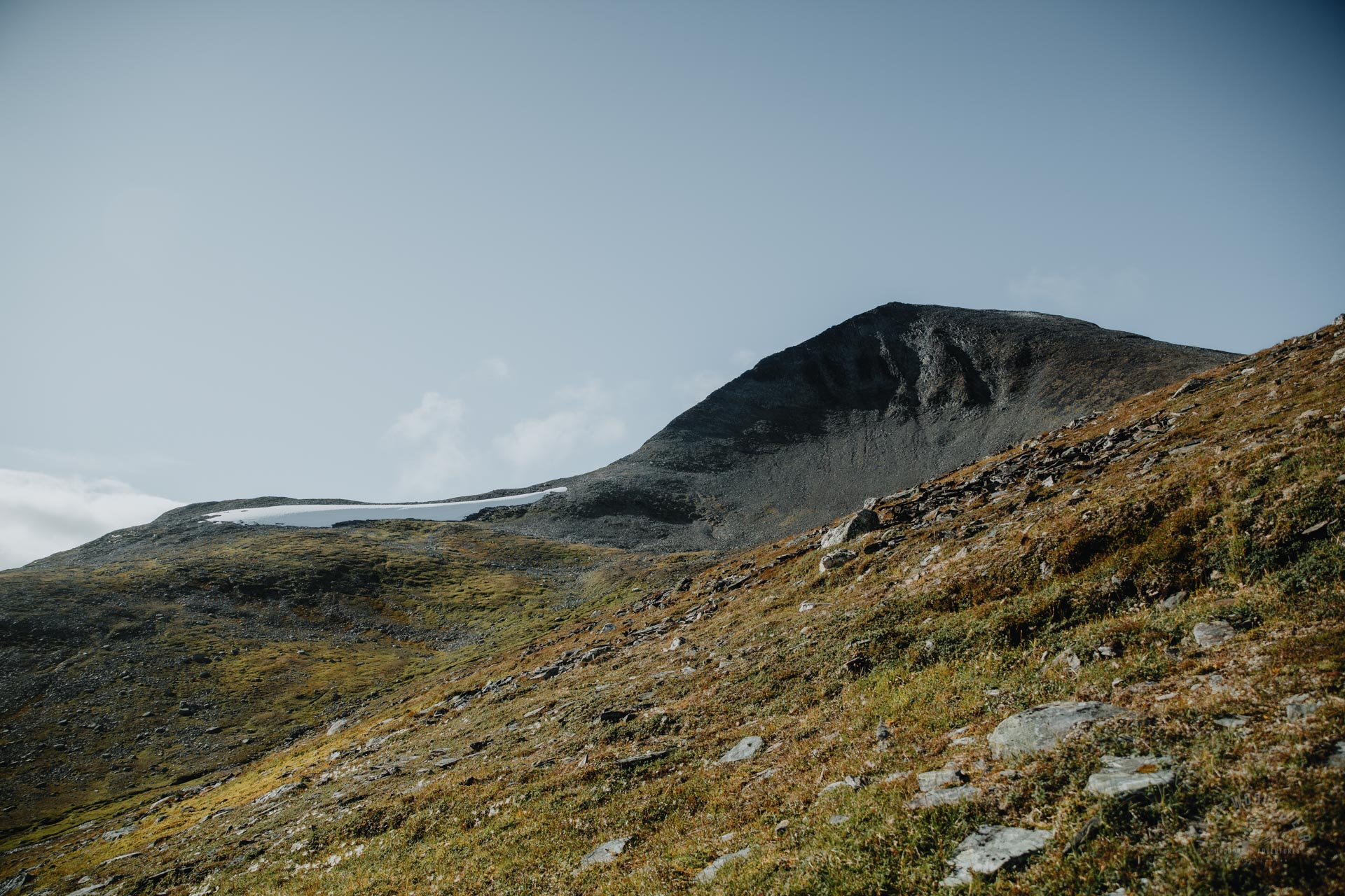
The last third of the final ascent was almost a brisk walk on the prepared path. In the snowy parts, I had to be a bit more careful, the icy surface slipping under my shoes. Eventually the slope became almost flat - with a large rocky outcrop ahead.
The summit of Parastinden was adorned with a thin layer of snow, which might not melt away this autumn. At the top, the temperature was near zero, and my fingers tingled in the cold wind despite the sunshine. I slipped my fleece shirt under my jacket before it was getting too cold.
Parastinden - summit in the afternoon sun
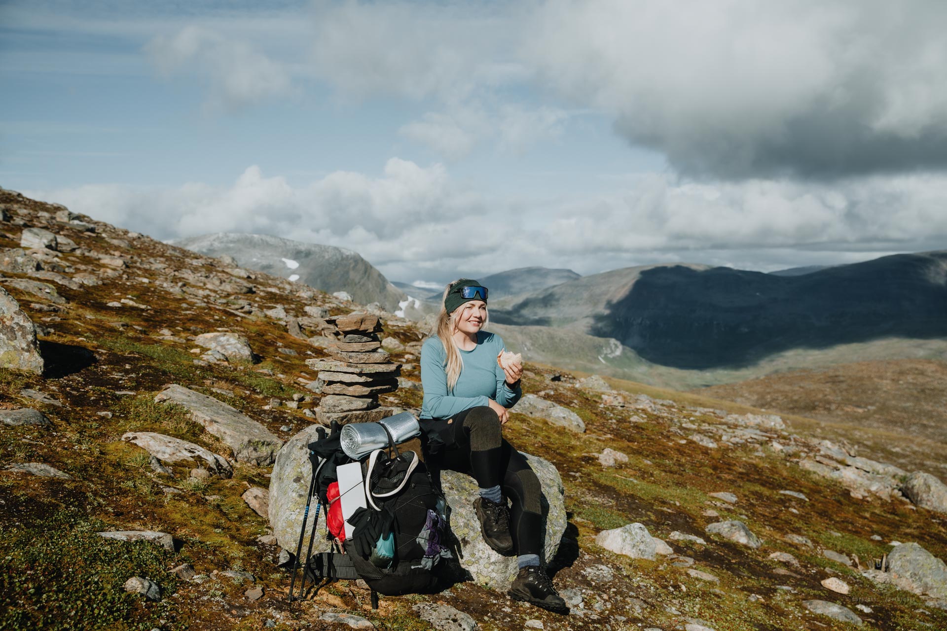
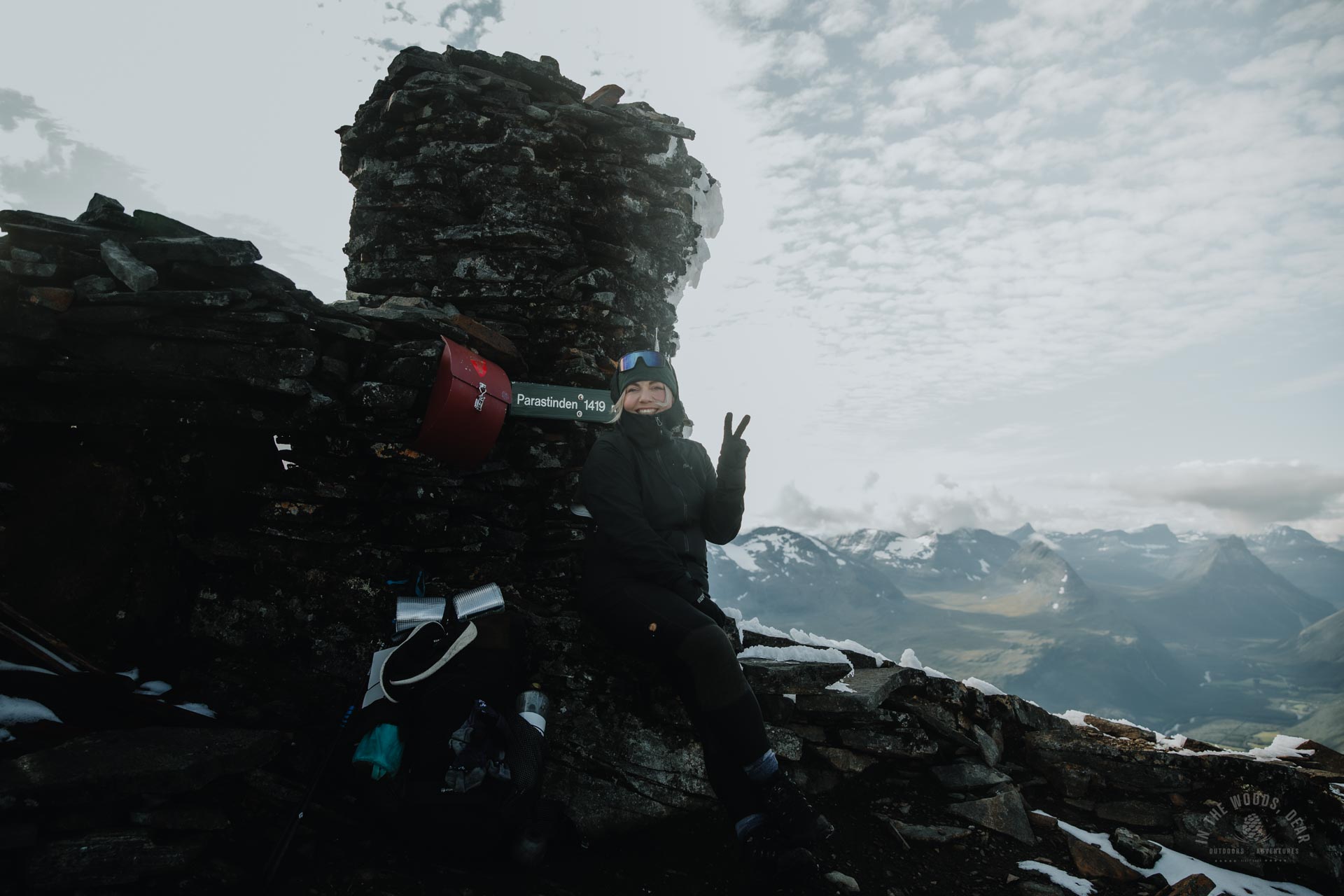
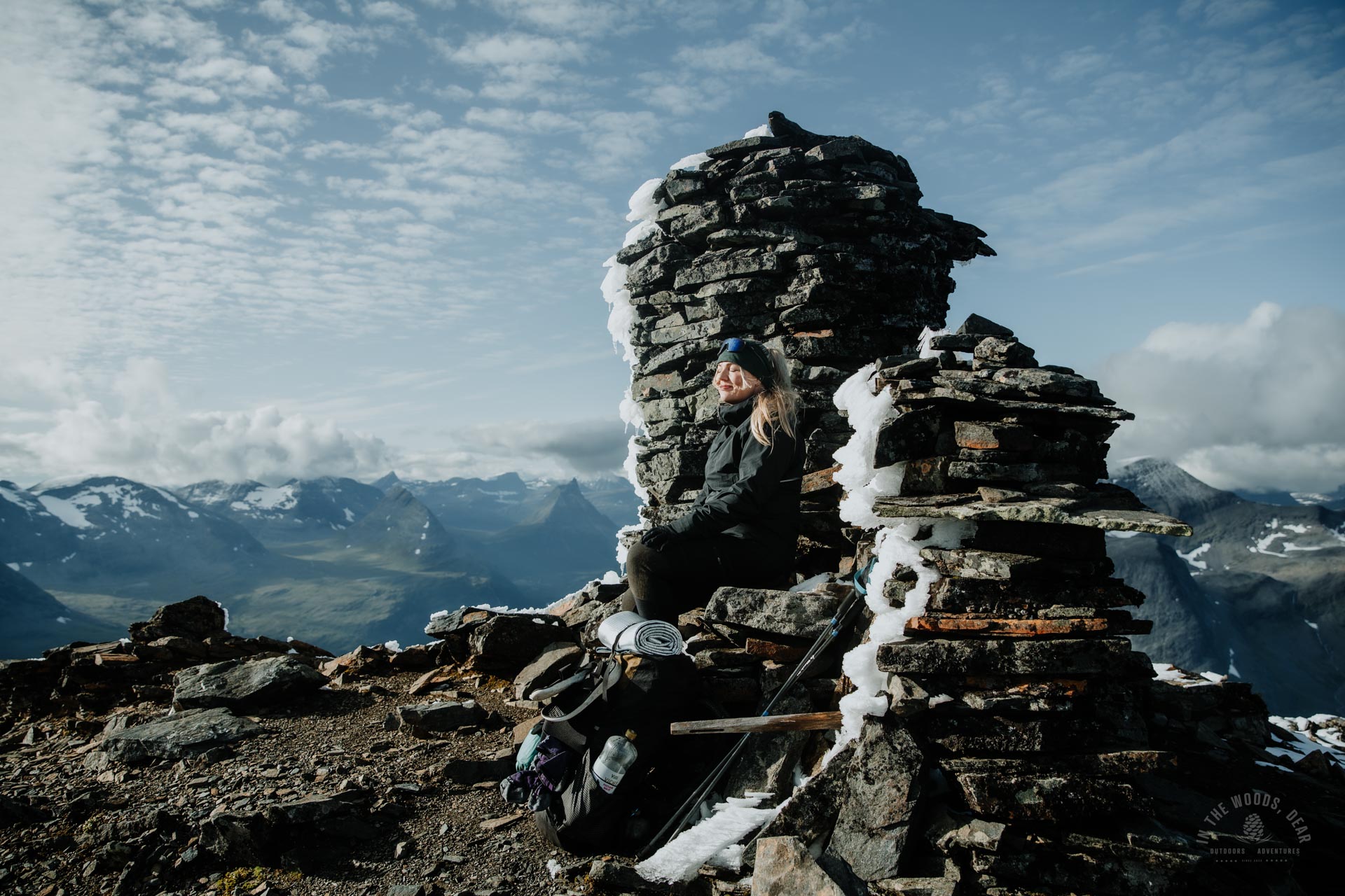
I dropped my rucksack at the foot of the red letterbox at 16:20. It took an hour and 20 minutes to get up, although it felt like a lot longer. Parastinden is a favourite with the Finns, at least according to the guestbook on the letterbox. It had been quiet at the top for the last few days, the late summer season was clearly over.
I wrote my own entry in Parastinden's guestbook, and moved to the sunny and windless side of the rock pile to enjoy life.
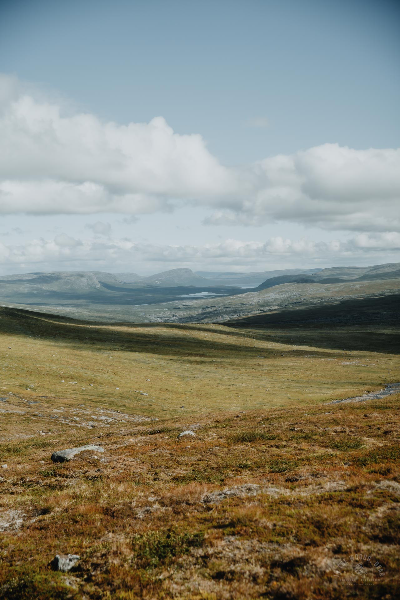
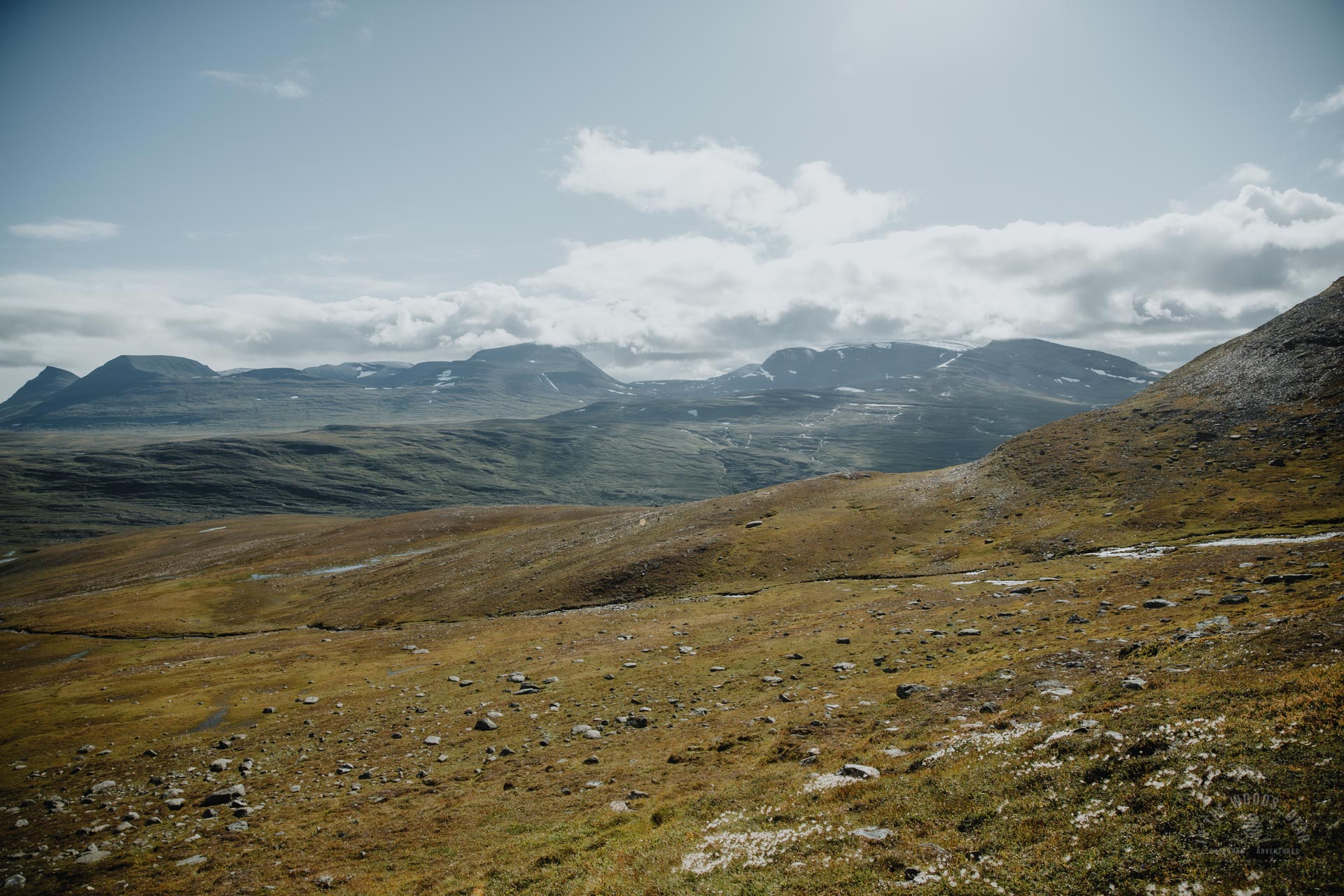
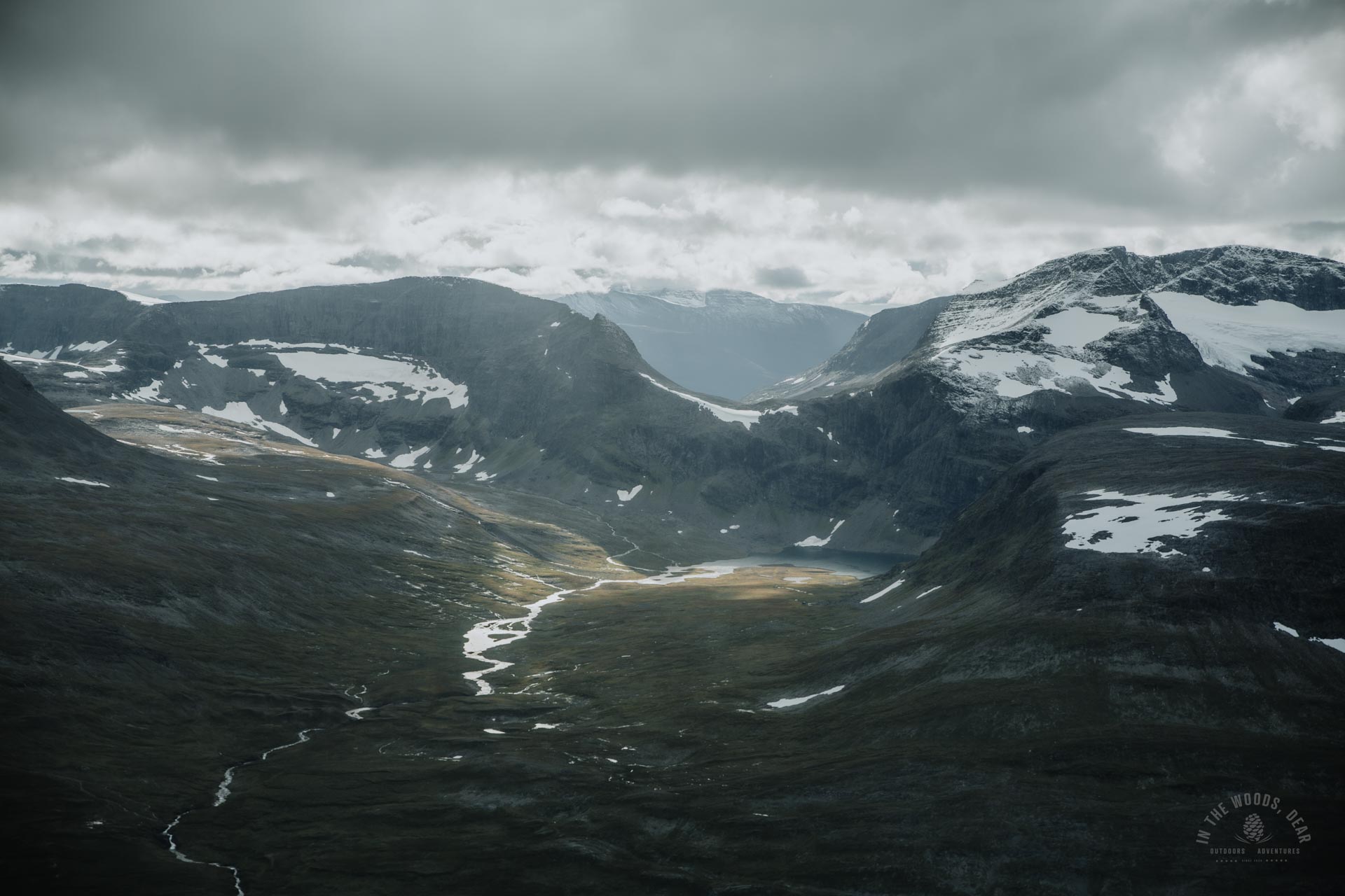
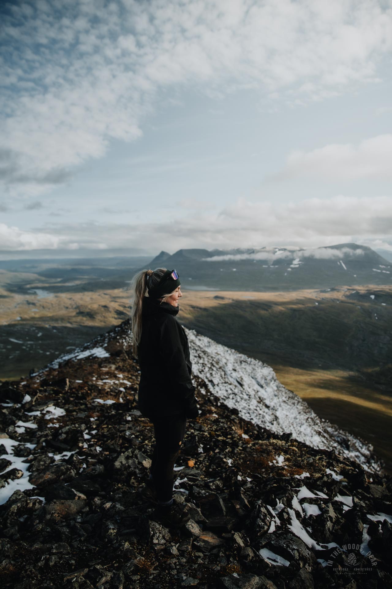
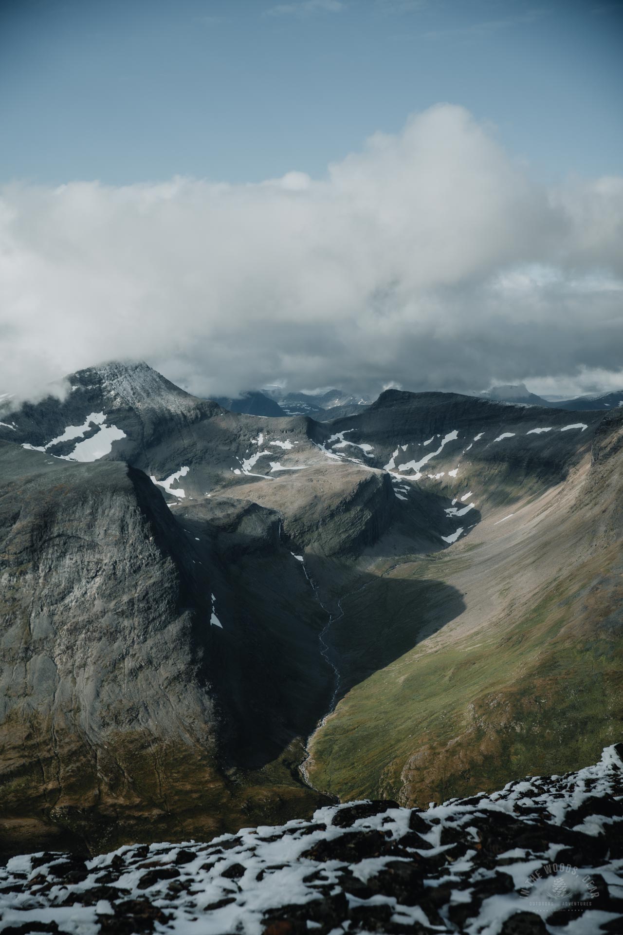
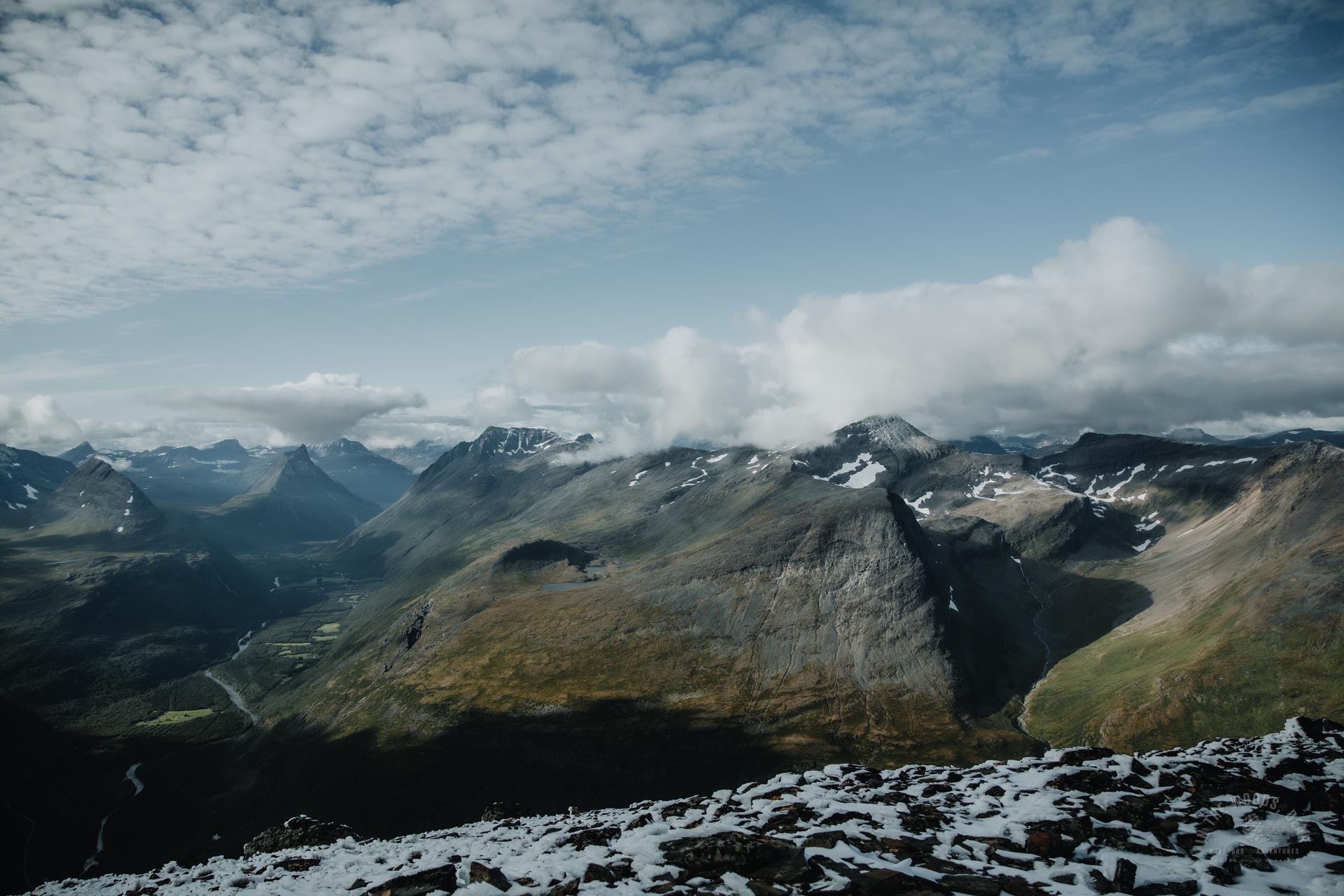
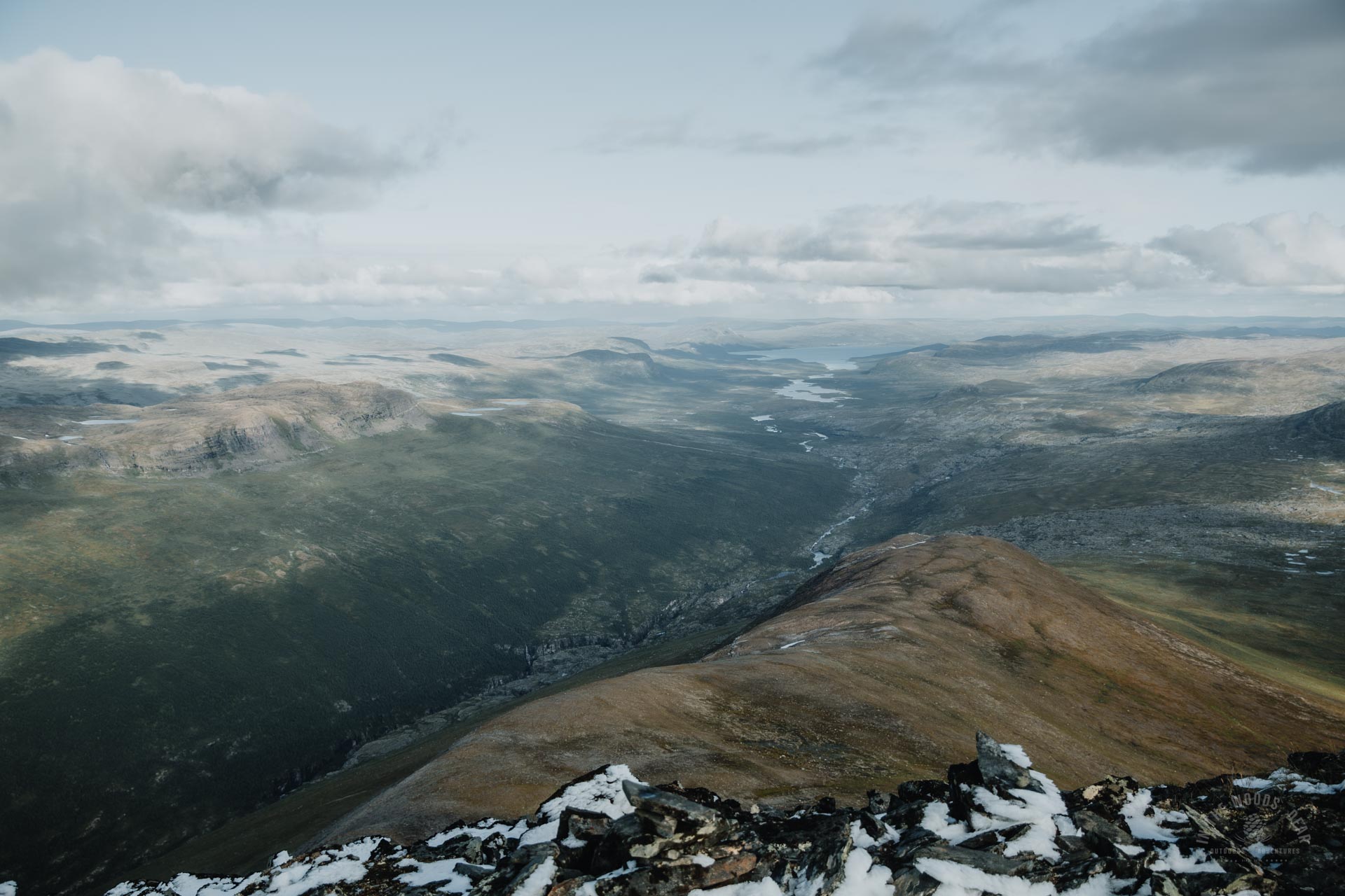
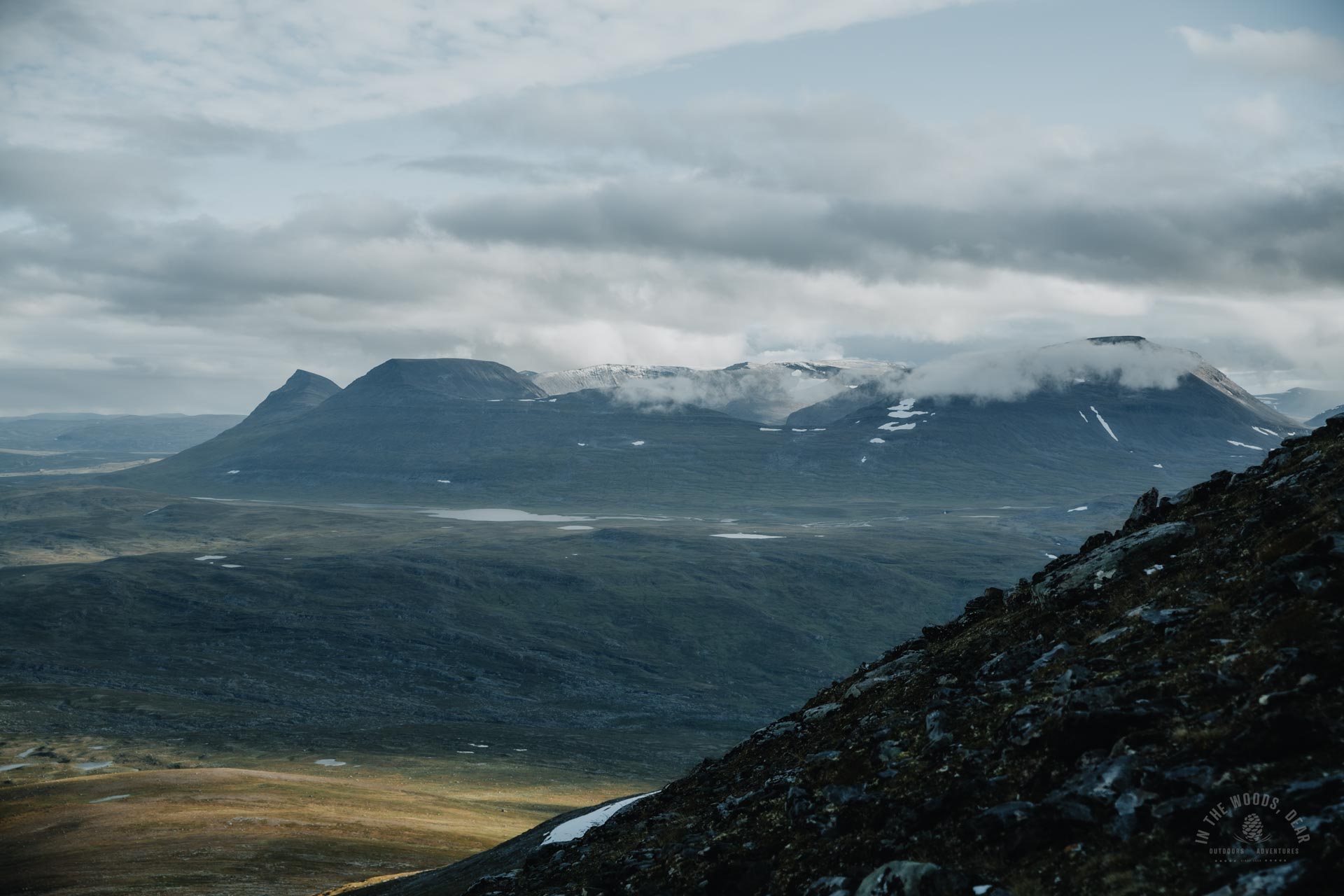
From the top of Parastinden, the views in all directions are incredible. To the direction of the three country cairn, you can see the steep rock faces in Malla Nature Reserve, Saana fell and Lake Kilpisjärvi in Finland. To the south, on the Swedish side, the magnificent Pältsa and snow-capped massif of Moskkugaisi. To the north-west, the lush Signaldalen meanders, with the sharp peaks of Otertinden towering skywards.
Parastinden summit is like a huge observation tower in the middle of the valleys. It is precisely the 360-panorama that Parastinden is best climbed on a clear day. Although training is always fun, it's super fun in stunning scenery!
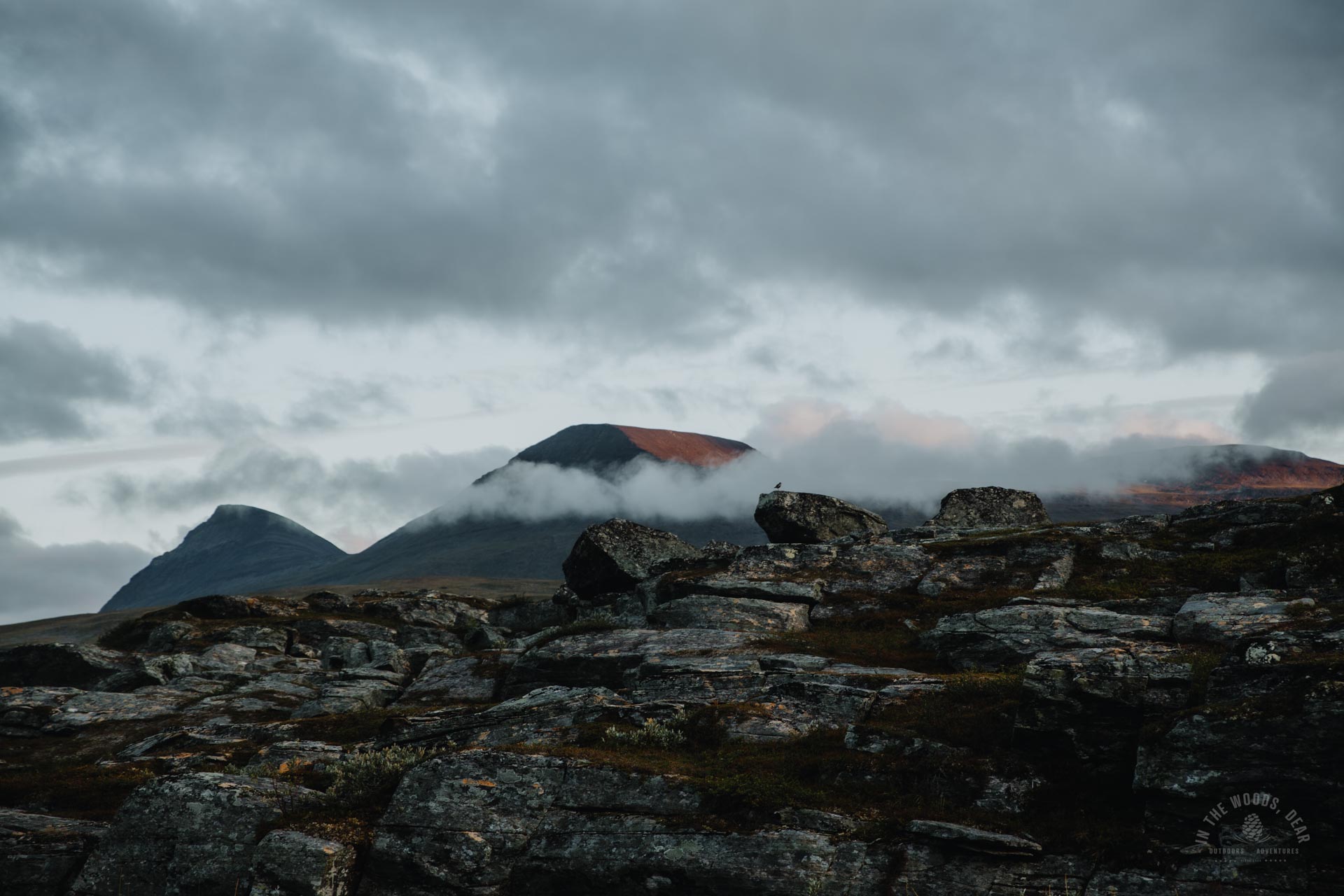
I admired the mountain views until it was time to head back. The sky seemed to be clouding over, so there was no reason to wait for a spectacular sunset at the top of the mountain. It would not even be comfortable to descend the steep slope in the dark, especially with a backpack.
Descending the prepared trail was a snap. I found my footprints in the snow and wondered for a long time why do I become sensitized when returning to the same place I visited a few days ago. Let alone an hour ago.
I got familiar with the lower part of the prepared trail, too. The big cairn and rock I sat on when I started climbing was about a hundred metres north of the trail.
I continued descending towards the creek, following the trail markers. The crossing point was about five hundred meters north of where I had walked on the way up. At one point, the marked path curved towards Rognli, and I continued along the creek towards the falls.
I took long exposure photos of the waterfalls and the fine gurgling water. For once, the silky water seemed to fit among the rugged rocks. A small herd of reindeer hovered around the creek and followed my every step closely.
The stream and the waterfalls are, apart from the scenery at the top, the best part of the Parastinden hike. You may miss the pretty waterfalls if you go round to the top from Rognli.
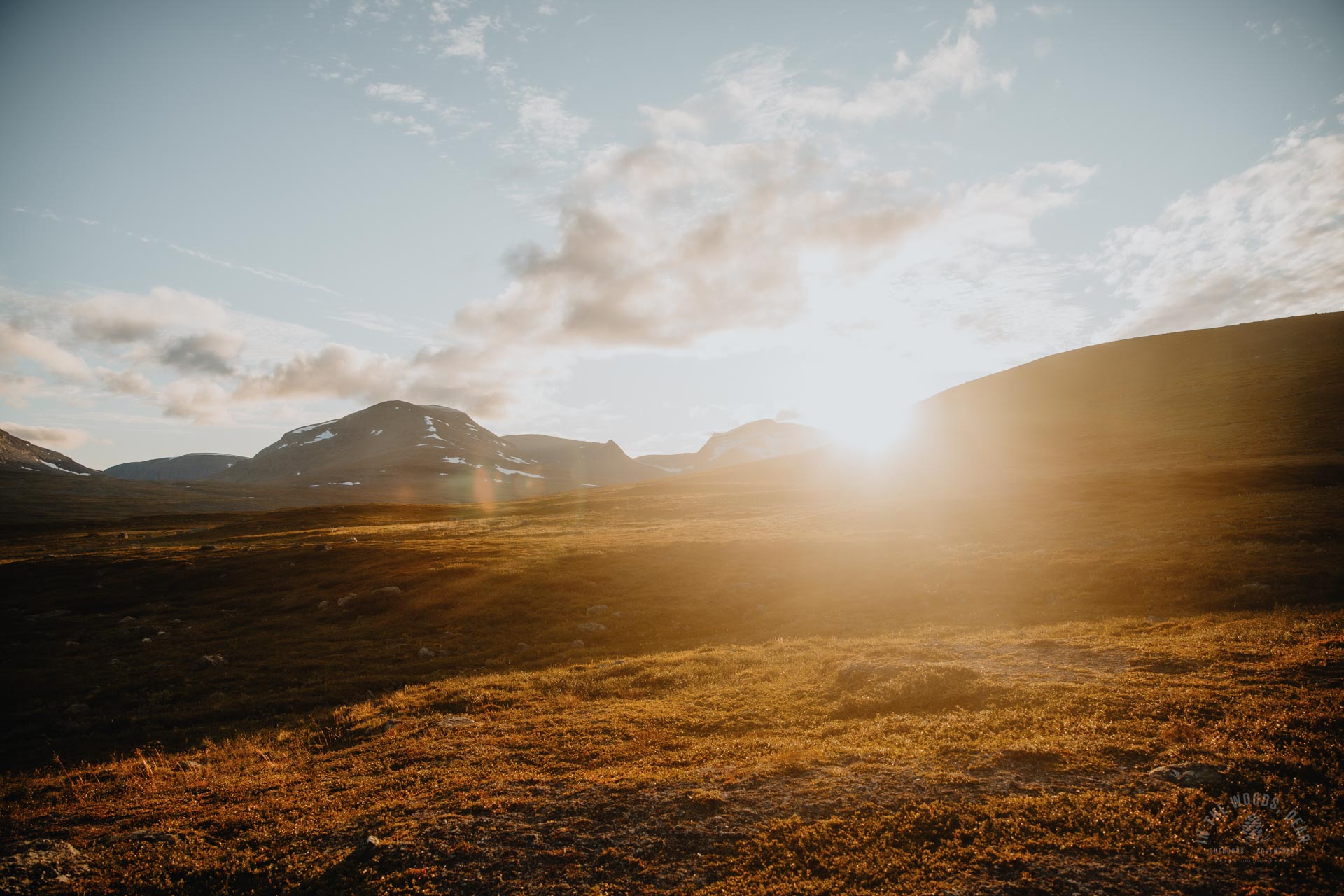
At the same time, the sky seemed to clear, the landscape glowing with golden light. Perhaps I should have stayed a little longer at the top of Parastinden after all.
From Parastinden to camping near Gappohytta
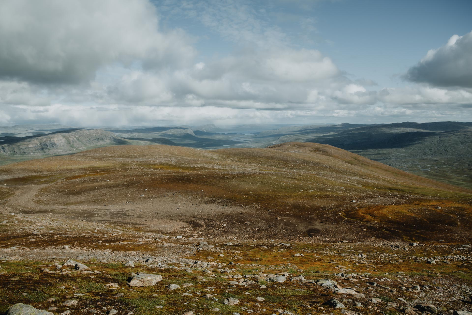
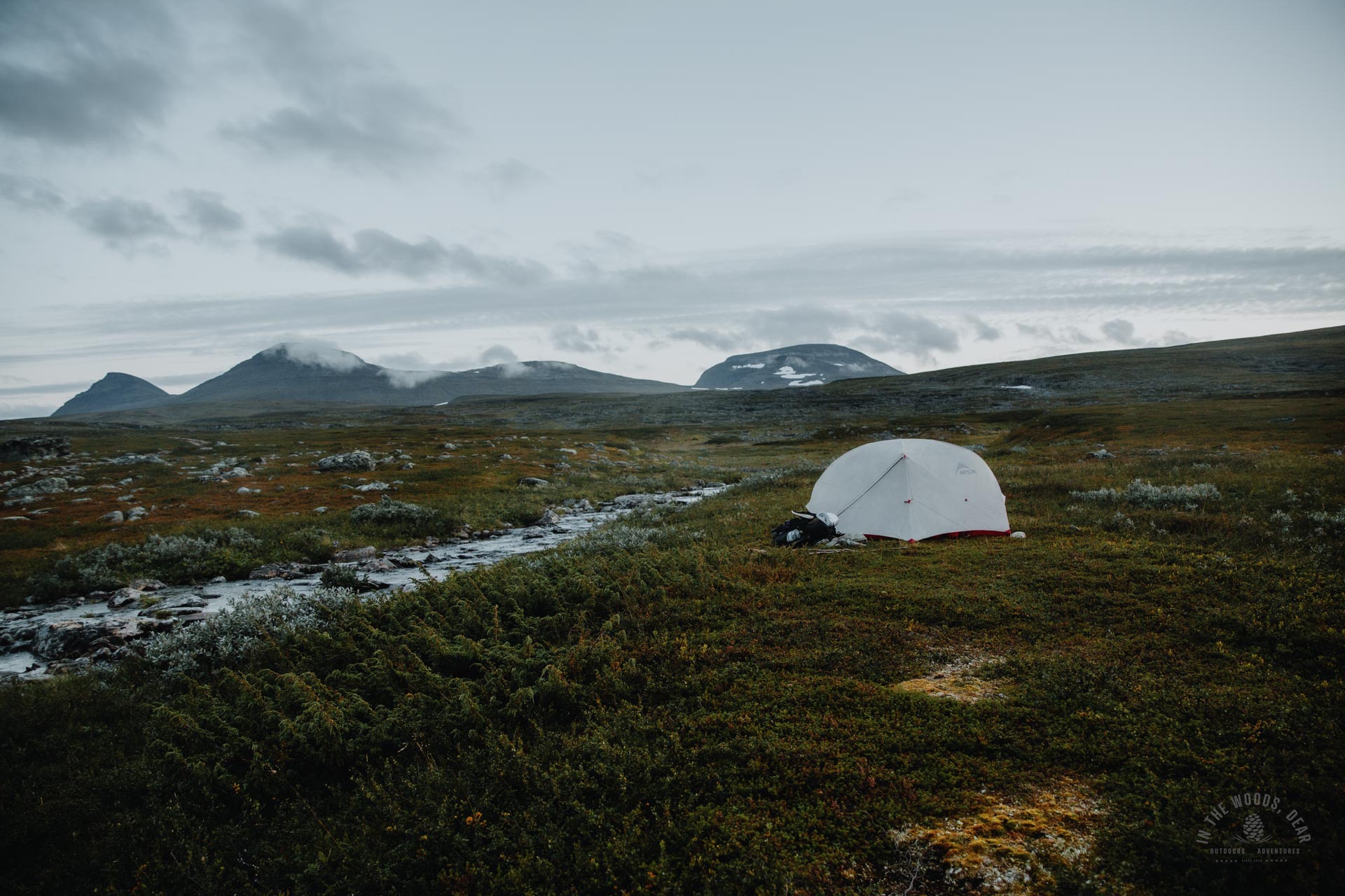
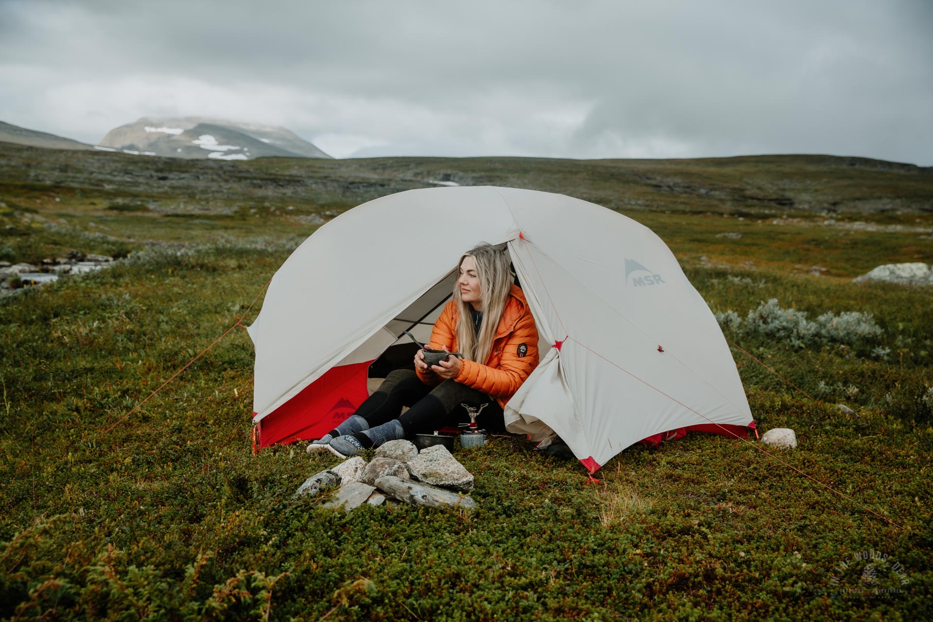
The flat terrain of Visiedga is like one big campsite. I planned to hike towards Gappohytta until less than an hour before sunset, and enjoy the warm golden rays from my tent.
The plan was otherwise excellent, but just an hour before the sunset the sun sank behind Parastinden and the other mountains. There was now no point in pitching a tent, even with the fine ponds, cliffs and flat land around me.
I continued hiking until 8pm to the Visiedggajohka, where Gappohytta huts could be seen on the cliffs. A perfectly flat spot for a tent was waiting by the river, a nice murmuring sound would be my good night music.
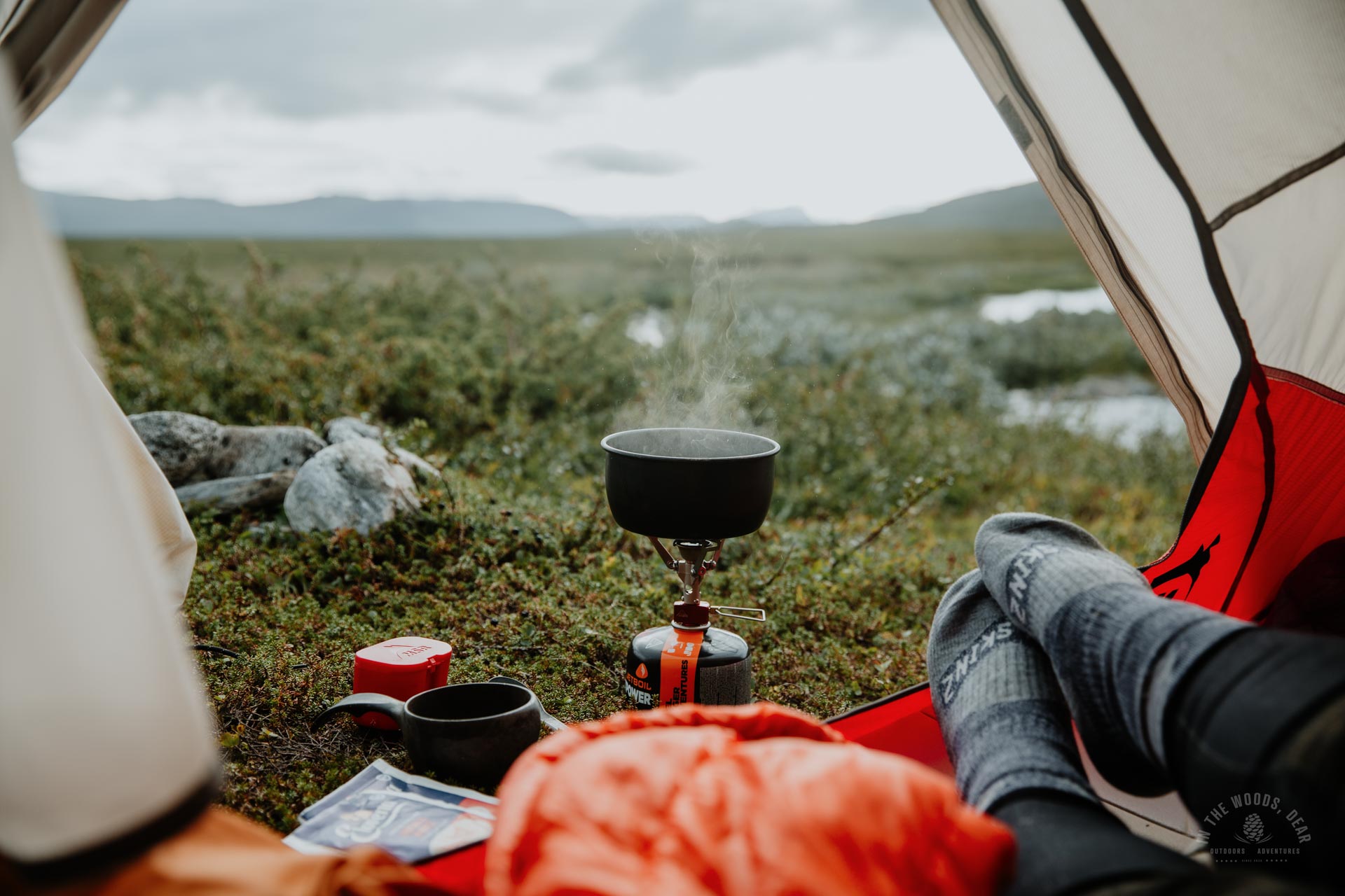
A golden plover flew to the vicinity of the camp to whistle. I made my dinner as the evening dimmed and whistled back.
The day was a good 21 km of hiking, with 1,042 m of ascent. From Gappohytta hut to Parastinden and back to the riverside took 8.5 hours with picnic breaks, photography and just sitting in the scenery.
Tomorrow, my hike across the three countries would continue on the usual route towards Pältsastugan hut in Sweden. The Parastinden hike and summit of the mountain was certainly the highlight of the whole hike - no wonder Bárrás is a favourite among Finnish hikers!
Kilpisjärvi - hiking and day trips
- Saana
- Malla Nature Park and Kitsiputous
- Korkea-Jehkas
- Saana nature trail
- Halti
Destinations in the Lyngen area
- Hengen Waterfall and Sledo (Skibotn)
- Dalberget and Dalberghytta + Storhaugen
- Gorsabrua (Birtavarre)
- Elvevoll - Elvevolldalen & Dalvatnan (Storfjorden)
- Steindalsbreen glacier hiking (Storfjorden)
- Lyngentrappa and Verdens ende
- Rottenvikvatnet and Rottenvikfossen
- Blåvatnet
- Lyngstuva


