Karhunkierros (Bear's Trail)
Karhunkierros (The Bear's Trail) is the most famous long hiking trail in Finland. The 82-kilometre "legendary trail" runs through the Oulanka National Park in the Salla and Kuusamo areas, combining the most spectacular natural sites in the Northeastern part of Finland in one single experience. I have hiked Karhunkierros and visited its trails and attractions 16 times in different seasons - and this guidebook contains detailed instructions and tips based on my own experiences.
For many Finns, Karhunkierros is their first long hike. For the first-timer (either first hike ever or first hike in Finland), there are many qualities that make it a great trek: the route is well marked, there are no water crossings, and there are numerous huts and shelters along the way. There are also some restaurants along the way and several places to get off the hike if necessary.
Every guide praises Karhunkierros hike and says it should be on every hiker's bucket list. In reality, some people don't like it, some don't care, and for some the Karhunkierros hike is a wonderful, even life-changing experience.
In this guide you will find "everything about Karhunkierros" to help you plan and do your own hike - whether you are on your first long hike or are setting off for the first time on Finland's most legendary hiking trail!
- Table of contents
- Oulanka National Park
- Karhunkierros map
- Karhunkierros - starting point
- Karhunkierros bus
- Karhunkierros accommodation
- Sights and route description of the Bear's Trail by stage
- Karhunkierros Gate at Arctic Circle / Hautajärvi - Rupakivi - Vasaoja
- Vasaoja - Oulanka canyon - Taivalköngäs
- Ristikallio
- Taivalköngäs - Oulanka Visitor Centre - Kiutaköngäs
- Kiutaköngäs - Ansakämppä - Jussinkämppä - Päähkänäkallio
- Päähkänäkallio - Pieni Karhunkierros (Small Bear's Trail)
- Small Bear's Trail: Harrisuvanto - Harrisuvanto suspension bridge - Kalliosaari - Siilastupa - Jyrävä - Aallokkokoski
- The right-turning route of the Small Bear's Trail: Kallioportti - Myllykoski
- Small Bear's Trail - Porontimajoki - Konttainen
- Valtavaara and Pyhävaara Nature Reserve
- Konttainen - Valtavaara - Ruka
- Water on Karhunkierros
- Karhunkierros in different seasons
- Safety on Karhunkierros
- Karhunkierros - equipment
- Services along the Bear's Trail in a nutshell
- Why Karhunkierros is not the best hike?
- Why is Karhunkierros so popular?
- Karhunkierros Bear's Trail - frequently asked questions
Oulanka National Park
The landscapes of Karhunkierros vary from forests to open swamps, from the banks of gushing rapids to rugged canyons and high hills. Some 54 kilometres of Karhunkierros run through Oulanka National Park.
Oulanka National Park is located in the Kuusamo town and Salla municipality area in the highlands of Northeastern Finland. The park stretches to Finland's eastern border and borders on the Russian side with the Paanajärvi National Park. The national park was established in 1956 and covers an area of approximately 286 square kilometres.
The landscape of the Oulanka area is dominated by vast pine forests, river valleys with roaring rapids and sandbanks, towering rock gorges and open marshland in the northern parts of the park.
The National Park is crossed by the meandering Oulankajoki and Kitkajoki rivers, which flow eastwards. Elevation ranges from about 150 metres in the river valleys to 400 metres in the hills. The Bear's Trail follows the rivers for long distances over high cliffs and forestry ridges.
Oulanka is one of Finland's most popular national parks, with almost 200 000 visitors every year. The area offers a combination of several days of hiking and shorter day trips.
The park's trails include both easy-to-access sights and more demanding hiking routes. In addition to Karhunkierros, the Oulanka National Park area also offers a number of hiking trails, such as:
- Oulanka Canyon
- Ristikallio
- Kiutaköngäs rapids
- Rytikangas nature trail
- Hiidenlampi pond tour (Hiiden hurmos trail)
- Könkään keino trail
- Könkään kuohu accessible trail
- Small Bear's Trail (Pieni Karhunkierros Trail) 12 km


Photo: Oulanka National Park - Hiidenlampi pond, the "bear milestone" of Karhunkierros
Karhunkierros map
The Bear's Trail is not a circular route, but a route from point A to point B. The most common way to walk Karhunkierros is either the full 82 km from Salla Hautajärvi to Ruka or a shorter hike of about 72 km from Ristikallio to Ruka.
The 82-kilometre Hautajärvi-Ruka hike has an ascending profile towards the end, with about 1250 metres of ascent.
On the map of Karhunkierros you can easily see how the route runs from Hautajärvi to Ruka. Along the route, the main attractions, open wilderness huts and camping sites are marked.
The Bear's Trail runs mainly in the Oulanka National Park area, closer to Ruka in the Valtavaara-Pyhävaara Nature Reserve. On the map, the route looks fairly straightforward, but the terrain is in places a crossing of endless rhizomes and, the closer you get to Ruka, a climb up endless cliffs and hills.
- Along the route there are many duckboards and gravel path sections. There is no wading on the Bear's Trail and no need to get your shoes wet except in the rain and spring floods.
- The trail is marked with orange paint markers on trees and metal "bear guides". Bear signs are placed at kilometre intervals and indicate the distance covered and the distance to go. You are unlikely to get lost if you stay on the marked path. However, it is recommended that you carry a map and compass with you on your trek.


Photo: Karhunkierros map - route, rest stops, attractions and profile of the route
Karhunkierros - starting point
Salla Hautajärvi - "the real starting point of Karhunkierros"
Hautajärvi in Salla is the traditional - and for many people the only real - starting point of Karhunkierros. Hautajärvi is located in the Arctic Circle in Lapland.
The route from Hautajärvi, which starts next to the Karhunkierros Visitor Centre, covers the entire 82 km of the Karhunkierros. From the same point in the other direction, you can also reach Sallatunturi via the Topsakantaival route.
- Overnight parking at the café is subject to a fee.

Photo: Karhunkierros Trailhead - Hautajärvi in Salla, Arctic Circle
Ristikallio
Ristikallio is a popular alternative starting point for those who want to shorten their hike or skip the flat marshlands of Hautajärvi. Parking at Ristikallio is free of charge.
From the parking lot at Ristikallio to Ruka, the hike is about 72 km. The parking at Ristikallio is along the Sallantie road, you can find it on Google Maps. The parking lot has space for several cars and an information board, but no table and benches or toilets.
- A bonus when starting from Ristikallio is the stunning scenery: high, rugged cliffs and the meandering Aventojoki River. This attraction requires about 9 km of extra walking on the Bear's Trail.


Photo: Ristikallio starting point, view from Ristikallio
Other starting points for the Karhunkierros trail
You can also start the Bear's Trail from other places and walk the route of your choice. However, the trek will then no longer be called the "Karhunkierros". Other starting points can be found in the FAQ section at the end.
Ruka
Karhunkierros can of course also be done from Ruka to Hautajärvi. The starting point in Ruka is located at the gate of Karhunkierros near the ski slopes. You can also start the hike directly at the foot of Valtavaara from the Saarua car park.
The Nationalparks.fi website recommends the Hiihtostadionintie car park (address: Hiihtostadionintie road 3a) for parking when leaving Ruka.
My personal recommendation for parking at Karhunkierros and planning your hike is to leave your car at Ruka, and take a bus or taxi to Hautajärvi.

Photo: Ruka - the starting point of Karhunkierros at Saarua parking
Which direction should you hike Karhunkierros?
The most common and practical direction is from north to south, from Hautajärvi or Ristikallio to Ruka. It is easier to end a hike in the middle of the services than in a quieter area in terms of transfers, accommodation and meals.
On the other hand, the most physically demanding sections are towards the end of the trek when going south. Personally, I usually recommend starting from the most challenging sections when you have the most energy, but for the Karhunkierros trail, I recommend starting from the north and heading south. There is plenty of scenery all along the way, whatever the direction.
Karhunkierros bus
The Bear's Trail is well served by public transport. The hiking trail can be reached by bus, as well as with a train or plane and a bus. In summer, there is also a separate "Karhunkierros bus" service between Kuusamo city centre and Ruka and Karhunkierros.
An airport bus operates from the airport for scheduled flights.
More detailed routes and current timetables as well as ticket purchase can be found on Matkahuolto website.
- In addition to the bus, taxis run between Ruka and Hautajärvi. Taxi phone numbers can be found at the departure points of Karhunkierros
- Car transfer on the Karhunkierros is also possible.
Karhunkierros accommodation
Accommodation on the Karhunkierros trail is based on open wilderness huts, tents and hammocks. There are no huts for rent along the route, and open huts cannot be booked in advance.
The rest stops are therefore a good starting point for planning the whole trek: start by thinking about the approximate distance you want to walk for the day, and mark down a couple of rest stops at this distance as a tentative campsite.
- Camping is only allowed near the marked rest stops and fireplaces.
- Fires are only allowed at the fireplace and only from wood found in the campfire sites.
- Karhunkierros is the most popular hiking trail in Finland, and especially in mid-summer and during the autumn foliage season this is also reflected in the accommodation. Open wilderness huts can fill up quickly.
- Along the Karhunkierros trail there are 7 open wilderness huts and 3 day huts, numerous lean-to shelters and a few cooking shelters and Lappish huts. For more information on the open wilderness huts, camping sites and rest stops, see the route description.

Photo: Tenting at Siilastupa cooking shelter area
Open wilderness huts
The open wilderness huts on the Bear's Trail are open to all and free of charge. The open wilderness huts provide no private facilities and you can't reserve room or beds for yourself. They are intended for temporary overnight stays of 1-2 nights, and space is shared among those who arrive.
- According to wilderness hut etiquette, space is given to the last arriving hikers and if space runs out, those who arrived earlier and have already rested continue on their way. In practice, people are oftentimes reluctant to give up their space, and the last to arrive often ends up on the floor. The unwritten rule is to arrive at the huts before the silence, i.e. at 22:00 PM.
- There is usually a gas stove for cooking, pots and pans and basic utensils for shared use, and benches for sleeping.
- In the huts, you clean up after yourself and do not leave any belongings, especially not extra food in the huts.


Photo: Siilastupa open wilderness hut, Kiutaköngäs cooking shelter area
Lean-to shelters "laavu" and cooking shelters
There are a lot of lean-to shelters, "laavus", and cooking shelters on Karhunkierros. You can stay overnight in lean-to shelters and Lappish huts, and next to all the rest stops.
Tent
Camping with a tent is the most popular form of accommodation for many hikers on the Bear's Trail. Camping is permitted near cabins and rest stops and in marked camping areas.
It is possible to pitch a tent near almost all rest areas. For larger groups of trekkers, tent accommodation is recommended as a priority, not open wilderness huts.
Hammock
On Karhunkierros, sleeping in a hammock is also allowed. Use tree-huggers and ensure that tree trunks are not damaged. Trees grow at almost all rest areas.
Toilets and environment
There are plenty of dry toilets along the route at the huts and rest stops. These should be used whenever possible - there is no need to carry a poo scoop on the Bear's Trail.
Composting toilets can be used to dispose of small organic waste. Bring your own toilet paper.
- Non-compostable wet wipes should not be placed in the composting toilet.
- Washing and dishwashing directly in water bodies near the rest stops and camp sites is not recommended. However, swimming is not prohibited.
- There are two garbage sorting points along the Bear's Trail: the Juuma ecopoint and the Oulanka camping ecopoint.

Photo: the forested route of the Bear's Trail at Kiutaköngäs
Sights and route description of the Bear's Trail by stage
In this section, the Bear's Trail is divided into stages, starting from Salla Hautajärvi and ending at Ruka. The route has been divided into sections according to attractions and rest stops.
Under each stage you will find the distance in kilometres and the estimated walking time based on my own experience. The walking time includes short breaks (snack, toilet, photography) but is only indicative.
If you walk more slowly and take longer breaks, the stage will take longer. If you walk briskly without pauses, you will move faster.
Karhunkierros Gate at Arctic Circle / Hautajärvi - Rupakivi - Vasaoja
Stage length: 13 km / (4h)
Accommodation on the stage: Rytiniva Lappish hut, Perttumakoski lean-to, Vasaoja lean-to
Note: This stage includes the first great attraction of Karhunkierros, Rupakivi stone.
Karhunkierros starts from Salla Hautajärvi in Lapland. The first rest stop, a Lappish hut is marked on the map a few hundred metres away. There is a fireplace and a dry toilet at the Rytiniva Lappish hut. From the visitor centre to the hut and back is a 1km accessible "Napapiirin Nopea / Arctic Circle Fast" trail.
For the first few kilometres the trail follows a flat gravel path and duckboards. Forest and open tussock marshlands alternate. The old blanks were replaced by new ones in 2020.

Photo: Karhunkierros starting point at Arctic Circle, Hautajärvi
Perttumakoski lean-to
Perttumakoski lean-to shelter is less than 7 km away and can be reached in less than two hours on foot from the visitor centre. It is a good option as an overnight stop for those setting off in the evening.
The Perttumakoski lean-to is located on the river with a nice view of the rapids. There is a fireplace surrounded by benches in front. In summer, when the weather is calm, mosquitoes are often abundant. The path continues on gravel towards Rupakivi stone, a little under 6km.
Rupakivi stone - the first attraction
Rupakivi is the first real attraction on the Bear's Trail. The large stone stands in the middle of the Savinajoki River, which flows wide around the wonderful rock island. Trees and bushes grow on the rocky stone.
A long staircase leads down to the shore. The beach stones provide a good place to sit down, for example for a lunch break.

Photo: Rupakivi stone is located in the middle of the Savinajoki river
Vasaoja lean-to
Vasaoja lean-to is about 800 metres from Rupakivi. Vasaoja is quite similar to Perttumakoski in terms of location: the laavu has a direct view of the river across the fireplace. The yard has a group of tables and benches, a dry toilet and a woodshed. In the summer, both of the lean-to shelters at this stage are thick with mosquitoes.
---- 13 / 82 km travelled ----
Vasaoja - Oulanka canyon - Taivalköngäs
Stage length: 6 km / (2,5 h)
Accommodation on the stage: Savilampi open wilderness hut, Taivalköngäs open wilderness hut
Note: The stage includes the magnificent Oulanka Canyon and Ristikallio, which you can visit from the Bear's Trail. This stage takes you from Lapland to North Ostrobothnia.
From Vasaoja the route continues towards the Oulanka Canyon. The gravel path finally turns into a natural forest path. From the canyon car park to the junction, the distance is 1.6 km, and 2.4 km to the Savilampi open wilderness hut.
Savilampi open wilderness hut
The Savilampi open wilderness hut is located right by the river and next to a long suspension bridge. The distance from Salla is about 16 km, which can be covered at a normal walking pace in well under 6 hours.
The Savilampi open wilderness hut is spacious, with a large lounge and two rooms with doors. There is room for 10 people in total. The lounge has tables and benches and a fireplace. There is also a covered terrace with benches and a gas stove on the table top.
From Savilampi it is only 3,6 km to the next open wilderness hut, Taivalköngäs.


Photo: Savilampi open wilderness hut, Savilampi bridge
Oulanka Canyon
Oulanka Canyon is located near the Savilampi open wilderness hut. A six-kilometre loop of the canyon runs along the north side of the Oulanka River. Only 800 metres of this, from the junction of the path leading to the car park to the Savilampi open wilderness hut, is part of Karhunkierros Trail.
- The canyon is worth a visit if your schedule allows. There is nothing too spectacular on the northern side of the ring trail, but the path along the edge of the canyon offers stunning views of Pikkuköngäs rapids and Oulanganköngäs rapids.
- Kirkasvetinenlampi pond and its fireplace are also great. The distance from the open wilderness hut to the fireplace and back is 3.6 km. On the south side of Oulankajoki river, there is also a lookout point just over half a kilometre from the open wilderness hut.
- If you don't want to hike around the canyon, the canyon can be reached later by car. Google Maps will give you directions to the parking area.

Photo: Oulanka Canyon
From the Savilampi open wilderness hut, the trail continues across the river along a long and creaking suspension bridge. The path, lined with marsh tea bushes, winds through a pine forest.
At about 17 kilometres, you walk under a large wooden gate with the words "Oulu Province, Kuusamo Municipality". The hike continues from Lapland to Kuusamo in northern Ostrobothnia.
From the forest, the trail brings you back to the ridge and beautiful river scenery. And it's not long before you can see a new suspension bridge of Taivalköngäs ahead.
Taivalköngäs - rapids and open wilderness hut
Taivalköngäs is one of the largest and most beautiful rapids in the Karhunkierros trail. Taivalköngäs open wilderness hut is located on the edge of the rapids and is reached by a long stairway down from the cliffs. There is a fireplace in the courtyard, with a table and benches next to it.
Taivalköngäs is the first overnight stop for many hikers - the distance from Salla is about 19 km and from Ristikallio 9 km - so it can get busy. In summer, the yard is densely vegetated, with good tent sites and another fireplace on top of the cliffs.
So if you start Karhunkierros from Ristikallio, you arrive at the Karhunkierros trail at Taivalköngäs.
From Taivalköngäs it is 4.5 km to Runsulampi, and 9 km to the Oulanka visitor centre.


Photos: Taivalköngäs open wilderness hut, Taivalköngäs rapids
Ristikallio
You can make a day trip to Ristikallio from Taivalköngäs. The route takes you to Puikkokämppä, a day hut. Ristikallio open wilderness hut is a small cottage for 10 people at the foot of Ristikallio cliff. In the yard there is a fireplace near the beach, a wood shed and a dry toilet. There is space for a few tents.
The path from the cabin continues up to Ristikallio cliffs, where you can enjoy the breathtaking views of the downstream Aventojoki River.


Photos: Ristikallio open wilderness hut, view from Ristikallio cliff to the Aventojoki river
---- Distance covered 19 / 82 km ----
Taivalköngäs - Oulanka Visitor Centre - Kiutaköngäs
Stage length: 9,5 km / (3,5 h)
Accommodation on the stage: Runsulampi lean-to, Kiutaköngäs cooking shelter camping area; Oulanka camping site (subject to fee)
Note: This stage allows you to admire one of Finland's most spectacular rapids, Kiutaköngäs. The water tap outside of the visitor centre provides fresh water during the summer.
From Taivalköngäs, the trail continues across the rapids along the suspension bridge. After a short walk over a rocky outcrop, you cross another short bridge. The path crosses a hill, followed by a third longer suspension bridge.
Next you'll get a workout as the path climbs up the cliffs of Kiekeröniemi and towards Runsulamminkangas.
Runsulampi lean-to
From Runsulamminkangas the path descends to the eastern shore of Runsulampi pond. The Runsulampi lean-to is located in a flat wooded area and not right next to the shore. There is also a fireplace in the area. The dry toilet is located about 100 m further along the Karhunkierros trail.
From the lean-to, the Bear's Trail continues through a dry forest and passes the Oulanka campsite at Haaralamminkangas. The Rytisuo nature trail also starts here on the left.
After half a kilometre you reach the Liikasenvaarantie road. The route continues to a bridge over the Oulankajoki River and turns left to the visitor centre car park. Grey wooden figures invite you to enter the gate of Karhunkierros.
Oulanka Visitor Centre
On entering the Oulanka Visitor Centre area, the hiker on Karhunkierros comes out of the forest and into "civilisation". During opening hours, the large car park is full of cars and the nearby paths are crowded with day hikers.
There is a restaurant in the visitor centre, the opening hours of which you should check on the restaurant's website. It may or may not be open. The visitor centre provides clean water from the tap outside of the building.

Photo: Oulanka Visitor Centre
From the Visitor Centre, Karhunkierros starts on a wide graveled and built path towards Kiutaköngäs rapids. It is less than a kilometre to the roaring of the rapids.
Kiutaköngäs
Kiutaköngäs is the most impressive rapids on the entire Karhunkierros trail. Kiutaköngäs is surrounded by an easily accessible environment of gravel paths, stairs and bridges. It is only about a kilometre from the nature centre to the gushing rapids, and thus, the area is very popular.
The rocks are freely accessible, there are no railings. Ropes have been placed as handrails at the steepest points. Kiutaköngäs gurgles between vertical reddish rock walls for a long distance. You can easily spend half an hour to an hour admiring the foaming water.


Photo: Kiutaköngäs rapids
The Kiutaköngäs area has a large cooking shelter area with dry toilets. Right next to the cooking area there are plenty of flat tent pitches. If you want to see the orange-feathered Siberian Jays, this is a guaranteed spot. A short distance from the cooking shelter, the path turns right to the Hiidenlampi pond route.
From the visitor centre's gate of Karhunkierros, it is 9 km to the Ansakämpä open wilderness hut.
---- Distance covered 28,5 / 82 km ----
Kiutaköngäs - Ansakämppä - Jussinkämppä - Päähkänäkallio
Stage length 18,5 km / (7 h)
Accommodation on the stage: Ansakämppä open wilderness hut, Kulmakkopuro fireplace, Jussinkämppä open wilderness hut, Ylikota, Venäänmutka lean-to, Päähkänänkallio lean-to
Note: The stage has perhaps the most famous landscape of the Bear's Trail, Päähkänäkallio. On the Päähkänäkallio Cliff, access is restricted from 1 April to 15 August.
The route follows the Oulankajoki River along a wooded path from the Kiutaköngäs onwards. On the old map (Calazo Tyvek Karhunkierros 1:25 000, March 2019), just after Kiutaköngäs, there is a sign for the camping area down to the beach, where there were two fireplaces, toilets and a group of tables. The Metsähallitus Retkikartta Map still has a fire site icon in the area, but there are no longer services at the site.


Photo: Kiutaköngäs cooking shelter and camping area
At Taipaleenniva, you reach a crossroads with the Taipaleennoro trail map. The Könkään keino hiking trail starts on the right, the Bear's Trail continues forward towards Merenoja.
Merenoja fireplace
The Merenoja fireplace is close to the shore and accessible to paddlers. The dry toilet can be found on the forest side. The Merenoja stream and its branches are crossed by wooden bridges.
From Merenoja, the Bear's Trail continues through a pine forest.
Ansakämppä - open wilderness hut
It takes about 2.5 hours to walk from Kiutaköngäs to Ansakämppä. To get to the open wilderness hut, you descend a long flight of stairs down to the riverbank. At Ansakämppä area, the river makes fine U-shaped meanders, where canoes and kayaks descending the Oulanka River can land on the light sandy beaches.
The open wilderness hut is large and spacious, with sleeping places for 20 people. The hall has a fireplace and gas stove. Pets are allowed and the cabin is open all year round.
There is a fireplace on the beach and a toilet further back. The beach is sandy and deepens quickly in the river.
Immediately ascending from Ansakämppä you have a beautiful view of the Oulankajoki River, which makes a wide bend from the high sandy banks. After a couple of kilometres, you climb up to a high ridge in a wooded area. From Ansakämppä open wilderness hut it is 3 km to Kulmakkopuro.


Photo: Ansakämppä open wilderness hut, Oulankajoki River
Kulmakkopuro fireplace
Kulmakkopuro is reached by descending from the ridge into the creek bed, with wooden bridges over the water. The Kulmakkopuro fireplace is along the stream, with a composting toilet on the forest side. The distance from Kulmakkopuro to Jussinkämppä hut is 5 km.
From Kulmakkopuro there is a long climb to an even higher ridge. The halfway bear sign is passed on the section between Ansakämppä and Jussinkämppä huts, on the forested ridge between Oulanganvaara and Kulmakkovaara hills. At the same time, the Oulankajoki river is left behind.

Photo: halfway along the route of Karhunkierros
From the ridge, you descend to the shore of the lake and cross the swampy area with duckboards.
Read also: Karhunkierros Bear's Trail - solo hiking story 1/2 (first 41km)
Jussinkämppä - open wilderness hut
Jussinkämppä open wilderness hut is located on a small peninsula on the shore of Lake Kulmakkojärvi. There are sleeping places for 20 people. The cottage has a stove and gas cooking stove, pets are allowed inside.
There is a Lappish hut in the yard, with room for 5 people. There is also a fireplace and table and bench groups near the beach and two toilets on the forest side. The ground is graveled and flat.
From Jussinkämppä hut it is just under 5 km to the first resting stop at Venäänniemi cape, from the visitor centre it is 15 km.


Photo: Lake Kulmakkojärvi, Jussinkämppä open wilderness hut
From Jussinkämppä Karhunkierros continues with a thigh-hopping tour - ascending and descending the hills in turn. Before Pähkänäkallio cliff, Karhunkierros descends down to the Venäänniemi cape by the river. In 2020, the route was re-routed to run slightly east of the original route.
Venäänniemi and Venäänmutka
Starting from Venäänniemi, the route follows the meandering Kitkajoki River for a long way along the river valley floor. There are several lean-to shelters and a Lappish hut along the riverbank. This is a popular campsite.
The first rest stop is Ylikota. The Lappish hut can accommodate five people. The toilet is behind the cottage. A little further on there is also a fireplace near the river.
Next is the Venäänmutka lean-to. There is a fireplace and a toilet next to the laavu. From the Venäänmutka laavu there is a path up to Pähkänäkallio cliff.


Photo: Perhaps the most famous landscape of the Bear's Trail - Päähkänäkallio cliff, Päähkänäkallio stairs
The most famous Karhunkierros sight, Päähkänäkallio - a landscape you don't see on a summer hike
The Bear's Trail passes underneath the Päähkänäkallio (also called "Pähkänäkallio" on some maps). Pähkänäkallio overlooks the bend in the River Kitkajoki, and is one of the most photographed cliff views on the Bear's Trail. This is evident from the completely worn vegetation on the cliff.
The path is found at the forest boundary, with long stairs climbing up the cliffs. It is 900 metres from the Karhunkierros trail to the P area of Päähkänänkallio. The total length of the trail just to the cliffs and back is about 1.3 km. Note: do not enter the restricted area between 1 April and 15 August.
Downstream of the Päähkänä cliff there is a third rest stop along the river, the Päähkänä laavu lean-to.

Photo: Päähkänä laavu at night
---- Distance covered: 48 / 82 km ----
Päähkänäkallio - Pieni Karhunkierros (Small Bear's Trail)
Stage length: from Päähkänäkallio to the junction of the Pieni Karhunkierros Trail a good 4.5 km / (1.5 h), Pieni Karhunkierros Circle trail 12 km, total time approx. 3-6 h
Accommodation: Harrisuvanto site, Siilastupa cooking shelter surroundings, Siilastupa hut; for a fee: Juuma / Oulanka Basecamp.
Note: The Pieni Karhunkierros is a ring trail, the Karhunkierros trail branches into two different trails. If you want to go around the entire Pieni Karhunkierros, you have to walk part of the way back and forth. I recommend to walk around the Jyrävä side of the route and make an extra turn to Myllykoski.
From Pähkänäkallio, the trail continues first right along the water's edge and then along very rutted and rocky paths towards the Small Bear's Trail.
From here it is only a short distance to the Harrisuvanto crossroads, where you descend the stairs. There are metal signposts at the junction. While the Karhunkierros is Finland's most popular long hiking trail, the Pieni Karhunkierros is Finland's most popular short hiking trail.
The 82-kilometre Karhunkierros follows a left-turning route.
Small Bear's Trail: Harrisuvanto - Harrisuvanto suspension bridge - Kalliosaari - Siilastupa - Jyrävä - Aallokkokoski
Harrisuvanto site
The Harrisuvanto rest area has a large cooking shelter, a lean-to shelter behind it and a fireplace on the beach. The toilets are on the other side of the small bridge. From the laavu you have a great view towards Harrisuvanto, which is crossed by a long suspension bridge. In calm weather, the suspension bridge is beautifully reflected in the water.


Photo: Harrisuvanto cooking shelter, Harrisuvanto suspension bridge
Harrisuvanto suspension bridge
From the site you walk along the shore to the bridge. Harrisuvanto Suspension Bridge is an attraction and the longest suspension bridge in Oulanka National Park. The bridge is over 40 metres long.
The Harrisuvanto suspension bridge crosses the Kitkajoki River at Harrisuvanto, where the river is wide and calm.
The Small Bear's Trail continues from Harrisuvanto around Vattumutka meander. There is a lookout point at the bend where you can sit on a bench and admire the scenery.
Kalliosaari - Rock island
Kalliosaari is one of the most beautiful sights on the Pieni Karhunkierros trail. The tiny island in the middle of the river is hard to spot at first if you don't know what to look for. The mini island, which is covered in trees, has endured waves and ice for tens of thousands of years. From this vantage point, the landscape would continue along the river all the way to Lake Paanajärvi - you're standing close to the Russian border.
There is a small bench and an information board at the viewing platform on the rocky island. The landscape is beautiful all year round, whatever the weather.

Photo: Pieni Karhunkierros attractions, Kalliosaari
Siilastupa cooking shelter and Siilastupa open wilderness hut
The Siilastupa cooking shelter is located about 100 m before the open wilderness hut. There are plenty of tables and benches in the area, and reindeer might be wandering around there. On a summer Bear's Trail hike, it's probably quieter than in the prime autumn season.
There is a fireplace with long benches in the courtyard. There are several good tent sites a bit further down near the beach. The newish toilets are on the other side of the trail.


Photos: Siilastupa cooking shelter, Siilastupa open wilderness hut
A stone's throw away is the dimly lit Siilastupa, the only open wilderness hut along the Small Bear's Trail. While enjoying a picnic on the terrace, you can gaze directly into the rapids of the mighty Jyrävä. A few metres away is the beach, where you can take a dip in the cold water from the warmth of the hut.
There are not many suitable tent sites next to the open wilderness hut, so you should head for the area near the cooking shelter. The Siilastupa hut is so close to the Juuma car park that the open wilderness hut is almost always crowded.
Jyrävä
It's a short walk from the Siilastupa hut to Jyrävä, a natural rapids and the largest waterfall on the Small Bear's Trail. The waterfall can be viewed from a vantage point on the cliffs.
From the shore, you climb long, steep stairs to the cliffs, where you can watch the Jyrävä Falls cascading between the rocks. The foaming water slowly flows into a large estuary, forming beautiful patterns on the surface.
A number of "no fishing" signs are attached to the trunks of the trees here.


Photos: Jyrävä rapids and falls, Aallokkokoski rapids
Aallokkokoski
The final attraction on the scenic route is the 900-metre-high Aallokkokoski. The long and straight rapids is only partially visible through the trees and branches, but if you look hard enough you will find a great spot to admire and photograph the rapids. You can also go rafting the Aallokkokoski.
The right-turning route of the Small Bear's Trail: Kallioportti - Myllykoski
The Kallioportti View & Stairs
The Kallioportti lookout point is a great climb with a heavy rucksack, the stairs are steep and rise from ground level to high altitudes. In winter, I would not try taking a sled either up or down the Kallioportti stairs.
There is a viewing platform built on top of the cliff with high railings and a couple of benches. The sweeping views look down into the endlessly rolling forests and over the Kitkajoki River.

Photo: Kallioportti stairs
The Pyöreälampi pond fireplace is no longer in use. You can still take a break here, but there is no firewood. Putaansaari island is the way to Myllykoski.
Myllykoski
Myllykoski is one of the most famous, or at least most photographed, sites in the whole of Kuusamo. The old mill building, the suspension bridge and the gushing rapids creates a daily queue of photographers at the end of the bridge. The old mill is a day hut where you can visit the interior. There is a fireplace and toilets in the courtyard.
There is no camping by the mill: it is not allowed to stay overnight in the day hut or pitch a tent in the yard. There are long and steep stairs around the area. From Myllykoski it is 1.5 km to the Juuma parking area and 600 m to Oulanka Basecamp restaurant.


Photo: Myllykoski - Kuusamo's most photographed attraction
Read also the detailed description: Small Bear's Trail (12 km) is the most popular hiking trail in Finland
---- Distance covered: 58 / 82 km ----
Small Bear's Trail - Porontimajoki - Konttainen
Stage length: 16,5 km / (6h)
Accommodation on the stage: Porontimajoki open wilderness huts, Puurosuo laavus
Note: The best views of the stage are from Konttainen. There are no toilets or camping facilities at Konttainen.
After the Pieni Karhunkierros trail, the Oulanka National Park is left behind and the trails are quieter again. The next rest stop is 4 km away at Puurosuo swamp.
Puurosuo lean-to shelters
The trail continues along the duckboards to the Puurosuo laavus. The laavus are open side by side and are located in the woods next to the swamp. If you have avoided mosquitoes so far, the air here can be thick as porridge (Puurosuo = Porridge Swamp).
It's about four kilometres to Porontimajoki, about an hour's walk. After the duckboards, you follow a bit boring landscape of Karhunkierros: flat old logging area and more open marshland.
Porontimajoki open wilderness hut
There are several buildings on Porontimajoki. The millhouse on the Porontimajoki River is two small open wilderness huts, standing with their doors facing each other. One of the cottages is a former mill, which still stands half above the Porontimajoki River, which flows from the Myllylampi Pond. The cottages have stoves and cookers, and can accommodate about 4 people each.
There is also a day hut and a laavu with a fireplace in the courtyard. On the yard there is also a greyed-out cooking shelter, a wood shed and toilets. The terrain is flat grass and there are good tent pitches in the yard.
Porontimajoki is only about 1 km from the nearby road, so the site can be busy. The Porontimajoki site is an atmospheric place to stop for at least a picnic break.

Photo: Porontimajoki open wilderness hut
From Porontimajoki, Karhunkierros trail continues towards the final kilometres. The ascent to Vattuvaara is the first leg training stretch.
Kumpuvaara laavu
3.5 kilometres from Porontimajoki, the next stop is Iso Kuikkalampi and Kumpuvaara lean-to by the Porontimajoki road. The Kumpuvaara site apparently has a mobile charging point.
My own memories of the existence of this site are non-existent - after the fine Porontimajoki site, you may already be thinking about the next views of Konttainen vistas and anxious to arrive at Ruka.
However, Ruka is still "far away", as next on the Karhunkierros trail you will climb Iso Kumpuvaara hill. If you have not carefully studied the map and route profile before the hike and only looked at the remaining kilometres, the hills and slopes can be a bit of a shock from now on.
Konttainen
Konttainen is a well-known hill located in the northern part of the Valtavaara-Pyhävaara nature reserve in Kuusamo. The Karhunkierros trail ascends halfway up the northern slope to the trail and makes a loop through the top of Konttainen.
Konttainen rises to 433 metres above sea level. There are several fine viewpoints at the summit, offering breathtaking views of the forested landscape dotted with lakes.


Photo: Karhunkierros offering great views from the top of Konttainen
The ascent to Konttainen is not very difficult and the whole trail is less than a couple of kilometres long. The trail is mainly gravel, except for the very top parts of the hill.
After several days of hiking, Karhunkierros can start to feel in your legs at this point of the trail. Especially if you have been walking in the wrong kind of hiking shoes and your feet are blistered.
- There are no fireplaces or dry toilets on Konttainen.
- You are not allowed to camp or make campfires on Konttainen.
- Next to the Konttainen parking area is the bird feeding area of the Kuusamo Bird Club, where you can often see Siberian Jays.
Read also: Konttainen (2km) - Kuusamo's charming trail
---- Distance covered: 74,5 / 82 km ----
Valtavaara and Pyhävaara Nature Reserve
The last ten kilometres of the Karhunkierros trail are largely through the Valtavaara-Pyhävaara Nature Reserve. The most famous spots in the nature reserve are Konttainen, Valtavaara and Pyhävaara.
In the nature reserve, everyone's rights are not valid.
Konttainen - Valtavaara - Ruka
Stage length: 7,5 km / (4h)
Accommodation: Suolampi lean-to, Valtavaara cooking shelter
Note: The most spectacular views of the stage are from Valtavaara. In order to protect the delicate vegetation, you should only walk on marked paths.
From the Konttainen car park, the Bear's Trail continues towards Valtavaara. First cross the Virkkulantie, then start climbing.
Valtavaara
Valtavaara is the highest and largest hill on Karhunkierros - or fell, as the peak area is woodless. The Valtavaara-Ruka section is one of the most physically demanding stages of the whole trek. The long Valtavaara is by no means a flat ridge, but the trail climbs and descends several times.


Photo: Landscape from Valtavaara, Suolampi laavu
Suolampi lean-to shelter
The first rest stop in Valtavaara is one kilometre from the Konttainen car park. Suolampi lean-to is located on the shore of Suolampi pond, slightly off the path.
The pond has a charming dock, and the logs in the woodshed are long and heavy. There are several good tent sites behind the laavu, near the woodshed. Reindeer may wake those sleeping in the laavu in the morning.
The Suolampi rest area is a good place to camp if you want to take pictures of the Valtavaara landscape in the morning sun. This is also a much quieter place than the resting place at Valtavaaranlampi Pond.
From the laavu, the hike continues along the western edge of Valtavaara. The slopes of Valtavaara are steep and rocky. When it rains, the slopes are muddy and very slippery.
Ropes have been placed on four steep slopes, starting from the Suolampi site, to assist the hiker. The longest and most difficult descent is the last of these, the slope closest to Ruka.


Photo: Karhunkierros in Valtavaara - ropes on the steep slopes
The Valtavaara day hut
The Valtavaara day hut sits on the highest fell in Kuusamo, at the top of Valtavaara. This is the highest point of Karhunkierros, 491 metres above sea level.
Originally used as a fire guard's hut, the hut is an attraction not only on the Karhunkierros but also on the Valtavaara route. Until 2020, the interior of the hut was equipped with a stove, but nowadays only a table and benches are provided.
At the top of Valtavaara, it can be very windy. If there is room in the hut, you can get protection from wind and rain, but it is not allowed to stay overnight in the hut. Remember to close the door when you leave.


Photo: Valtavaara day hut
On a clear day, the summit of Valtavaara offers stunning views in all directions. The sunset at Valtavaara is particularly spectacular. On the other hand, in pouring rain, fog and thunderstorms, crossing Valtavaara on a hike is unpleasant - avoid it if possible.
Valtavaara cooking shelter
From Valtavaara, the Karhunkierros trail descends towards Ruka and the Saarua car park. Before that, there is one more rest stop.
There is a spacious cooking shelter on the shore of the Valtavaaranlampi pond, where you can cook and take a break. There is a toilet and a woodshed in the courtyard, as well as a few tent pitches. Valtavaara is one of the most popular day hiking destinations in Ruka and Kuusamo, so you rarely get any privacy here.


Photos: Valtavaaranlampi cooking shelter, Ruka
Ruka
The steep slopes don't end here, but from Saarua you continue along the path to the right and ascend to the top of Rukatunturi's northern ski-jump hill along a very steep ski slope. The path is graveled.
From the ski lifts you finally descend down a grassy slope towards the village of Ruka. It can be difficult to find the right route among the various paths. The Bear's Trail ends in the Ruka area, under the gate of Karhunkierros.
Unfortunately, the last few metres of the Karhunkierros deserve a "not so great scenery" pole. But the hiker under the gate at least deserves a "challenge accomplished" trophy!

Photo. Happy or at least relieved hiker under the Karhunkierros gate at Ruka. In a way, the fun of hiking depends quite a lot on the gear.
Read also: My first solo long-distance hike on Karhunkierros
Water on Karhunkierros
Water availability on Karhunkierros is good throughout the route. The trail goes largely close to rivers, rapids and streams, and there are no long dry stretches. However, there is always a risk in drinking water directly from the wild, even if the water looks clear.
The Karhunkierros trail is a busy route with many beginner hikers. Some hikers wash their food containers on the beach and dump the waste water straight to the river or lake. In some places, people paddle and swim in the river.
On my hike, conversations revealed that those who drank water directly from the river had gotten their stomachs upset. On hikes, I usually always drink natural water directly, but with these instructions:
- Don't drink water directly from a busy trail or next to buildings.
- Drink only flowing water, never standing water. Check that the flowing water is not coming from a stagnant pond.
- Drink only water that runs off the fells or mountains. Check the dead reindeer upstream - as far as you can see there is enough.
- Drink unpurified water only above the Arctic Circle.
- The Karhunkierros trail is below the Arctic Circle.
So my own recommendation is to purify the water at Karhunkierros. You can purify the water using a water filter, purification tablets or boiling.
Karhunkierros in different seasons
Karhunkierros is open all year round, but the recommended hiking period is from late May to October.
Karhunkierros in June & July
Summer is the busiest season for Karhunkierros, with July seeing the highest number of visitors. The best part is the bright green of the forest and the fragrant summer flowers, with plenty of light even through the night. Around Midsummer in June, for example, you don't need a headlamp on Karhunkierros because of the bright nights.
- On hot days, dehydration quickly sets in. In windless weather in June and July, mosquitoes and horse flies are a constant nuisance. Some people think mosquitoes have declined from the northern summers, but they still find me year after year.
- In summer it's nice to sit by the fire, but after even a short heatwave or dry days, forest fire warnings come into effect. During this time, fires are not allowed to be lit at break areas. The ban does not apply to cooking stoves or other fireplaces with chimneys (Kiutaköngäs, Harrisuvanto and Jyrävä). The use of own wood stoves is not allowed.

Photo: Karhunkierros in June, Kitkajoki river
Karhunkierros in September and during the autumn foliage
Autumn is a favourite for many on the Bear's Trail, with September seeing the highest number of hikers. The lush yellow and orange colours are at their best at the attractions, the mosquitoes are fewer and the cooler air means it's easier to hike longer.
- Daylight levels fall sharply in autumn and nights can be cold early on. Rain can come in the form of water, sleet or first snow, and temperature differences within the day can be large. The packing list for hiking is bigger in autumn than in summer.
- In the fall, the Karhunkierros trail is more crowded, and especially the Kiutaköngäs, the Pieni Karhunkierros Trail, Konttainen and Valtavaara are congested. Open wilderness huts and rest areas fill up quickly in these areas, even when the rest of the route is quieter.


Photo: Karhunkierros in the September season, the Oulanka canyon route and the Harrisuvanto suspension bridge
Karhunkierros in winter
There is no winter maintenance on Karhunkierros and hiking in winter is not recommended. Karhunkierros in winter requires experience in winter hiking and the ability to judge weather and snow conditions.
- Do not walk on the ice of flowing water, which can be fragile throughout the winter.
- In mid-winter, temperatures can easily drop to -30-40 degrees Celsius.
- The Bear's Trail has many wooded ridges and steep slopes. In these, pulling a sled in a metre deep slope may or may not be comfortable.
The Small Bear's Trail, Konttainen and Valtavaara are clearly more popular in winter than hiking the entire Karhunkierros trail. They too have no winter maintenance, but the route remains passable in winter due to the high number of visitors.

Photo: Karhunkierros in winter - Kiutaköngäs
Spring on the Karhunkierros Trail
Spring from April to May is a challenging time on the Bear's Trail. Melting snows cause waterways to flood and the trail can be broken in places. I do not recommend the Bear's Trail at all at this time of year.
Safety on Karhunkierros
The Bear's Trail is densely marked with orange landmarks and signposts, and it is rare to get lost on the actual route.
- Mobile phone reception is good on Karhunkierros, but there are some bad spots.
- A paper map and compass are essential equipment on a trek. An offline map on your phone may be sufficient on Karhunkierros, as long as you have enough power for the whole trek.
- A small first aid kit is a good idea to have on every trek.
- Be prepared for the weather.
Solo hiking
The Karhunkierros trail is perfect for a first solo hike or as a first trekking destination. It's a popular hiking route, so you probably won't have to wait too long for help in an emergency. The entire 82 kilometres are so well marked that there is virtually no risk of getting lost. It's also nice to check how much further there is to go.
There are several access points to the Bear's Trail, so it's easy to stop the hike if you feel like it. It is especially important for solo hikers to tell someone about the route and schedule beforehand.
Read also: Hiking solo the Karhunkierros Trail
Emergency situations
The mobile phone network along the Karhunkierros trail works well for the most part, but there are gaps of coverage. In case of emergency, 112 is the primary means of calling for help.
If you have to wait for help: don't wander off, protect yourself from rain and cold and put something colourful on or next to you to make it easier to see you.
Karhunkierros - equipment
Karhunkierros does not require any special equipment, but it should be chosen according to the time of year and the weather. In summer you often need less clothing and can manage with a cheap sleeping pad.
Before my first hike, I also googled "Karhunkierros gear". What did it lead to? I bought a heavy Fjällräven Kajka backpack, uncomfortable rain clothes, unnecessary Nalgene bottles, unnecessary Trangia stove, the wrong sleeping pad, very wrong hiking boots and carried a bag of rye bread and emmental cheese that I don't like at all on a hike.
Of all the gear I bought for my Karhunkierros trek, I nowadays only use Fjällräven hiking tights and Black Diamond folding poles. And I also re-designed my camping food.
Check out the packing lists and avoid buying anything unnecessary:
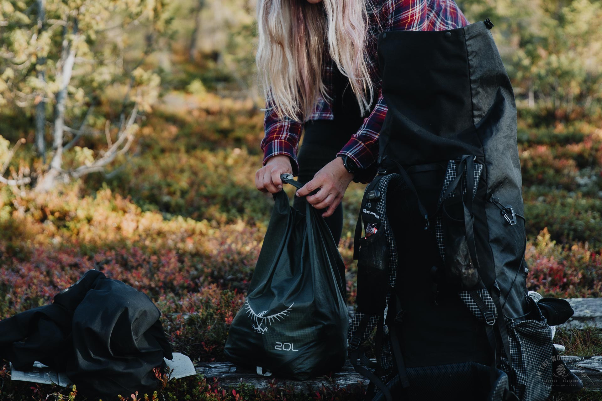
Photo: Karhunkierros gear - lightweight hiking gear
Shoes for Karhunkierros
The most important piece of equipment for a hiker is shoes. Their choice depends on your own foot characteristics, the weight of your rucksack and your personal preferences.
- For example, if you've done a lot of trail running and your gear is lightweight, you probably don't need traditional hiking shoes with ankle support.
- If you're not used to off-road hiking and carry a heavy backpack, ankle support shoes are a safer choice for the Karhunkierros hike.
- The Bear's Trail is basically the kind of trail where you may not need a traditional sturdy hiking shoe. The trail is in many places graveled or otherwise just a flat forest track, with plenty of duckboards. There is only little rocky paths or boulders.
- The key is not perfect waterproofness, but that the shoes do not cause chafing and are comfortable to walk in.
- Good socks and foot care are as important as the shoes themselves. Preventing blisters is easier than dealing with them in the middle of a hike.
Backpack for Karhunkierros
What is the best backpack for Karhunkierros? One that's the right size for your gear and hiking style. Big and heavy gear requires a bigger rucksack, while small and lightweight gear will fit in a smaller space.
Choose a rucksack according to your gear and gear according to the season. I use a 60-litre lightweight rucksack, which I use for both three-day and two-week hikes.
Tent & hammock
A tent, hammock or other accommodation is recommended, even if you plan to use open wilderness huts. Tents and shelters can get crowded in high season and it's often uncomfortable to sleep under the stars.
The Bear' Trail is a wooded route, so there are plenty of trees to keep you comfortable in a hammock. The rest areas are wooded and sheltered at the same time, so you won't need any special storm-proof tents on this hike.
Your sleeping bag, and especially your sleeping pad, should be up to the task on the coldest nights. In early summer, the ground can still glow cold and nights can be chilly. It's best to look at the weather forecasts for the near future and use common sense.
Read also: the best sleeping bag and sleeping pad - how to choose
Cooking stove and food on Karhunkierros
Even if open wilderness huts have a gas stove, it's a good idea to bring your own cooker. This will make it easier for you to cook in the campsites and rest stops. Your own camping stove allows you to cook when the hut is full and there are ten people queuing at the stove, or when the gas is running out.
Food tip: bring food you like. On the other hand, it's only with experience that you might know what you want to eat when you're out in the wild. Lightweight but calorie-dense foods will lighten your pack.
Look at the packing lists and avoid buying junk:
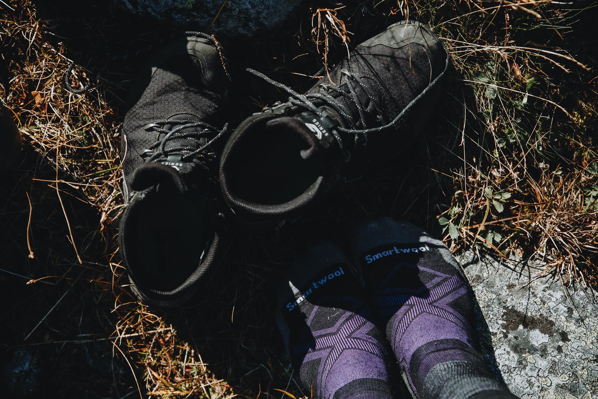
Photo: choose your shoes for Karhunkierros according to your own foot physique, your habits and the weight of your rucksack.
Services along the Bear's Trail in a nutshell
There are a few points along the Bear's Trail where road access and services are close by if needed.
Oulanka Visitor Centre
The Oulanka Visitor Centre is located along Karhunkierros, 27.5 km from Hautajärvi, at Liikasenvaarantie road 132. The visitor centre has a restaurant-café, toilets and hiking information when the visitor centre is open.
- There is a water tap on the outside wall of the building, which is not used in winter. There is a toilet in the courtyard.
- The opening hours of the visitor centre are seasonal, so it is advisable to check the website in advance. The visitor centre has only been open once during my visits.
- The car park is open all year round and has winter maintenance. With the exception of mid-winter, you are not allowed to stay overnight in a caravan in the car park.
Juuma
Juuma is the official starting and finishing point of the Pieni Karhunkierros trail. There is a large car park and signposts to the trails. During the summer there is a kiosk in the car park where you can buy cold drinks and ice cream, among other things.
Oulanka Basecamp
Oulanka Basecamp is located in Juuma, right next to the starting point of the Small Bear's Trail and Myllykoski. Basecamp has a paid camping area, accommodation for reservation and a café.
Ruka
Ruka is the end point of Karhunkierros. The route ends practically at the village and tourist centre, with all services within walking distance. The centre offers camping equipment shops, grocery stores, restaurants and various levels of accommodation.

Photo: Karhunkierros - trail in a forest
Why Karhunkierros is not the best hike?
So even if you think everyone likes Karhunkierros, they don't. Here are some strong opinions I've heard to the contrary:
- "It's just a boring forest." Absolutely, it's a hike in the woods. The Karhunkierros is not a Lapland hike on fell highlands, but a "Kuusamo forest hike".
- "It doesn't feel like wilderness at all." It doesn't, because it's not wilderness. Although in some places the road and civilisation are relatively close, most of the time there is peace and quiet in nature.
- "There are too many people." That's true, or not. Hikers are spread evenly over the 82 kilometers, and even in high season, you don't have to walk alongside other hikers. It's crowded at the campsite, but a tent is your own quiet home.
Why is Karhunkierros so popular?
Karhunkierros is a Finnish classic. The Bear's Trail has been walked by many generations from 1950's. In my opinion, the secret of its popularity lies in these:
- The dense old forests, the deep green coniferous forests and the smell of marsh tea
- Roaring ancient rapids and waterfalls, surrounded by towering vertical cliffs
- High dunes and cliffs, where you can admire rivers meandering through canyons and endless forests stretching to the horizon
- Easy access, close to services
- A relatively easy and well-constructed trail, but still with its challenges and sweat, sometimes blood and tears, too
- Rest stops every few kilometres - ease, safety and comfort all in one package
- An amazing number of great sights along a relatively short route

Photo: Karhunkierros trail - sunset at Valtavaara
The author has hiked Karhunkierros solo on her first long hike, has toured the attractions of the Karhunkierros trail several times in different seasons and has hiked thousands of kilometres in nature over the years.