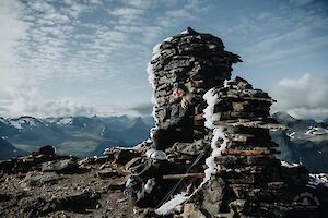
Parastinden in Norway is a favourite mountain especially among Finnish hikers. The mountain, which resembles a shark's fin, can be climbed on a short day trip from Rognli in Norway, or on a longer hike from Kilpisjärvi in Finland.
Read more
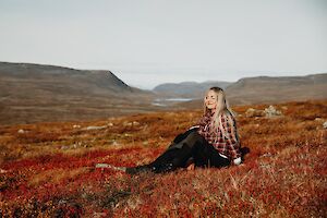
Autumn
The Arctic Trail is a demanding 800-kilometre hiking trail along the borders of northern Finland, Norway and Sweden. You don't have to hike the entire Arctic Trail in one go, but can do it in many different sections.
Read more

The Alta Canyon (Sautso) in Finnmark, northern Norway, is the most spectacular hike in Alta region. It is one of the largest canyons in northern Europe, and it can be reached by hiking, cycling and by boat along the river. The canyon hike, south of Alta, is a day trip and not as inaccessible as you might think.
Read more

Sipoonkorpi National Park is a place to admire the majestic mossy cliffs and walk through dense, wilderness-like coniferous forests. Fiskträsk is a beautiful wilderness lake, that you can reach with a quick hike to its shores and a new campfire site.
Read more

Kukastunturi (477 m) is one of the easiest routes in Ylläs Lapland to the top of fells. Located in Pallas-Yllästunturi National Park in Finland, the Kukastunturi summit offers great views in all directions. The most convenient way to hike Kukastunturi is from Karila.
Read more

Särkitunturi (492 m) is a fell in Muonio Lapland, on the shore of Lake Särkijärvi, overlooking one of the most photographed landscapes in Finland. The Särkitunturi trail is 3 km long in one direction. The highlights of Särkitunturi are the Lappish hut next to a pond and beautiful views of the Pallas-Yllästunturi National Park, rolling fells and lakes.
Read more

Gorsabrua, or Gorsa Bridge, is a spectacular bridge in the picturesque Kåfjorddalen valley in Birtavarre, Norway, under which the deepest canyon in northern Europe drops. A massive waterfall rushes along the wall of the gorge.
Read more

Abisko National Park is the most famous hiking and outdoors destination in Swedish Lapland. Abisko trails are accessible for both short day hikes and multi-day long-distance hikes of hundreds of kilometres. The most popular of Abisko's trails is Kungsleden, which runs along the River Abiskojåkka and the banks of the Lake Ábeskojávri in the national park.
Read more

Abisko in Swedish Lapland is a popular year-round outdoor destination. Abisko offers various trails for day hikes and long hiking trails of hundreds of kilometres. The most famous hiking trail is Kungsleden, but the most spectacular scenery awaits around it in the mountains.
Read more

Abisko National Park in Sweden is a well-known year-round hiking destination. Abisko's trails are suitable for short day trips as well as hikes of hundreds of kilometres. The most famous hiking route is the Abisko-Nikkaluokta hike along Kungsleden, or The King's Trail.
Read more