Adventures // 8 September 2025
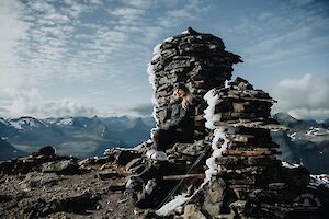
Parastinden in Norway is a favourite mountain especially among Finnish hikers. The mountain, which resembles a shark's fin, can be climbed on a short day trip from Rognli in Norway, or on a longer hike from Kilpisjärvi in Finland.
Read more
Parastinden - daytrip or long-distance hike
- Destination: Storfjord / Signaldalen, Norway
- Distance: From Rognli 5 km / 3.1 miles, from Kilpisjärvi 32 km / 19.9 miles (one direction)
- Difficulty: moderate / demanding
- When to go: June to September
Adventures // 14 August 2025
The Arctic Trail is a demanding 800-kilometre hiking trail along the borders of northern Finland, Norway and Sweden. You don't have to hike the entire Arctic Trail in one go, but can do it in many different sections.
Read more
Arctic Trail, Kopmajoki - Reisadalen
- Destination: Käsivarsi, Lapland, Finland & Saraelv, Reisa, Norway
- Distance: 46 km (one direction, Kopmajoki-Sieimma)
- Difficulty: advanced, trail may be poorly marked, river crossings
- When to go: from end of June to end of September for a summer and autumn hike
- Duration: 2-3 days
- Where to stay: camping in tent, wilderness huts, rental huts
Destinations // 31 July 2025
Reinebringen on Lofoten Islands, Moskenesøya has become one of Norway's most popular hikes in recent years. The summit of Reinebringen is the most famous photo shooting site in the whole of Lofoten. From the top of the mountain you can enjoy stunning views of the Reine village, the deep blue sea and fjords, and the dramatically sharp mountains of Lofoten.
Read more
Reinebringen hike
- Destination: Lofoten Islands, Reine, Moskenesøy, Norway
- Distance: 2 km / 1.24 miles (out-and-back, from the beginning of the Reinebringen stairs)
- Difficulty: BLUE medium
- When to go: from June to August for a summer hike (NO HIKES LATE AUTUMN - WINTER - SPRING)
- Duration: a daytrip 1-2 hours
Destinations // 29 July 2025
Munkebu hut hike is one of the best hikes in the most alpine parts of Lofoten Islands on Moskenesøy. The Munkebu hut hike is demanding and long, about 10 km (6.2 miles) out-and-back.
Read more
Munkebu Hut Hike, marked trail
- Destination: Lofoten Islands, Sørvågen/Moskenes, Moskenesøy, Norway
- Distance: 5 km / 3.1 miles (elevation 540 m / 1771 ft) & Hermannsdalstinden + 5 km & Munken + 1 km (one direction)
- Difficulty: RED demanding (Hermannsdalstinden hard)
- When to go: from June to August for a summer hike
- Duration: a daytrip 4-5 hours (Munkebu hut hike)
Destinations // 23 July 2025
Volandstinden (457 m) is not one of Lofoten's most famous hikes, although its shark's-fin-like summit offers a photo-shooting spot for Fredvang bridges - the view that is almost as scenic as the view from Reinebringen. The hike is around 5 km and it is mostly easy to moderate, and the views in all directions from the heights are rewarding.
Read more
Volandstinden, Lofoten Islands
- Destination: Lofoten Islands, Flakstadøya, Norway
- Distance: 5 km / 3.1 miles (whole trip)
- Duration: 2-3 h
- Difficulty: medium (challenging trail to viewpoint)
- When to go: from June to August for a summer hike
- Special: Photo shooting spot for Fredvang Bridges (if you can make it to the viewpoint!)
Destinations // 8 July 2025
The Alta Canyon (Sautso) in Finnmark, northern Norway, is the most spectacular hike in Alta region. It is one of the largest canyons in northern Europe, and it can be reached by hiking, cycling and by boat along the river. The canyon hike, south of Alta, is a day trip and not as inaccessible as you might think.
Read more
Alta Canyon
Location: Alta, Finnmark County, Norway
Route length: 12.6 km / 7.8 miles (from Gargia upper parking / trailhead and back)
Difficulty: easy (viewpoint moderate)
Duration: 3-4 h
When to go: from June to September (accessible in winter)
Special: The largest canyon in Northern Europe
Lille Raipas is a well-known fell in Alta, Norway. It is part of the Struve Geodetic Arc and is a UNESCO World Heritage Site. Lille Raipas is a fast route, and the summit offers spectacular views of the Alta fjord.
Read more
Lille Raipas (UNESCO)
Location: Alta, Finnmark County, Norway
Route length: 5.2 km / 3.2 miles (225 m ascent)
Difficulty: easy-moderate
Duration: 45 min - 1h (trail running) / 1.5-2 h (hiking)
When to go: from May to September
Special: UNESCO World Heritage Site, Struve Geodetic Arc
Destinations // 13 June 2025
Gorsabrua, or Gorsa Bridge, is a spectacular bridge in the picturesque Kåfjorddalen valley in Birtavarre, Norway, under which the deepest canyon in northern Europe drops. A massive waterfall rushes along the wall of the gorge.
Read more
Gorsabrua, Birtavarre, Norway
- Location: Birtavarre, Kåfjorddalen, Northern Norway
- Parking: paid parking at Ankerlia (large car park) or small car park closer to the route.
- Route length: 1,8 km in one direction (approx. 4 km round trip) from the upper car park
- Difficulty: easy, walking on the bridge can be challenging :D
- Duration: 1-2 hours for the whole trip
- When to go: from June to September
- Suitable: for hikers of basic fitness, also for families (not accessible)
- Special: 153 m high bridge over the gorge, spectacular waterfall, bungee jumps
Adventures // 5 June 2025
Abisko National Park is the most famous hiking and outdoors destination in Swedish Lapland. Abisko trails are accessible for both short day hikes and multi-day long-distance hikes of hundreds of kilometres. The most popular of Abisko's trails is Kungsleden, which runs along the River Abiskojåkka and the banks of the Lake Ábeskojávri in the national park.
Read more
Adventures // 26 May 2025
Abisko in Swedish Lapland is a popular year-round outdoor destination. Abisko offers various trails for day hikes and long hiking trails of hundreds of kilometres. The most famous hiking trail is Kungsleden, but the most spectacular scenery awaits around it in the mountains.
Read more